
Sanmin refers to the Chinese modern classic of political and social organization know in English as the Three Principals of the People, by Dr. Sun Yet Sen. By any standards it was abominable to force this name on three villages comprised almost entirely of Bunun aboriginals. In a move that smacks as much of opportunism on the part of local leaders looking for kick backs from funding to rename signs, as redressing authoritarian-era wrongs, the villages voted to rename themselves Namasiya starting January 1, 2008.
Anyway, it’s a lovely little pocket of Taiwan, hemmed in by high ridges, and riven by country lanes lined with yellow and red poinsettias, banana trees, betel buts, and, at least this time of year, blooming plum blossoms.
But on to the hike.
We had no destination in mind. The plan was simply to follow the Cishan (Namasiya) River valley upstream for several days and then return. Richard from Barking Deer Adventures had set up the outing, describing it on his blog as “a vigorous five day river trace.”
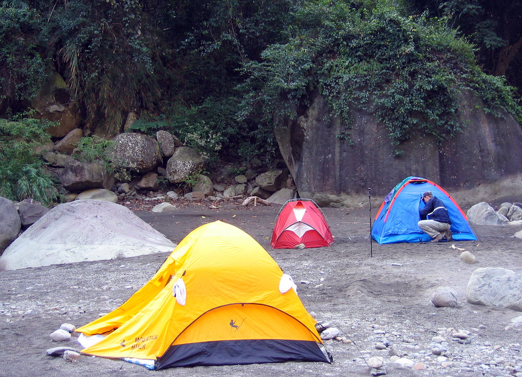
The trail began as a jeep track behind this wonderful little campground.
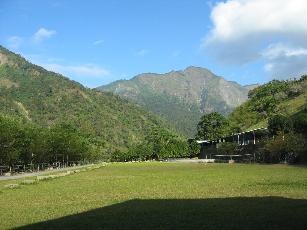
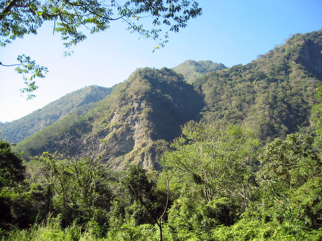
I just love the soft colors of the hillsides down here. It seems to result from the mix of vegetation: some scrub, some high acacias, some forests of bamboo, manchilus and cedar.
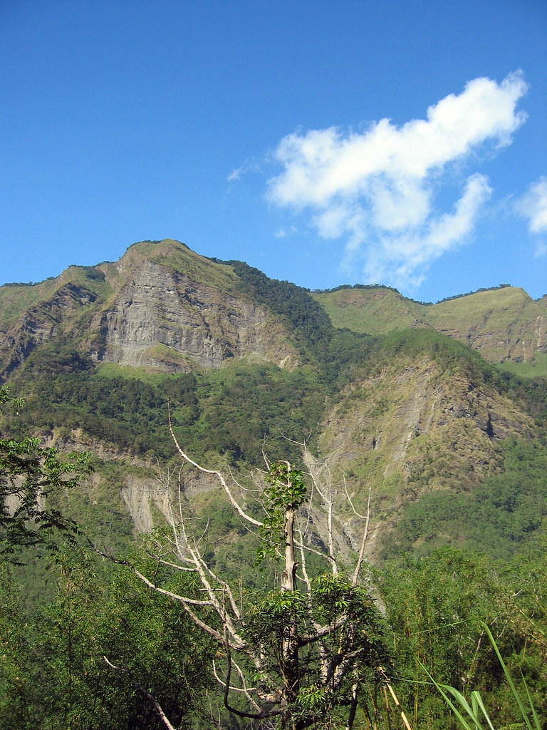
There are hot spring resorts nearby with open pools that offer pure mountain views like this. I remember sitting in one once last winter when the plum blossoms were filling the air with sweet odors. It was as fine an afternoon as any I have had.
But on to the hike.
We left the jeep track shortly and entered a thick jungle of bamboo, manchilus and barbed rattan. On the edges of the very narrow trail grew shin-high Cat Bite People (Mao Yao Ren), a kind of poison ivy. I was stung many times, but the bite doesn’t last long.
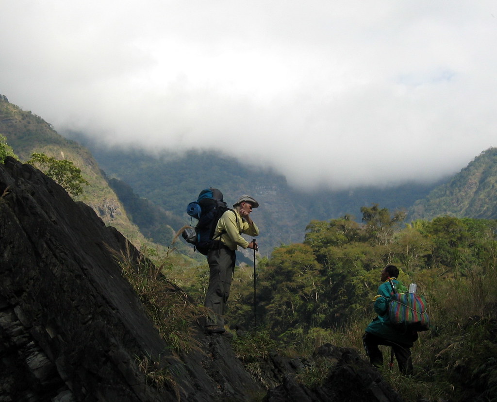
The trails are “maintained” by local hunters and rarely see regular hiking groups. They are similar to the cuts into the sides of steep slopes that pass for paths in Wulai, but were even more rough. At times there was barely enough trail for a wide foot to step on.
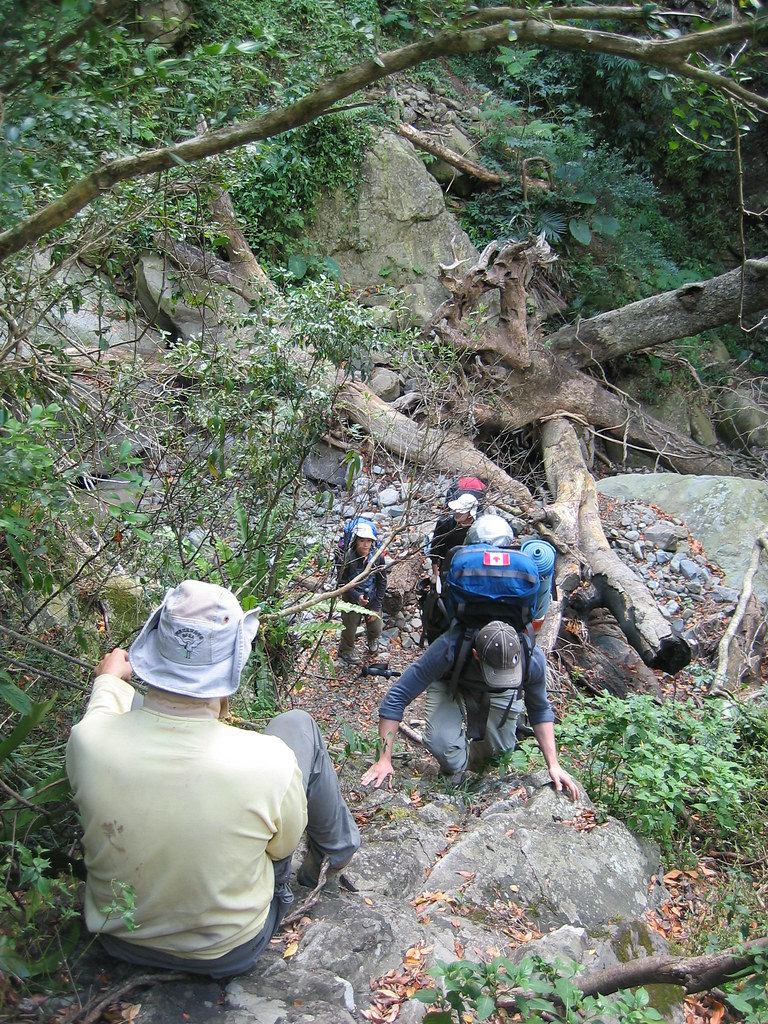
I’m used to this kind of terrain, but not when carrying a large pack. Balance was an issue the whole time. Here’s me sliding off the trail (pic to come).
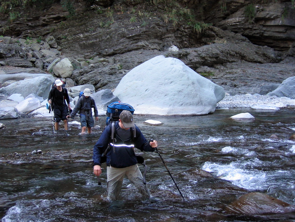
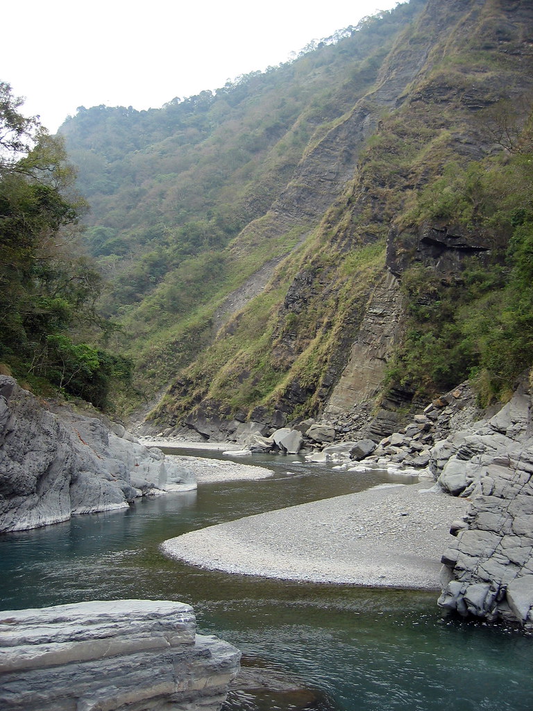
Making our way upriver, we alternated between hunting trails and hiking the stony riverbank itself. It’s always fun clamoring over and around huge boulders, but again, with the pack on it was tough on my knees…and ankle…and wrists.
At times we needed to cross the river. Interestingly, the local hunters mark the best places to cross with small rock cairns.
Though we only saw about 5 hunters in 5 days, signs of their presence were everywhere. They leave traps about (usually marked in some way) and numerous rough shelters.


Richard knows a few of them and is hoping to eventually try to get more of them involved in leading trips. Their hunting is devastating the local wildlife.
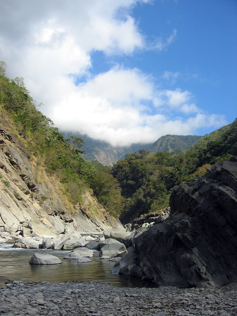
There were no stunning views along the trip, but that is not a complaint. We saw five people in five days, and the rest of the time had a winding river and relatively high mountain scenery for company. At night we camped on sandy clearings above the river and built campfires with the abundant dry driftwood around.
The Cishan River valley is a excellent location for a bit of rough camping especially in winter when the south is warm and dry (actually you couldn’t camp here in summer as the river level gets too high).
There were five of us on the trip, all avid hikers. Ray, a band teacher at the American school in Taipei, entertained us on Christmas Eve with stories of his adventures in the Peace Corp in Ghana. Life seemed pretty challenging living in a hut and contending with poor food, bad water, snakes, rats, and other vermin. And then one day, said Ray, “my cat got rabies.” Not sure why, but this cracked us all up.
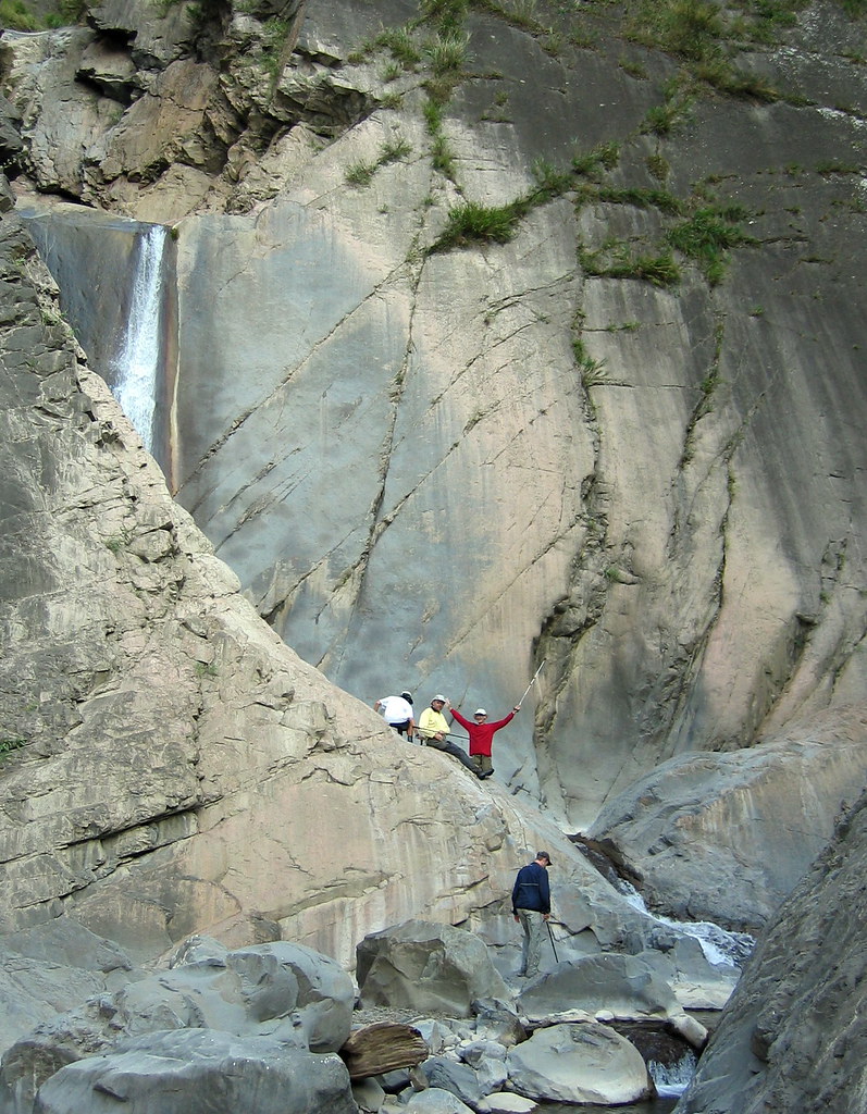
A number of small streams feed into the larger Cishan and it’s relatively simple to keep pretty good track of how far upstream you’ve gone. On the third day we reached stream 7. We hiked up the streambed a short distance to sit above a cool waterfall tucked in behind a slab of pinkish stone.
It occurred to me that this pool was the perfect secret swimming hole. In summer it couldn’t be reached and in winter it was a bit too chilly for a dip. At least for me. I left Canada for a subtropical country for a reason.
Stream 7 was the farthest point north we trekked. According to Richard, it’s possible to continue and reach the road to Alishan in another 2-3 days. But at this time the water level upstream was still too high where the canyon narrowed. Not even the local hunters would attempt it, such softies as they are.
On day five we returned to Sanmin and the campground. After resting I hiked up to the pretty Longfeng Waterfall for a swim. It was the right way to round off a week in the wilds.
Some random pics:
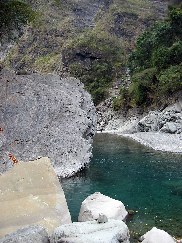
A lovely deep swimming hole. The Cishan flows down from Yushan National Park so the water is icy cold.
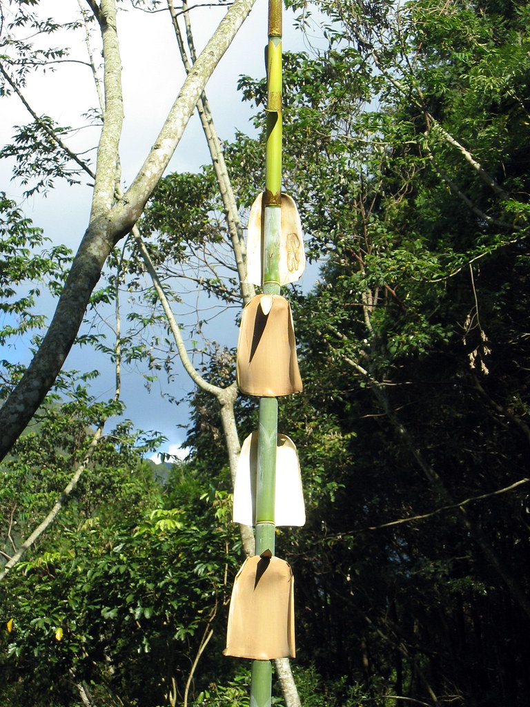
Bamboo shedding. This is a natural phenomenon.
A turn in the river.
Down at riverbed level.
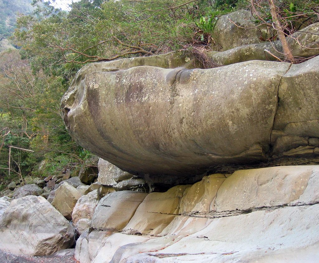
Jabba the Hut stone.
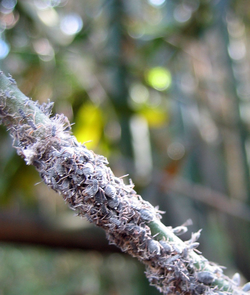
Aphids or some such insects devouring a tube of bamboo.
Lovely mountains scenery from the valley floor.
Where we turned back.

There’s my tent: the orange one.
Bit of a rant, but it performed so poorly I had to return it to North Face. Super lightweight (1.2k) but condensation was intolerable. I would have puddles on the floor in the morning if I didn’t wake up during the night and wipe down the insides of the walls.
Conditions were ideal on this trip, warm and dry, so the problem is with the design. I’m pretty grumpy about this as I bought this tent both because it was so lightweight and because it promised superior ventilation for humid climates. Oh well, North Face is being good about it.
Practicalities:
I don’t know if there is any public transportation to Sanmin but it would be easy enough to rent a scooter in Tainan and drive there. The campground has showers and bbq areas and there are plenty of small restaurants just down the road in the villages.
Barking Deer is likely to have more events in the area. Just to be clear, I have no financial or professional ties to this company though I do recommend them. Nice people and very knowledgeable of the south of Taiwan.
10 comments:
Amazing journey!!!
fantastic photo journalism. i thoroughly enjoyed reading about this hike. it makes me want to put on the tech gear and get out there! thank you for the wonderful views!
Great stuff. Sounds like you got upriver quite a ways.........Too bad about the tent. Judging by the weight, your tent must be a single layer. Perhaps a two layer tent, although heavier, would be more versatile.
Love the waterfall behind the rock slab. Beautiful!
Nice photos and good reporting.
I've just found your blog and think it's fantastic. I think I'll have to search out this camping ground and hiking area and get over there soon.
I saw on your profile that you worked for Lonely Planet, and now promote Taiwan as a hiking destination. This is exactly the kind of work I would love to do. If you have the time I'd really appreciate it if you would contact me at crosthwaiteandrew@gmail.com and tell me what I can do to get into this line of work. Thanks
Wonderful photos.
Wow!
Really looking forward to your blog.
Nathan Miller
www.bicycle-sidewalk.com
Nice informative post. I tried to meet you up there(Namasiya), but missed you by a matter of hours. next time.
Hi there,
I am off to Taiwan in a few weeks (March 20th 2008) and am hoping to do some hikes, such as the beautiful ones illustrated by this great blog. However I think I have hit upon a major snag.
I wanted to hike from Guguan to Deji, taking in the hot springs and the reservoir as I went, and then continuing on the Central Cross Island highway until I reached Taroko.
However, I read today that the road is closed for traffic between gugan and Deji which left me very dissapointed. Is the route I've outlined above still accessible by foot, and is it safe? I've never been to Taiwan before so any info from folks out there on this problem would be very helpful. Many thanks! my email is cjlines@gmail.com
Hi everyone,
Thanks for the nice comments. As my latest post explains I haven't been blogging for a while because of a bout with scrub typhus (and then too busy afterwards).
Andrew, I will write to you later and Chris, you too. Sorry, I didn't see your message earlier.
Post a Comment