
Back in 2005, exactly 90 years after the first recorded ascent, I climbed Snow Mountain (Xueshan; formerly Mt Silvia; 3886m) with a fellow hiker I'll call Igor (since that's his name). It was my first long trip in the high mountains of Taiwan and I thought I'd share the following report I wrote on Forumosa.com at the time. Snow is a popular hike - it's the second highest peak in Taiwan - and by most standards a more beautiful route than the one to Yushan.
While I have climbed Snow again as part of a longer route (across the glorious Holy Ridge), this is the only time I have done the standard three day hike to the main peak and back.
Day One:
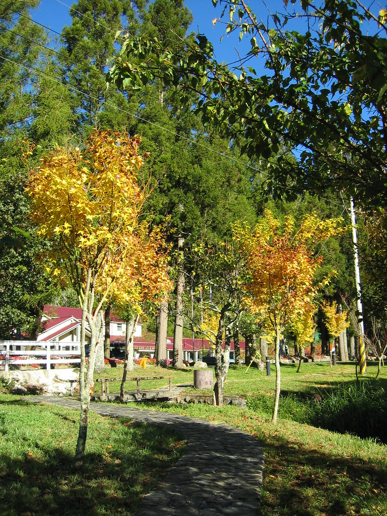
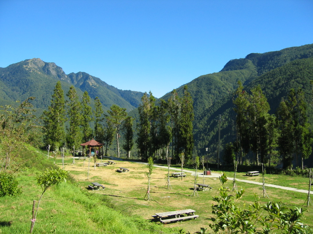
Igor and I left Taipei around 1pm and drove to Shei-Pa National Park, or more specifically Wuling Farm, a recreation area within the national park. It's a beautiful place, as well laid out and scenic as a national park back home in Canada.
"Shei-Pa National Park covers an area of 76,850 hectares on the central Taiwan range, slightly to the north of central Taiwan. This is a region of magnificent mountains: within the park are 51 peaks over 3,000 meters high. It is a mostly wild and undeveloped area with a range of wildlife that includes many rare and endemic species. The park was founded to protect and study this splendid wilderness, maintaining the natural environment and all forms of life it includes. Conservation is therefore the first priority for Shei-Pa National Park, and a large proportion of its land is protected as Conversation Area with limited access for ordinary visitors."
Great campground:
We stayed in the basic Wuling Hostel and after dinner strolled down to Cijiawan Creek. This stream is famous within Taiwan for holding one of the last stocks of the Formosan Landlocked Salmon. This ice age relic spends its entire life cycle in the chilly high mountain waters. In other words, it is a salmon that never lives in the sea.
"Trapped in the streams of the high mountains, the Formosan Landlocked Salmon (Oncorhynchus masou formosanus) have lost the instinct of migration. At present, this type of landlocked salmon can only be found in Japan, Korea, and northeast China. Moreover, Formosan Landlocked Salmon in Taiwan are at the southernmost distribution in the world. Cijiawan Creek and Gaoshan Creek in the Wuling area on the east of Shei-Pa National Park are the only habitat for this species of salmon."
Day Two:
After breakfast in a nearby hotel, we drove 5km or so up to the ranger station at the start of the trail to Snow Mountain. MISTAKE. In addition to a national park permit, hikers need to check in at the police station in Wuling Farm and apply for a mountain permit.
After sorting out these permits we returned to the station. The rangers checked our papers and then, in a friendly manner, fell into a debate over whether we should be forced to watch a movie introducing the park. They finally came down on the side of reason and told us to go our merry way. We humped our packs onto our backs and started up the trail.
At this point we were already at 2140m. Our destination for the day, the first cabin, called Chika, was 2,463m. It is a 2km, 1.5-2 hour hike to the cabin. (Chika by the way refers to the 7km from the original trailhead, or last station, to the cabin. Those taking the bus to Wuling will find that it is still Chika indeed.)

We arrived at Chika around noon, not two hours from leaving the ranger station. Our plan was to make a day of it at Chika and head up to the second cabin near the summit the next day. MISTAKE (of sorts). There is nothing to do at Chika. It is a cabin in a clearing on a very steep trail.
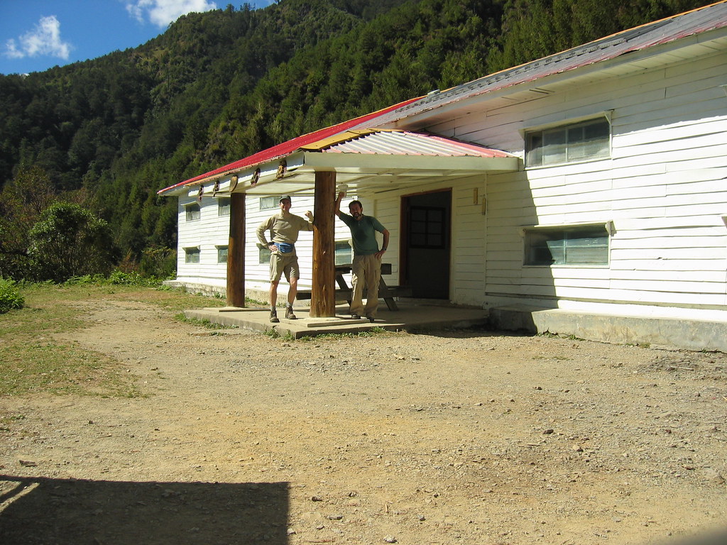
That said, there were a few small trails nearby (that weren't part of the main trail) and on one of these I was privileged enough to see a juvenile Formosan black bear at about 30 metres. I had followed a trail behind the cabin to a small waterfall that sources the cabins sinks and toilets. As I stood looking at the water tumbling down the shale slopes, I heard a crash and a large animal dashing across the level ground across the stream. At first I thought it was a monkey until it rushed passed a 3m wide clearly and I clearly saw a long snout, whitish fur around the neck (the Formosan's classic white V), and the unmistakable loping gate of a bear.
He was clearly more scared than me, though I was a little stunned to have seen a bear in Taiwan. I went back to the cabin, at first not sure if it had really happened. But it was a bear and while they are rare, they are still hundreds roaming the high mountains of Taiwan.
After exploring the cabin area some more, Igor and I realized we had nothing to do till the next morning. Stupidly, neither of us had brought a book or musical device, or even a deck of cards. It was a very very long day let me tell you.
There was no one else in the cabin that but Igor and me night: I still slept poorly. Lots of little critters crashed around in the bush outside and thumped on the metal roof.
Day Three:
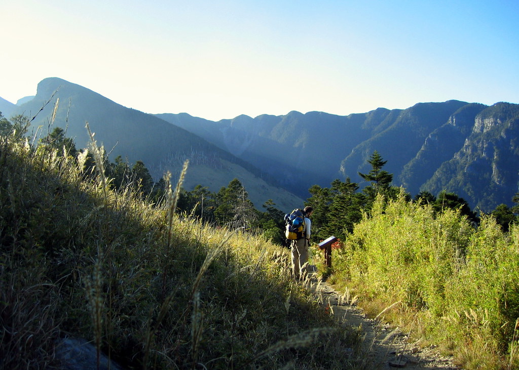
The next day, after a long breakfast, we set out around 11am. Our destination was 369 Cabin (at 3150m). It was a long, grueling hike up switchback after switchback. Very little level ground. All hikers to Snow will recall one particularly brutal section of trail called the Crying Slope: it was a good challenge with heavy packs on.


As the altitude increased it got harder to breathe deeply. I'm more used to it now but this first time above 3000m was difficult. Sudden movements up (such as two or three quick steps) left me lightheaded.
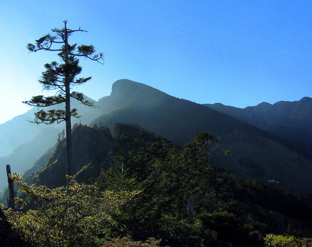
After four hours of hiking we reached the summit of the East Peak (3201m), an exposed knoll surrounded by stunning alpine scenery. It's the last section you can get regular cell phone reception.

We ate lunch and enjoyed the view. Actually, we enjoyed the view all the way up. One of the best features of this hike is the ever-varying terrain. There were forested slopes, sunlit meadowland, bamboo forest, grassy bluffs, and stands of thousand year old oak and juniper trees. The walls of the Holy Ridge to the north were folded up like a xylophone. If you dropped two people off on the mountain, pointed them in different directions and asked them to describe their surroundings they would not likely imagine they were in the same place.
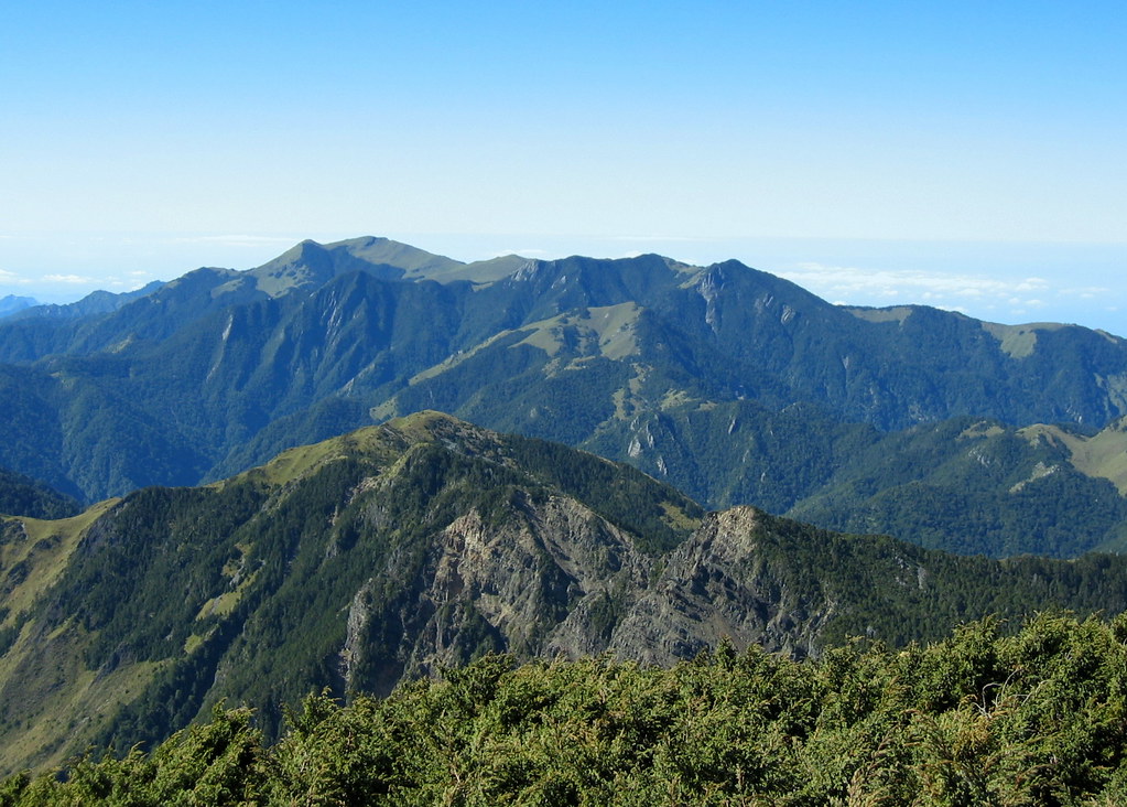

Off two km in the distance from East Peak, and a 100m lower in elevation, lay 369 Cabin (3150m) on a slope of dwarf bamboo. We were there in 90 minutes, grateful as hell for the stretch of downhill.
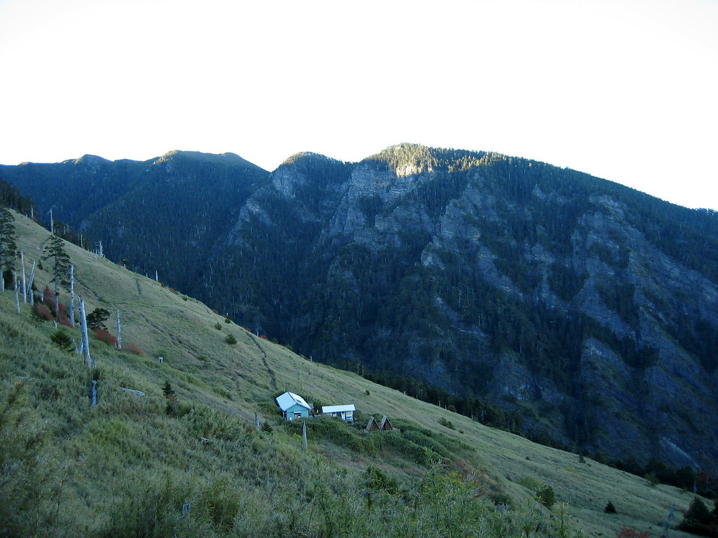
It was about 5:30 when we arrived and the daylight was fast fading. We set our packs down, claimed a bed (there were 20-30 other hikers - some already tucked in for the night) and made dinner.
After chatting with some fellow hikers, we discovered that it would take 3.5 hours to reach the summit the next day. Much longer than we had expected. This meant a 2am rise if we wanted to reach the peak at sunrise.
We decided against this. I knew I couldn't get up at 2am, hike 11 hours (we had to return to the car the same day) and then drive safely 4 hours back to Taipei. In retrospect, it was a wise decision.
Day Four:
We rose at 6am and watched a beautiful sunrise from the cabin deck. After a quick breakfast, we hit the trail.

Within a few minutes we both expressed our joy that we had not done the trail in the dark. The scenery was too good to miss. The first section cut through the Black Forest, a large stand of Taiwan firs.
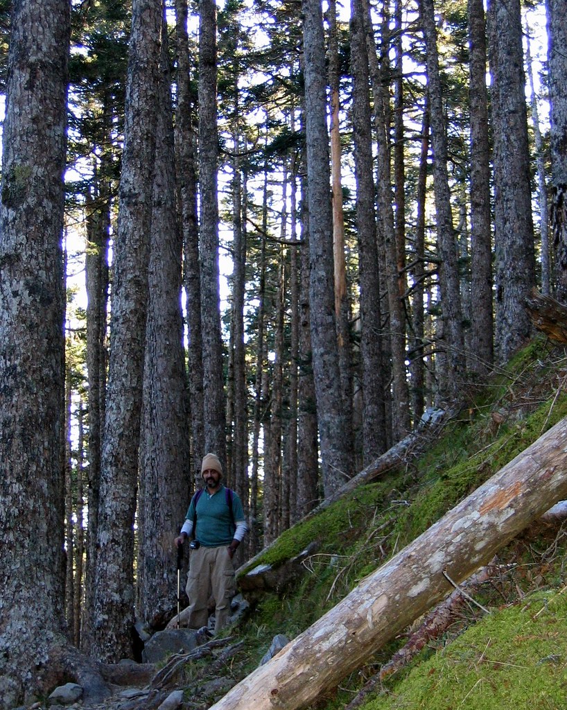
Later, closer to the summit, we emerged from the shade of the firs into an ancient stand of whitened junipers. Because of the short growing season in the alpine environment, many of the junipers were only a few feet off the ground yet hundreds of years old. They were an awesome sight, with their twisted roots, and complex branching patterns.
At the point where the forest gave way to alpine meadowland we were just under a kilometer from the summit. The views were grand up a glacial cirque, covered in scrubby Yushan Rhododendron plants about halfway to the summit. In May and June the slopes are blanketed in white and pink flowers. I am still hoping to see this one-day.
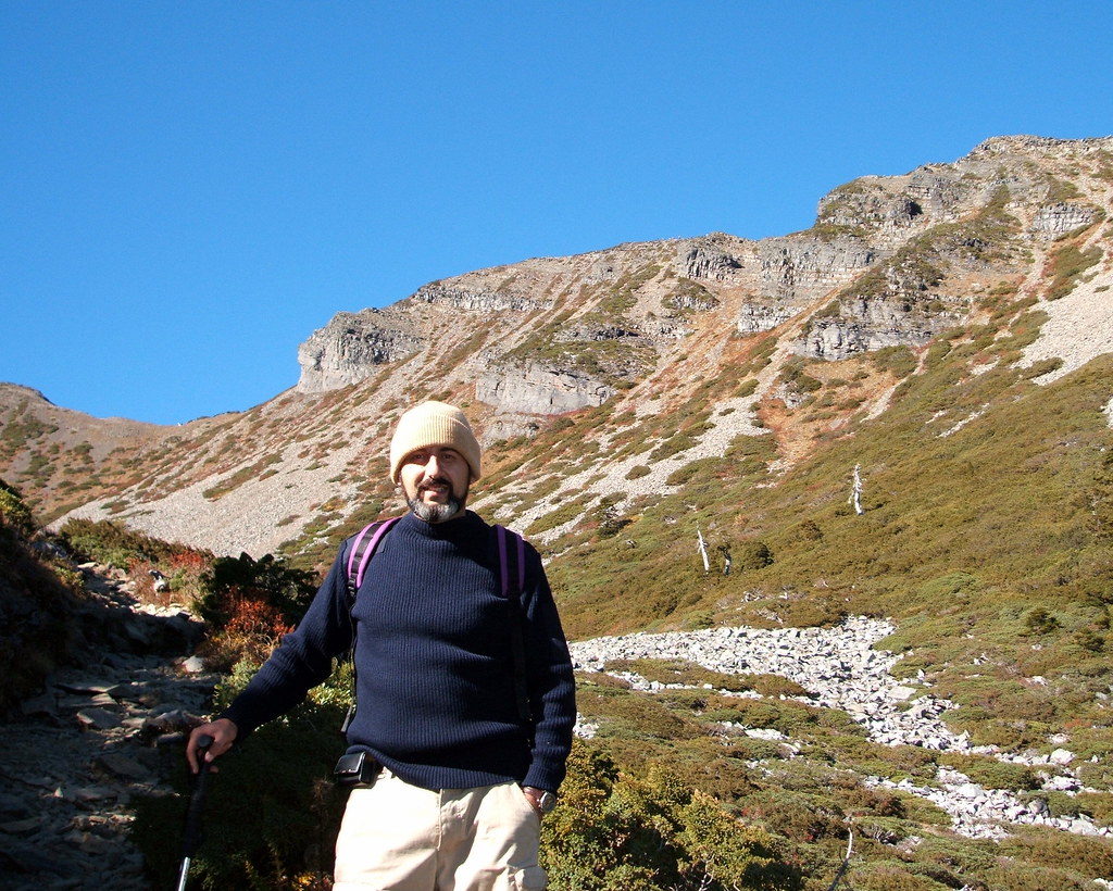
In this deep valley we found our perspective was really off. We thought the mushroom-like peak off to the right was our destination and wondered how we could possibly reach it in time. But actually the softly rounded mound that tops the slopes straight up the cirque was the summit. We discovered this, as so many must, only by reaching the summit and seeing the plaque.
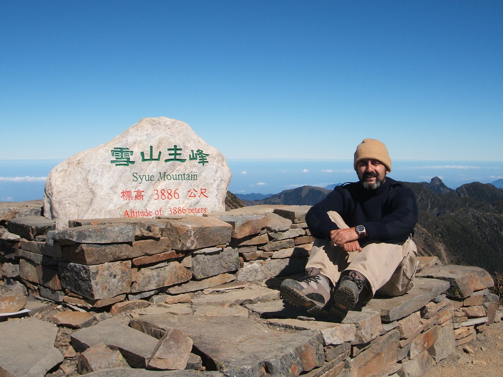
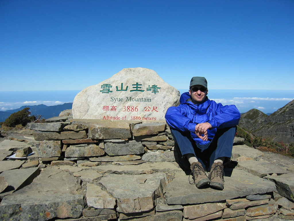
Igor and I were alone at the top when we arrived. A Japanese group (with a 71 year old woman in the lead) arrived shortly. We took some pictures and video and shared snacks and a conversation in broken English with the others. The Japanese had come to Taiwan specifically to climb Yushan and Xueshan. They all agreed that Xueshan had the better scenery.
It was hard to imagine then how it could get any better (though now having done both I am torn in half with my loyalties). We had perfect visibility in all directions and could see the run of +3000m peaks that compose the Holy Ridge. We vowed to come back and do the 5-day hike that covers them all. (Last August I did and will blog about it one day soon.)
We hung out on the summit for half an hour and then set off back to 369. It took 2 hours to return which brought us to 1pm. There were still had another 4 hours to hike back to the car.
After a lunch and some much-needed rest, we started out again at 2pm. At Chika we picked up some excess gear we had stowed and stopped for a break. Our Japanese friends were ahead of us and nicely had guides cooking for them. We would have loved to stay but it was growing dark and we had a 40-50 minute hike to the ranger's station and car.
As it was, we walked the last half and hour in the dark using headlights. This experience confirmed that getting up to hike in the dark is the dullest thing one can do in the mountains.
We had one last adventure.
After leaving the ranger station we drove down into the campground. But where was the road out of this area? After several tries, our frustration levels rising, we saw a working vehicle approach. We asked the driver for help and he said to wait till he had done his errands. Twenty minutes later (and one false alarm where we thought he was leading us into an empty field to murder us) he led the way out.
Why couldn't we find it on our own? Because the road we had taken in had washed out in the three days we were up in the mountains. There was a temporary dirt side road beside it, but it was unsigned and impossible to see in the dark.
The ride back to Taipei was long and tiring. There were times the glare from traffic made my eyes water so much I had to pull over.
Practicalities:
The trail is wide and clear the entire way up. It is signposted almost every 100 yards (1.1km, 1.2 km, etc.) with maps at the cabins and various points along the way. There are interpretation signs introducing trees, plants, animals and geographical features. They are in English and Chinese and add a lot to the experience.
There are small wicket fences blocking side trails and offshoots. This makes even the black forest area completely safe to cover. I can see how it would be possible before to get off on a side trail, but not now.
Both cabins are good, with barracks style bedding and water supplies, toilets and cooking areas. There are flush toilets and solar powered lights.
There is a reliable source of water a Chika. People have said that 369 does not always have a steady source but it seems to now. Best to call before you go. There are a few small sources of water in the black forest.
Hiking Times:
Ranger Station to Chika: 1.5-2 hours
Chika to 369 cabin: 5-6 hours
369 to summit: 3-4 hours
Summit back to 369: 2 hours
369 back to ranger's station: 4 hours.
(Dutch travellers should add about 35 extra hours to all the above to cover fying here.)
Igor and I went in mid-November. It was mild around the first cabin. During the day I wore shorts and a long short. At night it got down to around 12 degrees.
It was cooler at 369. By 5pm it was 8 degrees. It probably got down to 3 or 4 at night. But it was warm in the cabin. During the day, up near the peak it was probably around 12 degrees. You need to bring warm clothing for the summit, as it is exposed and the wind can really chill you. Gloves, a hat, a sweater, and a Gortex jacket come in handy. You may not need them as you tramp through the black forest, but you will up top.
Permits:
Barking Deer has the lowdown.
Wuling Farm:
There are three hotels and a campground within Wuling. The campground is set on a magnificent valley, surrounded by forested mountains. It's one of the loveliest settings for camping you'll find anywhere. It's halfway from the bus station to the trailhead. There are pre-set tents so you don't need to carry your own.
Transportation:
You can drive to Wuling Farm from Taipei in under 4 hours. It's a simple route with the new tunnel, essentially being a ride down the 5 (the tunnel) and then the 7.
By Bus: there is a bus from Ilan to Wuling Farm. I would call the 24-hour tourist hotline to get the latest schedule: 0800 011 765.
There is supposed to be a tourist bus within the farm area. Ask at the visitor centre when you get off the bus from Ilan. If there is no bus you will have to walk to the trailhead which will take an hour or two.
There's a convenience store by the visitor centre.
27 comments:
Great entry! I took my mum up to the East Peak and she loved it. It would be fantastic to do the main peak one of these days. Beautiful pictures, as usual. Well done.
Great stuff as always. You gotta post more. I'm especially looking forward to reading about the Holy Ridge trip.
Thanks guys. Yep, have to post more. It's not like I don't have a backlog of stuff. :)
In retrospect, would you consider hiking all the way to 369 the first day and spending two nights there? That is assuming you have an early start the first day.
Yes, I would hike all the way to 369. But the next day I would hike to the North Peak via a shortcut and stay in the cabin there among the old junipers. The North Peak has stuning views of the Holy Ridge and in general some of the best high mountain scenery in Taiwan.
The third day I would hike back toward 369 but via the Main peak. It's a long day back to the parking lot but not that much longer than the standard way up to the peak and back down (from 369) as the North Peak cabin is much closer to the Main Peak than 369.
The only downside is you must carry your full pack up to the peak.
A bit of bird songs from the same hike... A few weeks before...
http://kalerne.net/joomla/index.php?option=com_content&task=view&id=201&Itemid=78
;)
"Grey, huge beyond all telling, and the hosts of the heaped clouds
The black and white together......
And lower yet are the hollows striped down by the scanty green,
And lingering flecks of the cloud host are tangled there between,
White, pillowy, lit by the sun, unchanged by the drift of the wind."
Murray Walton - Xueshan
"Back in 2005, exactly 90 years after the first recorded ascent, I climbed Snow Mountain (Xueshan; formerly Mt Silvia; 3886m)...."
Interesting coincidence that you waited until now to write this up on your blog. This year marks the 80th anniversary of the first successful ascent by a Westerner - Herr Grubler of Hokkaido Imperial University.
Yannick, great site. I am going to link to it on Pashan.
Anon1: thanks for the Murray quote. I always enjoy your dropping these little bits of history on my blog.
Anon2: Excellent. Love a good coincidence.
It must have been pretty cold up there at night. Did you have a good sleeping bag with you? :-)
Hey, Balazs. I finally understood what you were talking about. Oh yeah, your sleeping bag. It was warm. Thanks.
great info, thank you. I am heading out on this trip on Saturday and see that my friend who is planning it estimates much less time for the hike. I will make sure to prepare for longer :)
Hi Robert,
Do you know how to get to Wuling farm without renting a car?
geofftan@yahoo.com
Geoff
Geoff, you can catch a bus to Wuling Farm from Ilan city. There is sometimes a shuttle bus within the park as well which can get you a little closer to the trailhead.
Call the tourism hotline for the schedule:
0800 011 765
Hello I want to congratulate to them by its site of the Web of the excellent looks like entertained and very good very to me it elaborated. I invite them to that they explore a little on my Web site.
To my mind everybody have to browse on it.
veCheap Hotels in GurgaonAre you looking for Hotels in Gurgaon? Call Cheap Hotels in Gurgaon Today @+91-9810104774 or Gurgaon Hotels at affordable rates.
I like it
Hi I'm attempting to plan a trip to Taiwan and do some hiking but my friend and I aren't exactly in good shape (physically). I'm pretty interested in hiking xueshan but am thinking of only hiking to the 369 hut. Do you think it is possible? Oh and do you have any mountains you could recommend that my group of 3 could attempt? The ones with clouds or meadows or just any nice scenery. I only know alishan as the alternative.
Hi Robert, do you know someone who can help us get permits and transpo to Snow mountain? We are planning to go there between Feb 27-March 1. 5 or 6 of my friends will join! Thanks much!
Thanks for one marvelous posting! I enjoyed reading it; you are a great author. I want to encourage that you continue your great posts, have a nice weekend!
Trekking in Nepal
Very useful information. I love Trekking East peak. Photos for day 3 is really nice. If you love to visit Nepal, please contact us. I can suggest various trekking tour packages in Nepal. Popular trekking like Everest Base camp trek, Annapurna Base camp trek, Buddhist circuit trekking in Nepal.
Hi, thank you so much for the info! It's very useful because I'm going to do this trek soon (mid october). I've one question though: what do you mean with a 'cooking area'? Should we bring a gas stove or is there a place where we can make a fire to cook some water, that we can use to cook our food? Thanks so much in advance! :)
Hi, thank you so much for the info! It's very useful because I'm going to do this trek soon (mid october). I've one question though: what do you mean with a 'cooking area'? Should we bring a gas stove or is there a place where we can make a fire to cook some water, that we can use to cook our food? Thanks so much in advance! :)
Hi. Nice post. I am planning also to go to Snow Mountain this February. Hoping to experience snow and cherry blossoms when we go there. I also do Travel Blogs in the Philippines
Nice Blog Post, Thanks for sharing it with us. hotels in gurgaon
People who enjoy winter camping love how a tent with stove transforms their experience by making their shelter warm and comfortable all night long tent with stove
Post a Comment