The pic above says it all: fun. This trail that runs along the upper valley of the Keelung River, the main river flowing through Taipei, is as fun-in-the-sun as a day at a waterpark - and with its half dozen falls, not that dissimilar.
The trail used to be a favorite in the early days of the hiking club but we hadn't been back for years. It was only the fact that I didn't have the car on Sunday that the idea to go here popped into my head. Need to give my head a good shake for forgetting a place like this.
Today's trail begins at Santiaoling Station, the point where the Pingxi branch line breaks off from the main east coast trunk line, but once it was part of the old Tanlan Trail, an important system connecting Yilan (the east coast) with Taipei. Most of the route we were following today runs along the Wufenliao-Hsinliao River fault line.
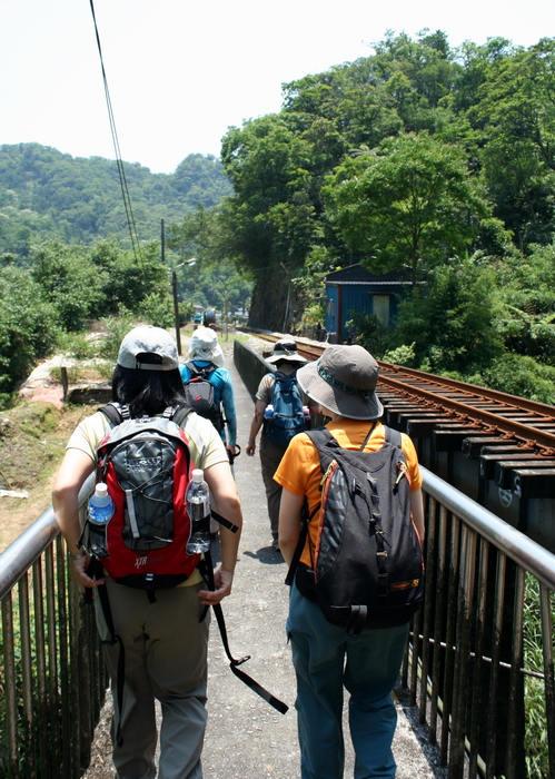
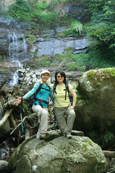
We had a good sized group with us, eight when we stepped off the train. Within a few minutes another train dropped off our old friend Trail-hacker. He hadn't told anyone he would join us but we were all thrilled to have him along.
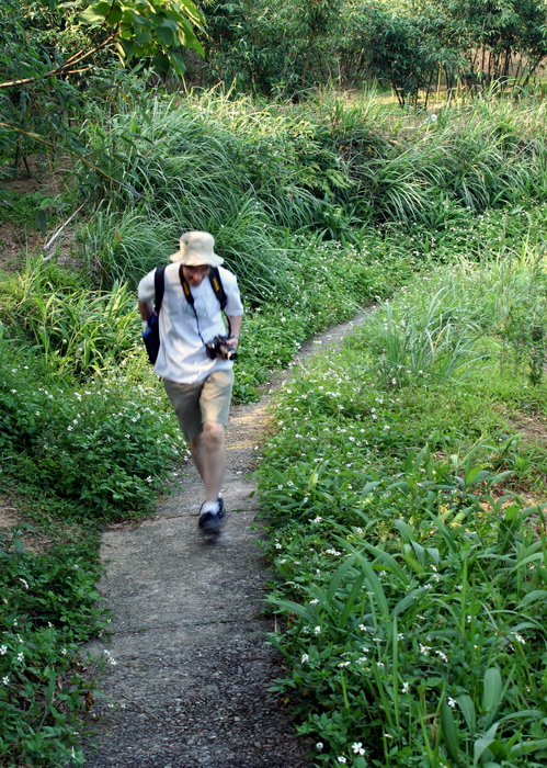
With this big group of old friends, and some new ones, we set off happily down the path alongside the railway line. We crossed under the main line and headed right, along the Pingxi Branch.
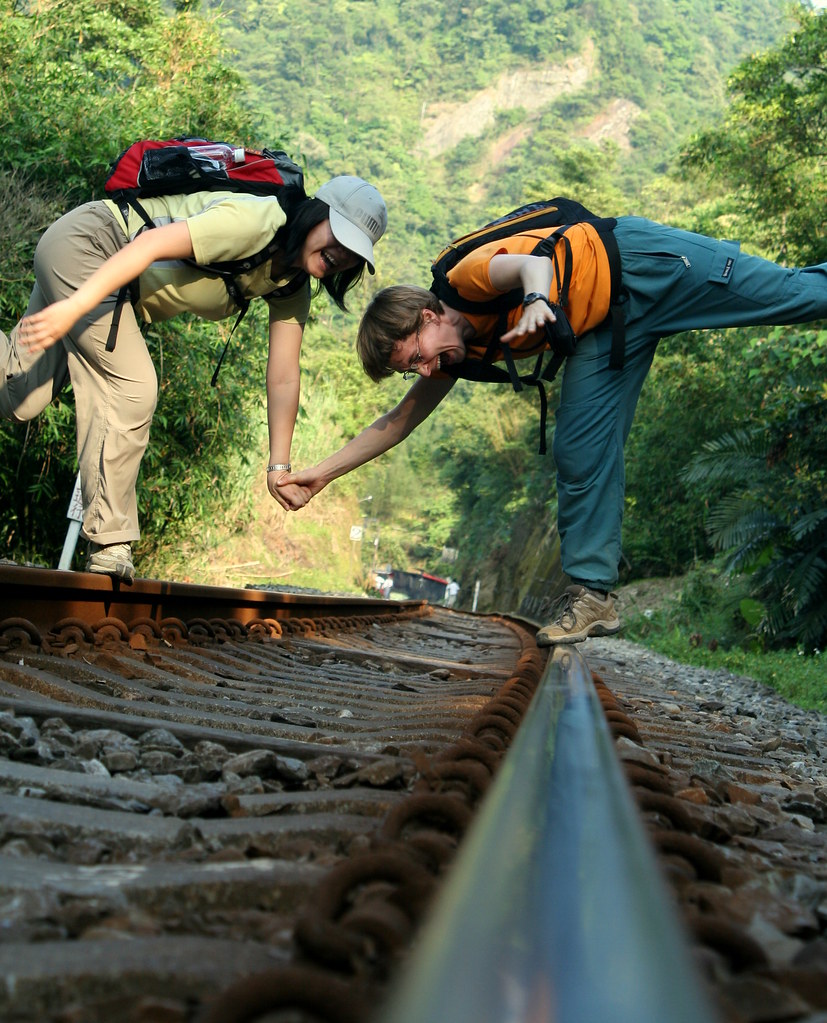
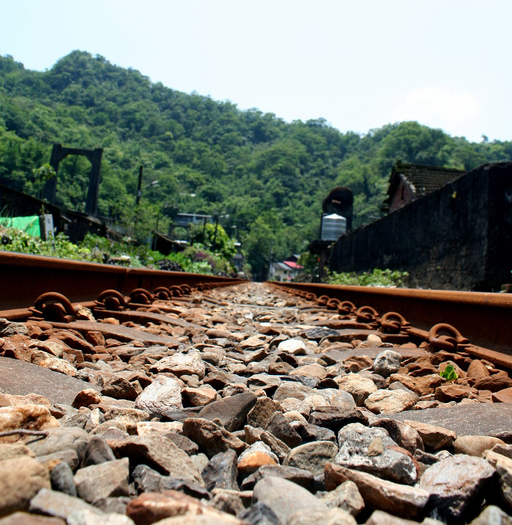
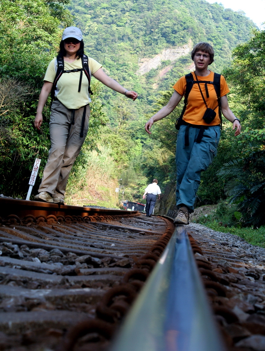
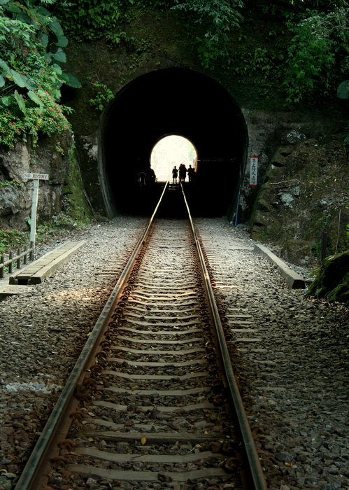
Low shooting of railway tracks was the goal for the day.
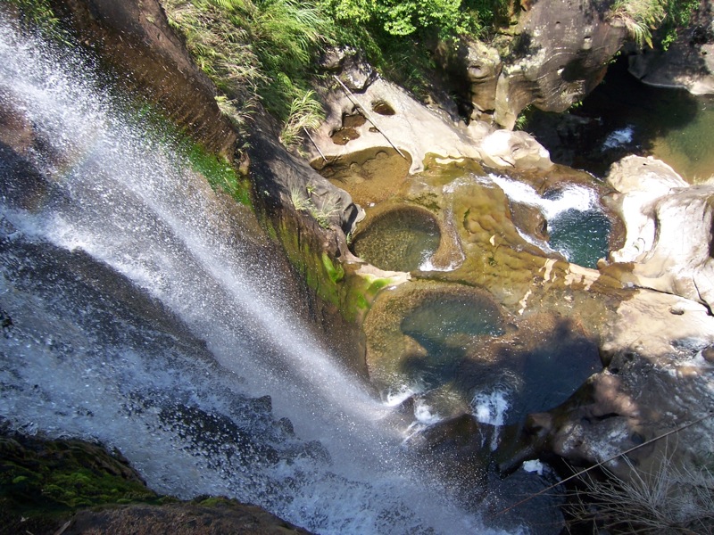
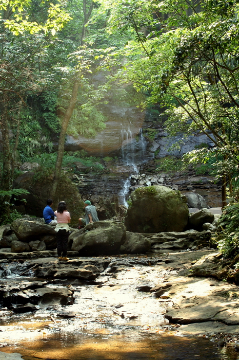
Five minutes later, at the tiny village of Santiaoling, we crossed the tracks again at the obvious sign for the trail. After a little bit on stairs we soon leveled out on a nice wide dirt path. The sun was warm as it shone through the trees, and we could hear the first fall, called Hegu (合谷瀑布; Joining of the Valleys Falls) not far off.
After viewing the falls from the distance we hiked round to the top. Two small streams come together at this point before dropping 40m to some nice pools that can be reached by river tracing up from where the stream joins the Keelung about .5km downstream.
According to Taipei Day Trips, there is a six-layer waterfall further up the smaller sidestream (the first you cross after viewing the larger fall from the distance). As long habit required, we vowed yet again to one day river trace up to these falls on a hot summer day.
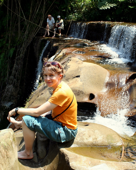
But today we settled for sitting atop the Hegu Falls on the rocks above the drop and enjoying lunch.
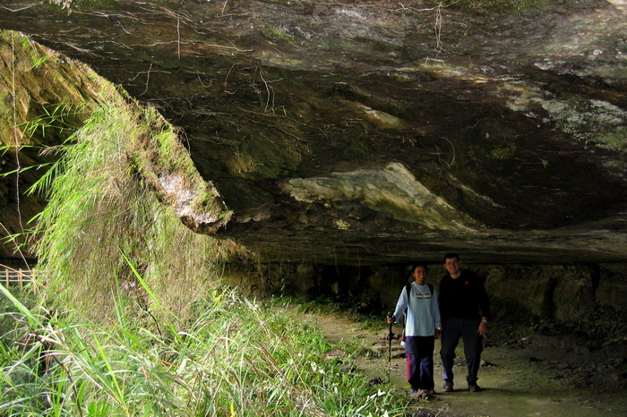
Behind us in the thickets were some abandoned stone buildings from the days when the Keelung Valley was a major source of coal mining. There are still some tunnels around nearby that you can walk into if you know where the entrances are.
Here's one:
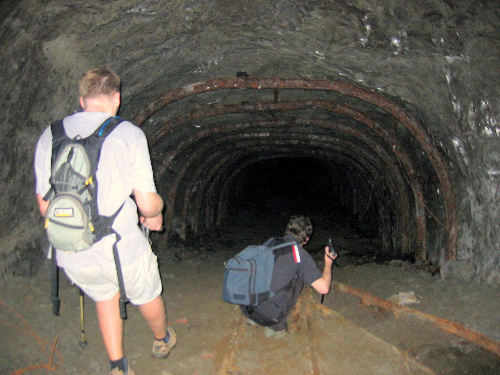
One day we may get up the nerve to wander deeper into the one above, which we believe crosses to the other side of the mountain a km or so away. But maybe not. These tunnels have been closed for 20 years and there has been a 6.9 degree earthquake along the way.
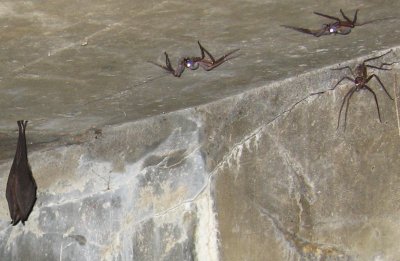
Somewhere out in cyberspace is a funny picture of Anita, an old hiking partner, in one of the stone buildings behind Hegu Falls. It was pitch black in the structure and a flash had to used to take a picture. Only when we got back and uploaded the file did we see the bats and massive spiders hanging on the walls behind her.
(Update: found the pic:)
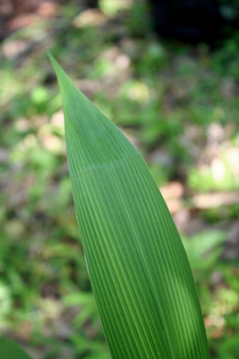
The common fern in the pic below is reportedly gifted with the talent of prophecy. Bends in the leaves foretell the number of typhoons in the upcoming season. All the leaves on the plant, and all the others nearby, had one fold on them: let's hope the prophecy comes true.
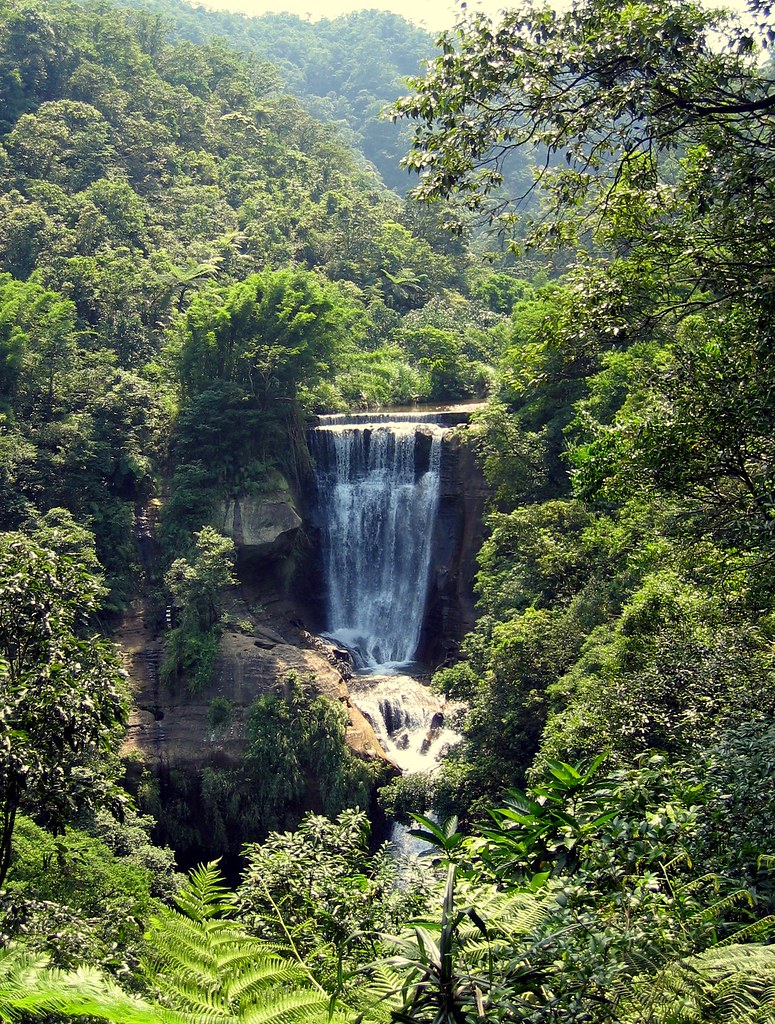
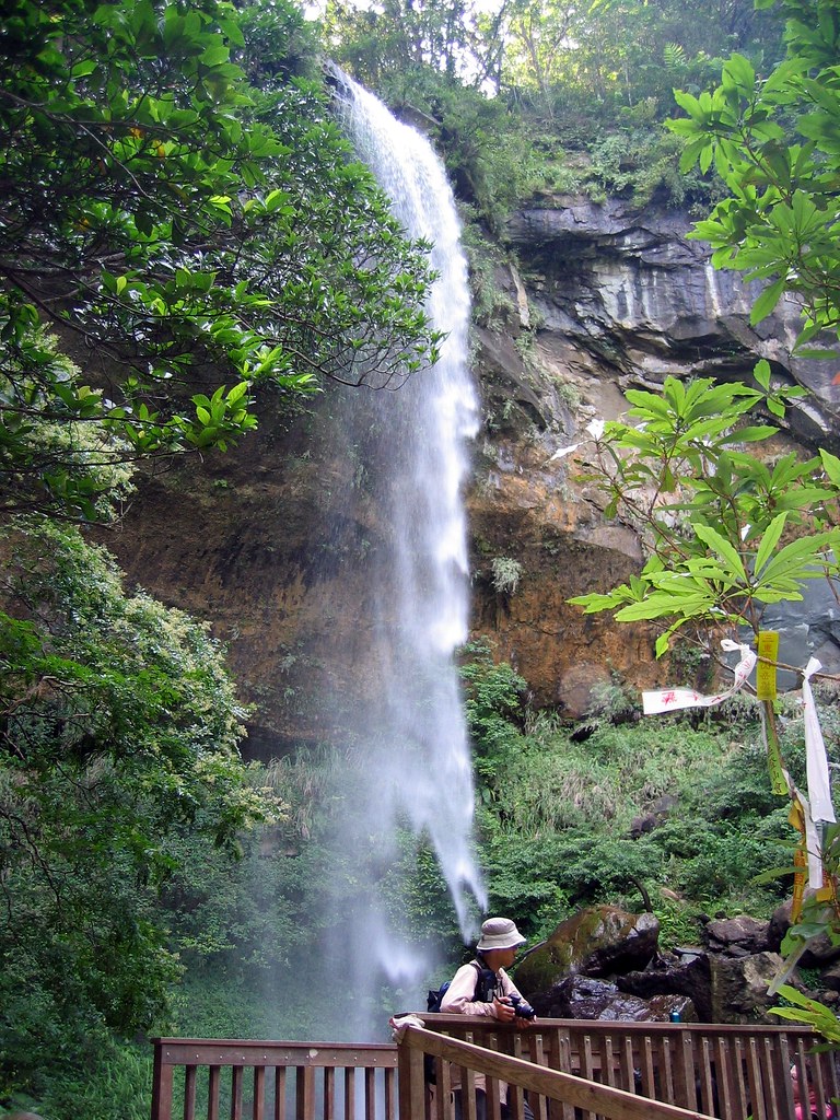
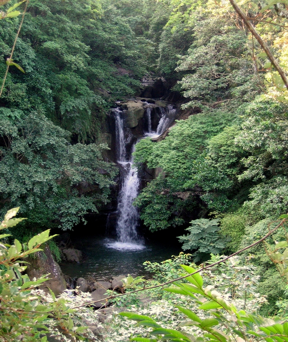
Anyway, after lunch we continued up the path to the first of the overhang falls called Motian (摩天瀑布; Skyscraping Falls). Our geology professor friend Ulrich explained that the wall was composed of limestone and shale in different layers. Since shale is softer, big chunks of it have broken and fallen out over the years, leaving the giant slash of a cave that swings round behind the falls. It's like a scene from Last of the Mohicans.
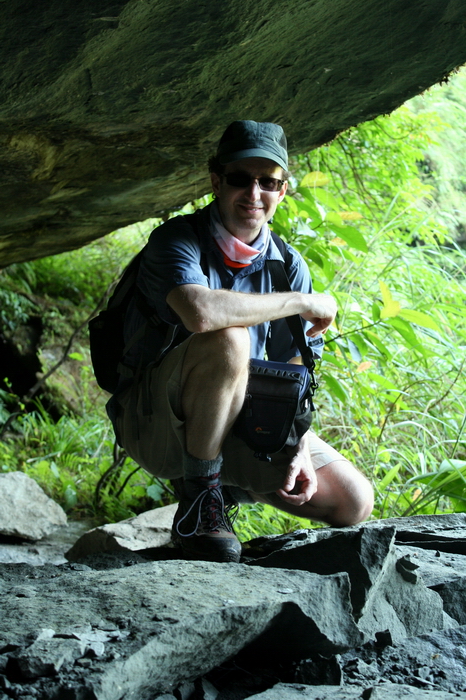
Gotta go in:
It's a little cramped at the end:
The Buddha and the falls:

Now to the untrained eye, this looks like yet another pic of the same fall:
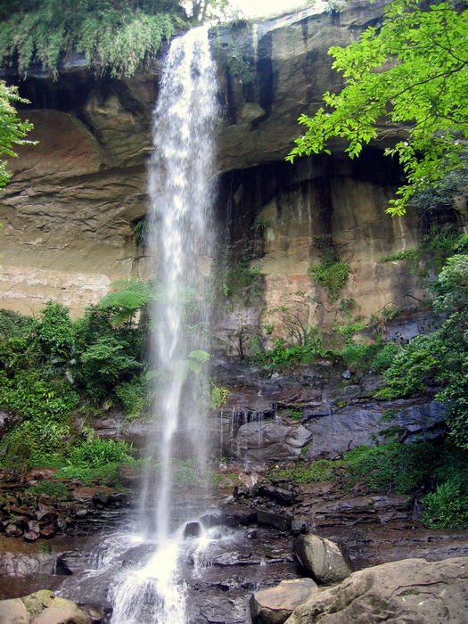
But it isn't. It's Pipa Dong Falls (枇杷洞瀑布; Loquat Cave) a near duplicate about 300m upstream. It's a steep climb up the slopes next to Motian to reach it and when you do you can't help but marvel at two 30m falls dropping off high limestone cliffs almost back to back.
The runoff after Pipa Dong flows along flatter ground here and there is a palpable serenity to the place. We stayed for a while snapping pics, wandering over to look down and across the valley from the top of Motian Falls, and just feeling good above being alive in such a place on such a day.
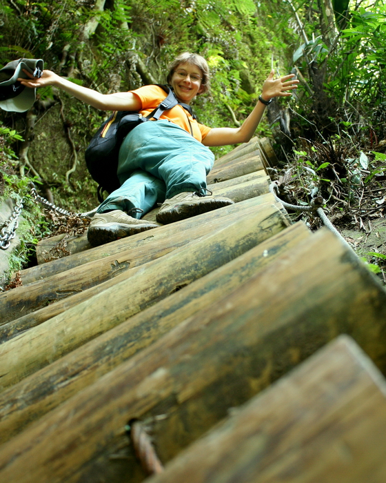
Another steep climb up some wood ladders brought us to a small paved trail. It's been so long that we've done this hike I thought it would soon be over. But in fact we had hours more to go.
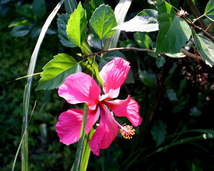
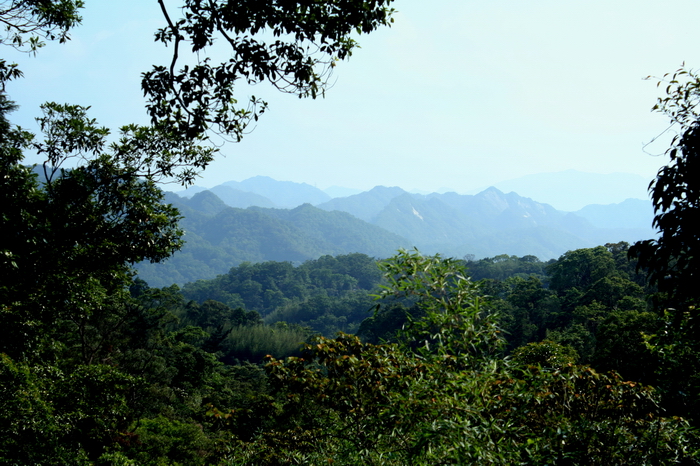
The path wended its way through pretty patches of bamboo, daisies, angel trumpets, hibiscus, and Morning Glories, before dropping us off on a road. As it was a clear sunny day we could see rows of mountains rolling back on the horizon. To our right was the ridgeline of the wonderfully scenic Wufenshan Trail, an important side branch of the Tanlan Trail. Wufenshan was the scene of the hiking club's first hike so it's a nostalgic site. (It's also the location of that tunnel above but I'm not going to give any more directions than that.)
We followed the road downhill, veering off on obvious natural paths that straightened the bends. At a small village we turned left after crossing a short bridge and wandered down into Barbarian Valley, an old tourist park chock a block full of waterfalls, that unfortunately has been closed since the big earthquake of 1999. It is the focus of yet another long-term plan: that of river tracing up a side stream into the park for a look around.
We forgot to stop to check out the Lost Souls Falls, visible from one of those fake Chinese pavilions that still mar rural landscapes. Anyway, here's a pic from the old days:
From the parking lot at Barbarian Valley we headed up an obvious trail and after rounding a short pass started our descent to the Keelung River. It's a mostly staired route, but be very careful: even on a dry day it is rare not to slip and fall on your butt.
Lovely scenery all around:
In about 30 minutes we reached a bridge crossing over the Keelung.
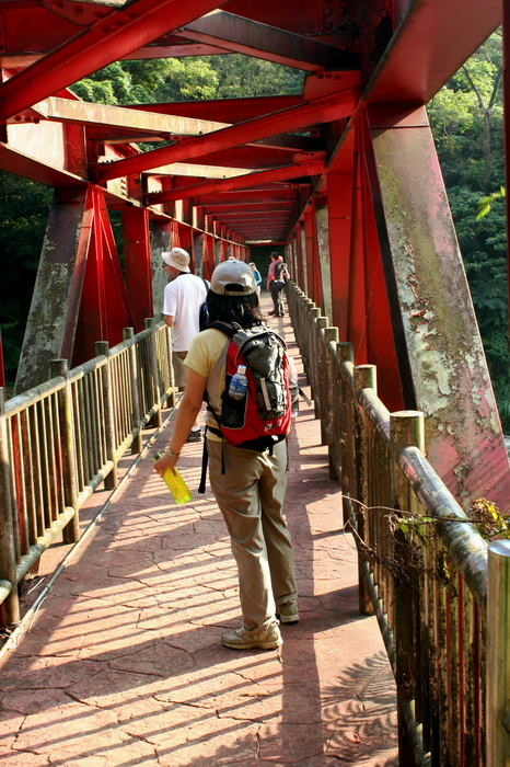
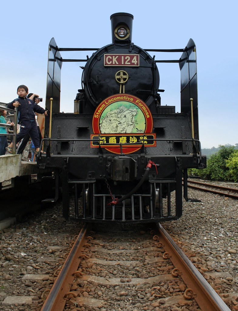
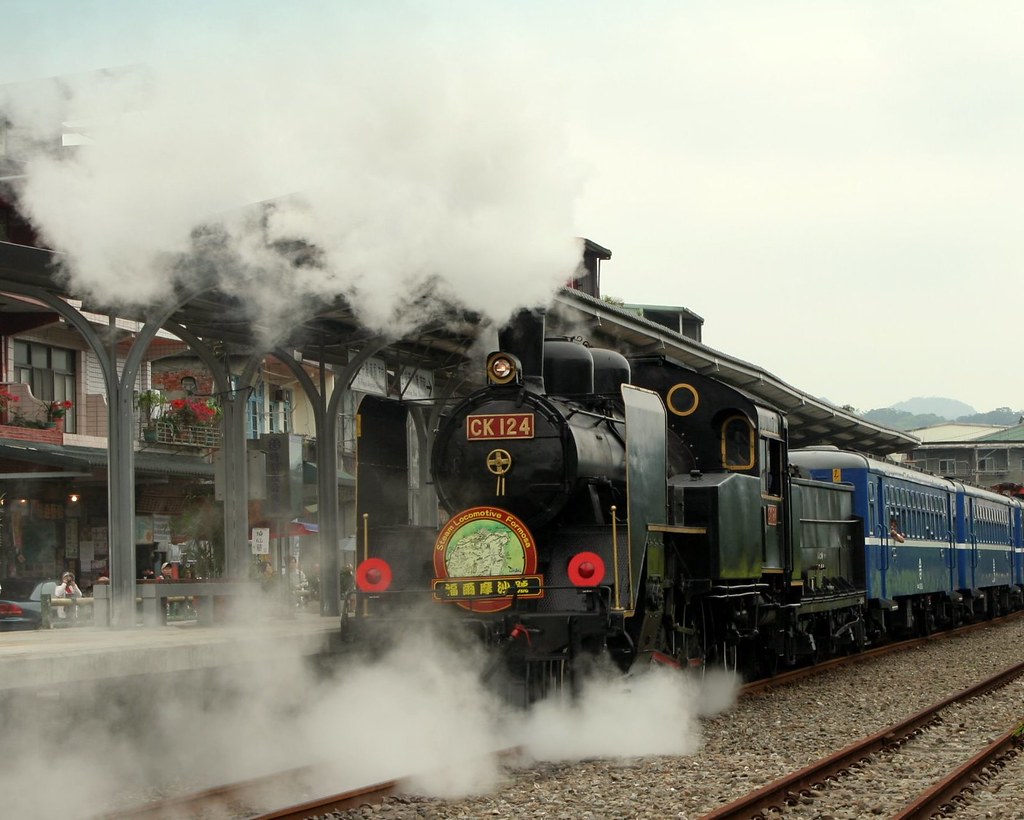
On the other side we connected with the railway tracks of the Pingxi Small Rail Line, Taiwan's only private rail during Japanese times. Originally built to haul coal out of the valley, the rail is now purely a tourist vehicle. It's fun and once a month they use old-fashioned steam engines to pull the carriages. I'm not sure how to find out when though. I was just lucky the day I took these pictures to be in the area at the right time.
There's no path alongside the railway so we walked the tracks. Of course it was great. We were in a perfect, deep forested gorge on a hot spring day. We could smell railway ties and wild ginger, hear the crackle of stones under our feet, and the rush of the Keelung River below. We were as happy as kids.
There was even a tunnel to walk through, with the added bonus of getting to ignore a sign:

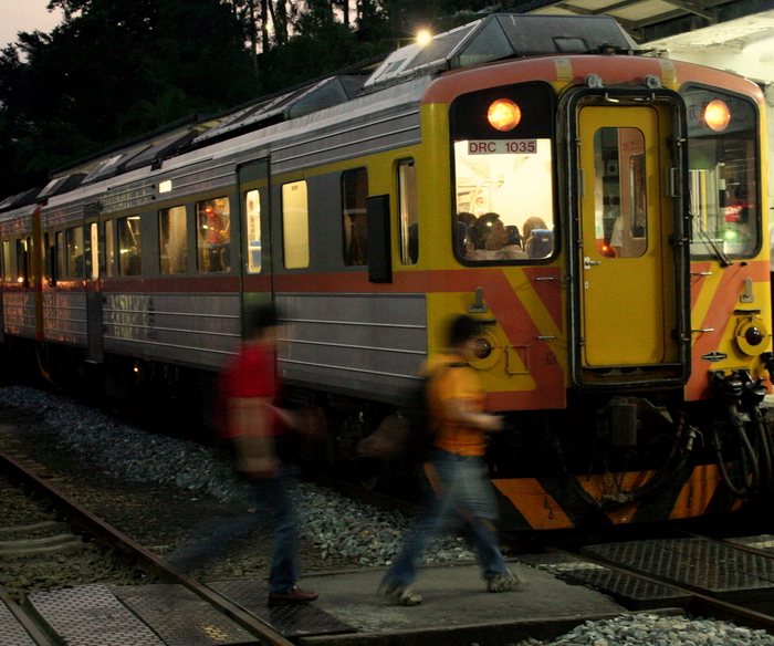
As we reached the other side we heard the train. These kids just barely got out in time (though the train drivers are used to walkers and would have stopped). Run away! Run away!

Stupidly, I was so consumed getting a pic of them that I didn't pay attention to my position. I felt a brush of wind on my cheeks and looked to see the yellow metal side of the train whizzing by about 6 inches from my face. Note to self: trains are wider than the tracks they are on.
We continued to follow the tracks and passed the old recreation area of Shifen Falls. The curtain shaped falls are known as the Niagara of Taiwan, and once, in an old brochure were mislabeled the Nicaragua of Taiwan (the latter was perhaps not so inappropriate however as the area was once a holdout for communist bandits in the 40s).

You used to have to pay an exorbitant (for Taiwan) NT180 to see the falls, but Taipei County suspended the operations license two years ago and is now is the process of trying to buy up the land. I hope they succeed. It is a beautiful fall, in a beautiful area and deserves to be a visible jewel in the crown of the waterfall trail (at the moment you can only gain a glimpse of it through the sheet metal fence).
I stood outside the gate of the old park and shouted "Free the Falls" but no one but me thought it was funny, alas.
Just past the falls a long suspension bridge stretches over the Keelung. Underneath is the minor Eyeglasses Waterfalls, so named because the shape of the depression behind the falls looks like eyes, with the fall water in the middle as a nose I guess.
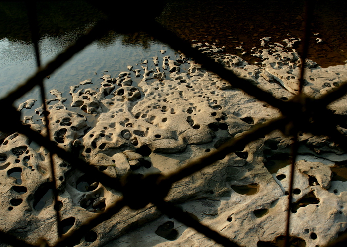
The area around the falls is developed in the sense of having sensible footpaths along the river and a nice looking visitor centre. We crossed another suspension bridge over an area called Dahua Potholes. The circles you see in the pic are formed by small pebbles, churned by water currents, carving a hole in the soft limestone. It's a pretty cool site. These kind of potholes are fairly common in the Keelung Valley though this is the largest example I have found.
It's very pretty around the visitor centre.

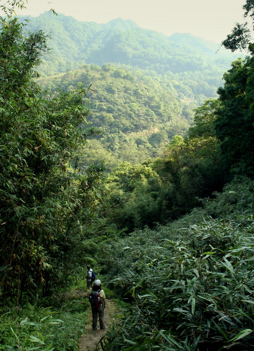
Note that the ridgeline in the distance comprises in part the Pingxi Crags and Fentou Jian, sites of many previous hikes. The Keelung Valley is one hell of a great hiking destination.
The small village of Shifen, about 10 minutes from the visitor centre, looked on Sunday as if it had had a nice cleaning recently. I commented how it could be really great if they fixed it up like the old street in Sanxia, and Katanya noted that it was already very quaint. She was right and the way the railway runs through the centre of the village brings back feelings of old Taiwan like few other places can.

A massive nine-course feed at one of the local restaurants cost each of us a kingly NT170 each. After dinner we parted ways, with some of use catching the line to Jingtong where we caught the No 16 bus back to Muzha MRT station. The other took the train in the other direction back to Taipei Main Station.
In Jingtong a few of us enjoyed a cup of Mi Day, a traditional sesame paste drink made famous it seems by me:
Practicalities:
This is a linear hike so it is best to start at Santiaoling and end at Shifen though you could simply walk to the last fall and turn back.
You can only conveniently reach Santiaoling by train (after a long flight for the Dutch; see EVA's new schedule for BIG BIG BIG discounts!), but there aren't many a day from Taipei. We always catch the 10.40am which gets us to Santiaoling Station just before noon. Though you could finish the trail in a few hours, it's nice to take your time and arrive in Shifen around dinner.
There are signs from the station to the trailhead. From there on just follow the obvious path. When you get to the small paved path turn left and follow to the road. Then follow the road down into a small village and turn left just after you cross the stream. Head down and on the far side of Barbarian Valley parking lot look for a trail. That trail takes you to the Keelung River bridge. Cross and head up to tracks. Turn right and follow to Shifen. From Shifen you can catch a bus to Muzha MRT (before 5pm) or a train back to Ruifang where you transfer to a train to Taipei.
Richard Saunder's wonderful Taipei Day Trips explains how to get to another two falls close to Santiaoling station. We have explored them on other days but decided not to see them this time.
Full set of pics here.
16 comments:
What an excellent entry. I am amazed at your perception. Well done.
I want to go back!
Perception?
Where can see the photo of the bats and spiders?
Great looking hike and some very nice pictures. I remember seeing the CK-124 steam train at the fan-garage in Changhua last time I was there. There's a pic here if you're interested.
Yes, same train, Craig. Good memory.
Kaminoge, I am trying to find a copy of that pic.
Kaminoge, found the bat and spider pic. It is now on the blog.
Be careful walking through those train tunnels. Stop and ask a local for the daily schedule of trains, there are about 20 per day (10 in each direction) I learned the hard way and almost lost my life. I found myself at about the midway point in the longest of those tunnels and was being bore down on by a train that was not about to stop. I ran for it and barely made it out in time(literally about 3 seconds) I had to dive off to the side to avoid becomming bug splat. I'll take train tunnels way more seriously from now on.
wow ! what a blog
wow ! what a blog
This is a lovely half-day trip, one of my favourites. Also, there is another variant of this trail, which I find even nicer: get off at Houtong and walk to the waterfalls from the other side, from the top, end up back in Sandiaoling. Slightly longer and without the lovely river for swimming at the end, but worth!
Time to time I search you blog inspiration, thanks for taking your time to share with others!
Thanks for this great information. Do you have to go through the train tunnels to make it to Shifen ? I am keen on walking the trail, but not terribly interested in playing chicken with a 50000 pound train.
Good blog
The dude is totally right, and there is no suspicion.
Hi
Thanks for the great description. Was wondering if the trail was suitable for kids about 4 plus years? Less the trek to the third waterfall of course, with the stone cut steps and all.
The first part of the trail is fine for a small child. Pretty flat and wide and the stream is usually shallow enough to play in.
Great Blog! I did the trip yesterday all on my own.... Love this place. Like your pictures and tracking trail.
Post a Comment