
It's already the middle of February and I haven't had an update of Pashan. There are so many hikes backlogged now it is hard to know where to begin. Some of the grander ones such as the five-day circuit of the aptly named Holy Ridge will have to wait until I sort through 1300 photographs. Let's start with an easy, but hardly less worthy, lower elevation route: the 18km Fu-ba National Trail.
Fu-ba gets it's name from the start and end points of the trail: Fushan and Baling Villages. According to the national trail system website:
The Dakekan Group of the Taiya Tribe first opened the Fubayuehling Historic Trail 200 or 300 years ago. The group traveled through the 2,000m-high Daguan Mountain in the southwest of Baling to reach Fushan and Wulai, making the trail an indispensable access for exchanges and marriage: for this reason the Historic Trail is known as Marriage Trail. In 1913 the Japanese army took Balong (Baling of today) and established a mountain police trail. In the early years of the Republic of China the trail linked mountain sectors in Taoyuan Department and Taipei Department to meet the economic needs required by the camphor industry and the military need to control the Taiya Tribe.
Some might know the end of the trail as Lalashan, a reserve for some of the oldest cypress trees in Taiwan (we're talking thousands of years here). Actually, some might even know this as the beginning of the trail, as many groups begin in Lalashan and hike down. But that's tough on the knees and in any case, the Fushan entrance is an hour from my house, while the Lalashan-Baling (on the somewhat treacherous North Cross Island Highway) is about 6 hours.
So the gang met up at Xindian MRT station and drove out to Fushan Village. Alert readers of Pashan may recal that this is the same route we took exactly a year earlier to hike the Hapen National Trail. At the time I did not know the Fu-ba and Hapen trailheads are within a kilometre of each other.
As the crow flies, Fushan isn't far south from Taipei. But past Wulai the road narrows and twists above the Nanshih, a fast flowing river in a deep cut valley that's green with the bounty of nature beyond compare. This is a gorgeous slice of Taiwan; a rugged mountainous holdout; a centre for aboriginal culture, and a hikers dreamscape with dozens of un-crowded trails cutting through undeveloped land. Just now, looking at my maps with the simple goal of getting the names of the rivers down, I got lost in plans for a hour.
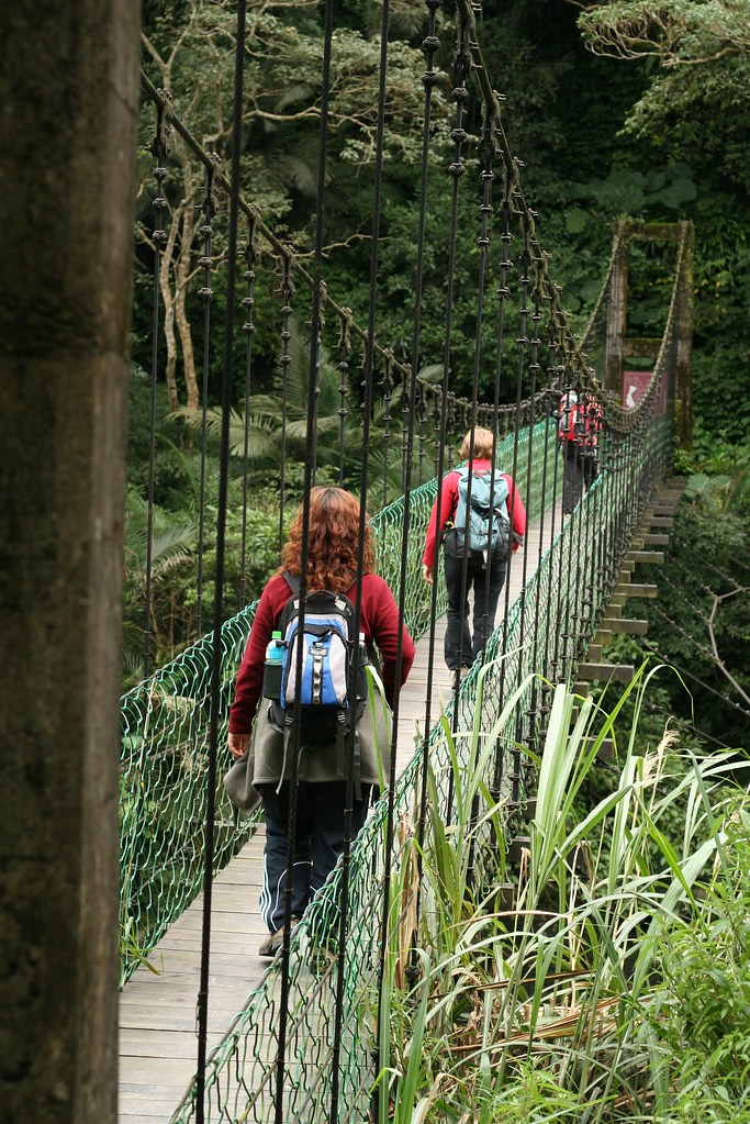
Anyway, last Sunday we parked at Fushan Village and crossed a little tributary of the Nanshih River on a handsome looking suspension bridge. Suspension bridges are common in Taiwan but I love them all.
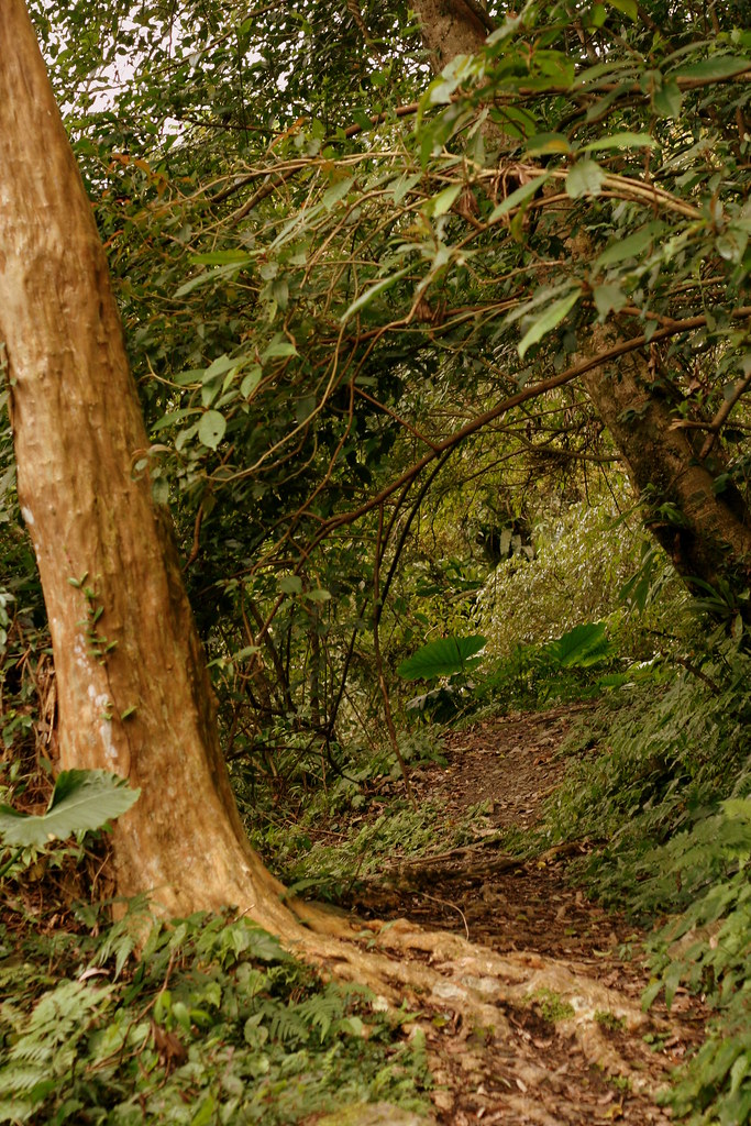
The trail began to climb right away but it was surprisingly manageable. In fact, it was downright pleasant, so unlike the stairmaster workouts that are so many of our hikes.
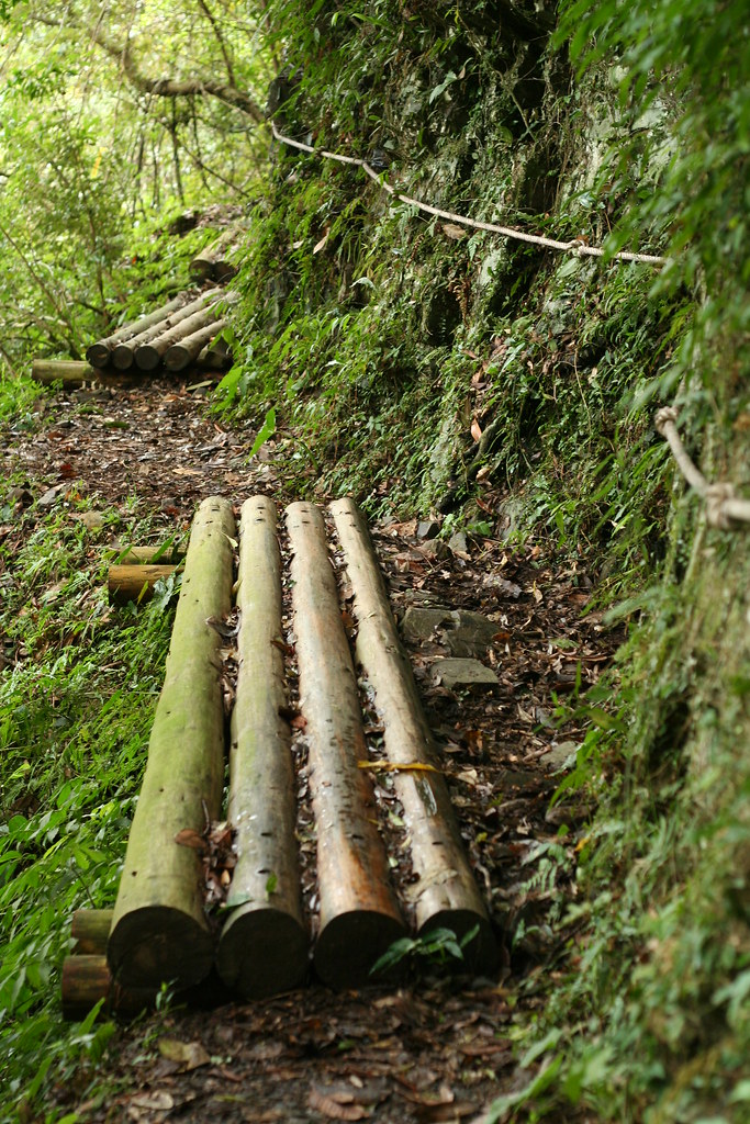
As a national trail it was also well furbished:
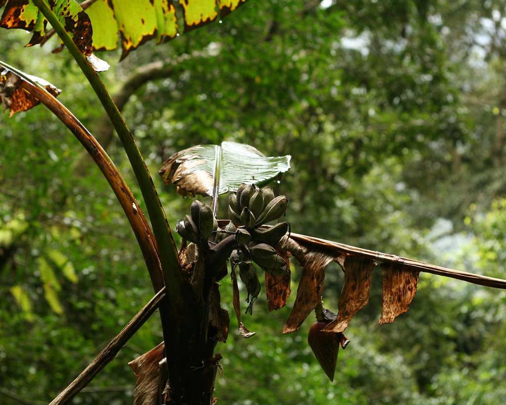
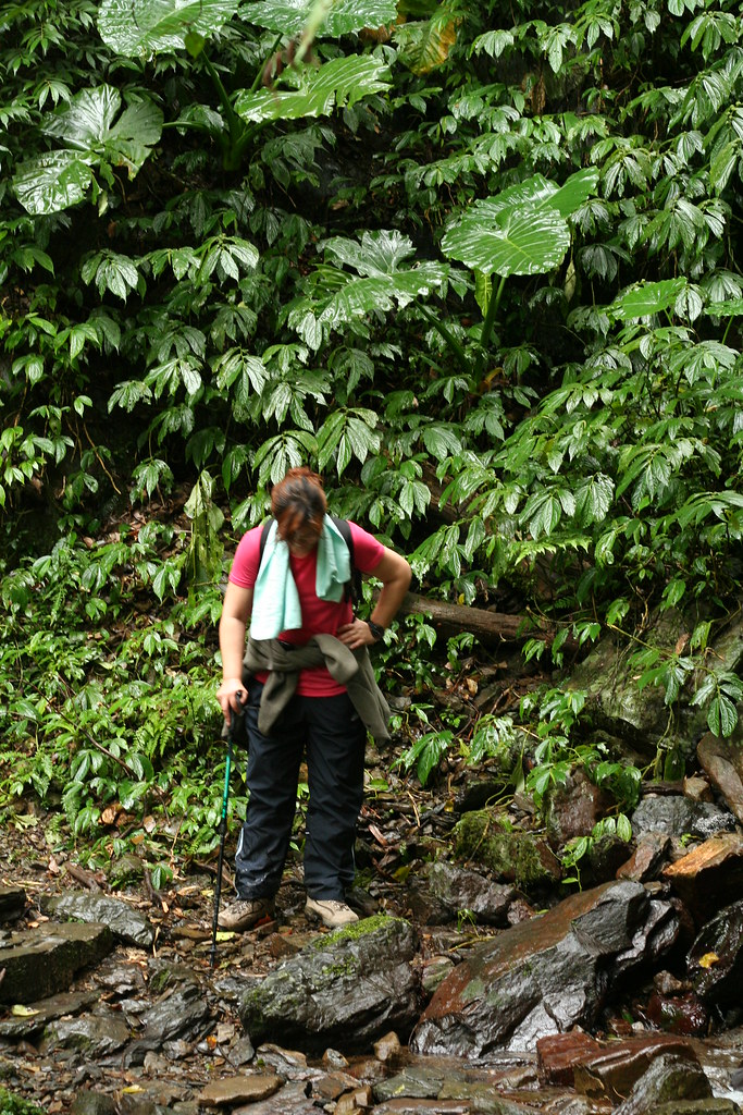
We climbed along the southern slopes of the Zhakong River Valley for a couple km. The trail then split, the Fu-ba heading right and up toward the Daguanshan mountains. The forest was rich in fir, cypress, and beech, and the barkless wonder known as the monkey slip tree (see two pics up). But I wasn't paying that much attention as the wet tropical vegetation was more varied and more distinguished.

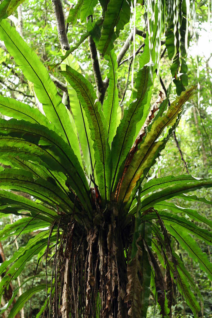
I love this shot:
We hiked about a third of the 18km length of the full trail before turning back. Near the end, we passed by the same flocks of chirping yellow-throated minivets we had encountered earlier, rounding the day off on a literally good note.
Practicalities:
The Fushan trailhead is south of Wulai about 18km (which is south-east of Holland about 19,345km). It's obvious on the left just before the village of Fushan. There is infrequent bus service from Wulai to Fushan so your own transport is best (you can arrange for a taxi to take you here in Wulai). Biking the route is also an option, and a damn fine one at that.
It's possible to hike up the entire lenth of Fu-ba in a long day (it's 6 hours hikng down) and stay in Baling at the top in a homestay. There may be buses from Baling back to Taoyuan (where you can catch a train to Taipei) but check first. Mountain bus routes are always being cancelled.
It's also possible to camp out on the trail. We saw lots of clearings along the trail that were obviously being used for just this purpose. This is an all weather trail, though inquire after typhoons.
The Sunriver 1:25,000 scale maps you find at mountain equipment shops near the Taipei Main train station covers the first half of the trail on map 9. If you can find the forestry department map of the whole trail buy it.
Last point, remember to bring a passport or ARC as you need to pass a police check on the way in (such checks are common into mountainous areas of Taiwan).
9 comments:
All that reading up on settings has really paid off. Your pictures actually capture how beautiful Taiwan is!
Great story and those pictures are really nice! I love this hiking trail and hope we can hike all the way to Lalashan in the near future.
Its always better to be out hiking and taking pictures rather than sitting at a computer sorting out photos and writing them up.
But we all appreciate when you can finally get down to the later. Thanks for sharing.
Thanks for the comments, guys. Stephen, I've been reading your adventures lately. Inspired to take my gang to Beidawushan in the coming weeks.
...19.345 kms. If I start hiking now, I will see you in approximately the end of May 2011...
Great photos, by the way! Dreaming away at my computer when I should be working on my PhD.
Can you post some Google map links to where you're going in Taiwan?
Another Taiwan hiking blogger does so and it's very helpful figuring out if a hike is accessible to living in Xindian without a car yet.
Scooter time...
Thank you for all of the posting. Taiwan is an amazing place to be hiking.
Hello Robert,
Thanks for putting this blog together - it is very informative. Anyway, a friend and I are now interested in hiking the full Batonguan cross mountain trail in August. Could you give us any tips on how best to go about getting the necessary permits?
It looks like we would need to camp during this trip - are there any other of the longer trails (100km or so) that you might recommend too?
many thanks, Will Pirie (will_pirie@hotmail.com)
Hi Will,
I take it you have read my account on the trail here:
http://hikingintaiwan.blogspot.com
/2008_04_20_archive.html
Anyway, there is also the South Section II which breaks off from the Batonguan on day 2 or 3 and heads south to the South Cross Highway and South Section I which head south from the same highway. Both take a week or more.
A favorite (I will blog on it in the coming weeks) is the Holy Ridge in SheiPa National Park. This 5-6 day trail runs along a ridge 3000m+ high. The scenery is as good as anything I have ever seen.
As luck would have it, my friend Steven Crook just wrote an article about some of the long trails:
http://taiwanjournal.nat.gov.tw/ct.asp?CtNode=122&xItem=47566
The main problem with August is the likelihood of typhoons either closing down the parks or damaging a trail so it needs to be closed down for several months/weeks. But there are many options so it is unlikely all would be closed.
As for permits, contact Richard Foster at Barking Deer. Note you can only apply 30 days in advance.
http://www.barking-deer.com/
apparently there are only 2 daily buses to get out of baling. one is at 9.30 am and the other one 3.30pm.
and as a side note, its very easy to hitch hike from wulai to fushan. most cars would happily pick you up (from my experience).
Post a Comment