You live here long enough and the whispers of the past start to rise to a conversation. Cuts through the forest became trade routes, sites of major battles, and forced resettlements of the native populations by Qing, Japanese and Guomingdang colonizers. And you start to make connections.
Such was it two weeks ago when we stumbled more or less on a centuries old path that runs from Nan-ao on the east coast as far inland as the No 7 highway. It's a few dozen km as the crow flies but 4-5 days with a pack on your back and a determined look to conquer the Batongguan of the north.
As with the Batongguan, the Biyahao Trail began as an aboriginal trade and transport route. In this case, it facilitated the salt trade for the Atayal. This from the National Trail System website:
"The Biyahao Historic Trail used to serve the Shakadan Group of the Taiya Tribe when traveling upstream of the Dajia River across the Siyuan Path before proceeding eastward to Nanao River and Dazhuoshui river and the trip covers the mountain trails in Siji and Nanao."
Those who recall my blog on the Batongguan trail will know that work on that trail began in 1875 after the Mudan incident showed the Qing had no real control over most of eastern Taiwan. As rush of trade and military routes began to be established all over the island.
"In 1889, Liu Chao-dai (劉朝帶), Liu Ming-chuan's nephew, led a team of about 500 soldiers to developed a path in the mountainous region at Xiao Pi-nan-tang (小埤南塘) in Xiao Nan-ao. They tried to find a route to reach San-pu-li village (前山埔里社). In search of San-pu-li village, Liu Chao-dai and his men were attacked by Atayal people of Lao-gou-fan village (Lao-gou-fan, 老狗番, literally means old dog barbarian) at Dong-si-ren-keng (Dong-si-ren-keng, 凍死人坑, literally means freeze to death in Chinese). Approximately 300 soldiers were killed in this encounter which included Liu Chao-dai himself."
Liu Ming Chuan was the first governor of Taiwan after it was made a Qing province in 1885. He used all his power and connections to gather an overwhelming modern force to punish the Atayal for killing his relative.
Six years later, the Qing lost Taiwan to the Japanese. Under the new colonial rulers the Atayal did not fair much better and the Biyahao trail became yet another police route (as the Batonguan was). After 1945, all the villages up the valley were forced by the new KMT government to relocate closer to the coast. Hence Wuta is now a small settlement along the coast (served by the east coast rail line), while a day up the Biyahao trail you can find the abandoned remains of Old Wuta and a number of other centuries old aboriginal villages.
So how did I find all this? Well, a Taiwanese friend we all refer to as "Trail Hacker" informed me last summer that the forestry department was restoring an historic trail from Nanao to Siji: in other words, from the east coast across undeveloped mountain ranges to the No 7. The National Trail System website had a short entry on the trail and I devoured it, hungry as always for more.
A few weeks ago I headed out to Nanao to see if I could find anything more. During the day I visited an Atayal museum, a native species centre, a forestry department branch, and a local village chief. Information was sketchy, conflicting, or at best, promising, but out of immediate grasp ("I'll give you the number of a friend who does guiding in the area.") But we did get general directions to the area where the trail should begin.
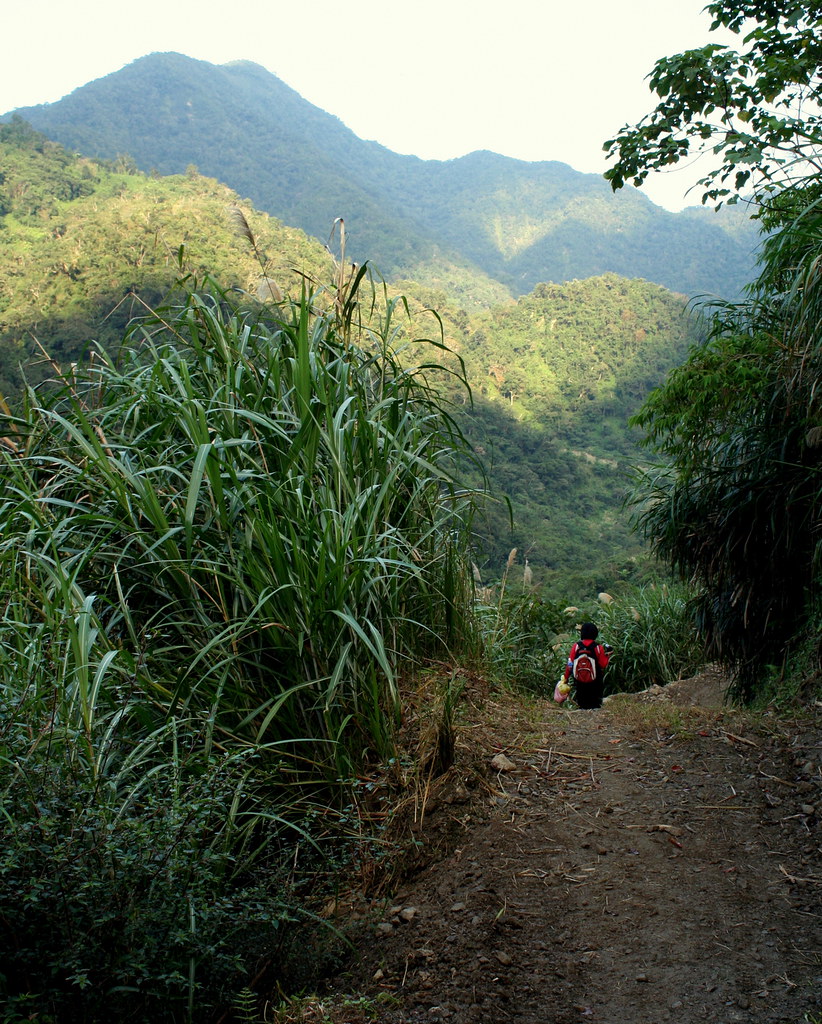
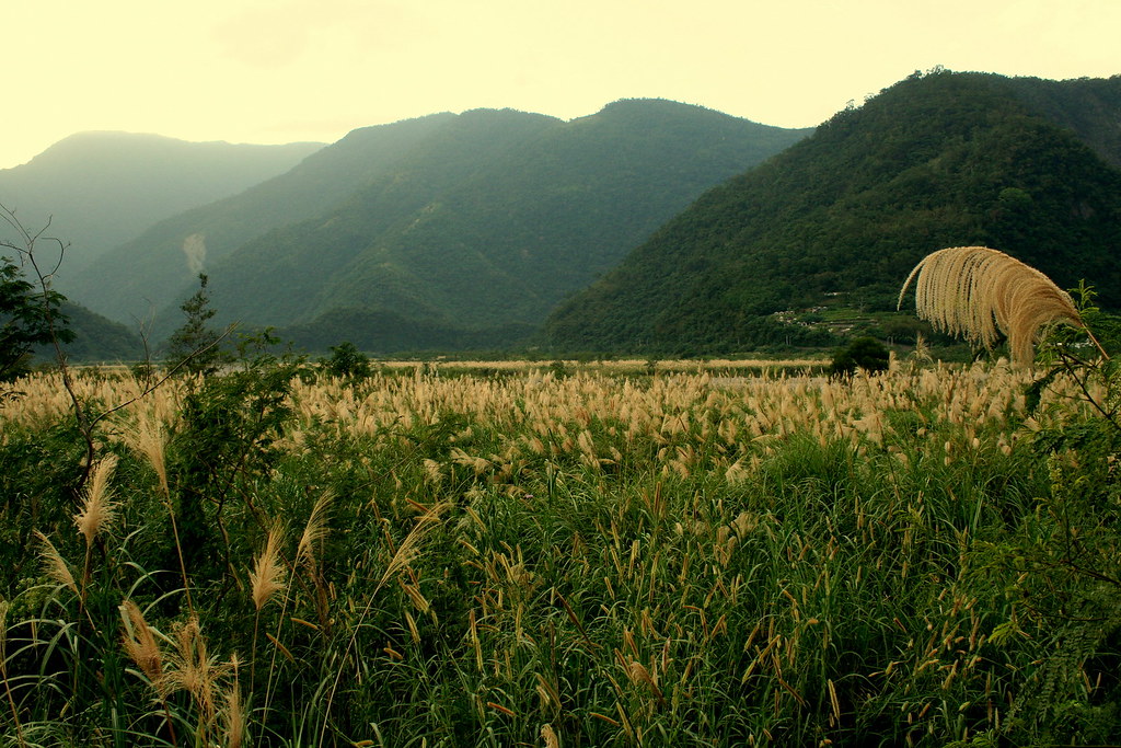
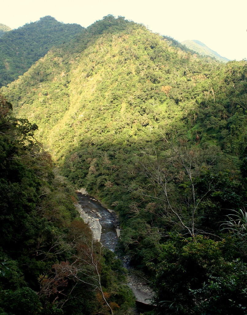
Now readers will recal that last month I visited Nanao and wrote about a river trace up the Nan-ao North River. Well, this time we were heading up the South River. As with its counterpart, the south runs through a deep wooded valley. On this day the valley was bursting with color as the handsome white silver grass bloomed in the open fields.
But as captivating as the scenery, what caught me more was the feeling that this was land, though so little developed, had been lived in for a long time.
We drove up the 57, a small country lane off Hwy 9, and a little past the village of Jinyang found a path called the Zhong-yue Stream Trail. I don't know the history of the trail but it was recently restored as a type of make-work project for the local community. We explored briefly, admired the crystal clean clarity of the stream water, but had to return to our car prematurely as it was getting dark.
That was a Sunday. By Monday I was chaffing to go back and explore. The weather that week promised to be glorious, sunny and dry, and so I made a date to return on Thursday no matter what. One of my regular hiking partners, Kate Lin, kindly offered to join me, and we set off at 8am from Muzha.
Despite the early morning traffic through town, it was smooth sailing once we got on the highway, and two hours later we arrived in Nanao. We drove across town, crossed the north and the south river, and then turned to follow the latter upstream.
When we got to the trailhead for the Zhong-yue Stream Trail, I decided to drive a little further to the end of the road. Since Sunday I had had a look at my wonderful Formosan Complete Road Atlas, and discussed the area online with the hiking god Jah Linnie. I was pretty sure the road would end in a few km and the trail to Siji would begin.
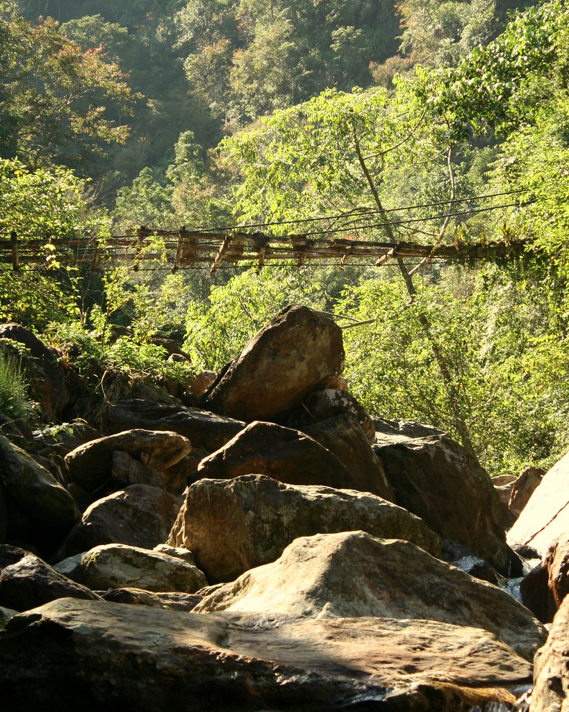
So it was. And the trail was signed too:
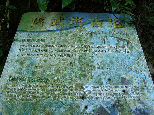
Of course it says Wuta Old Trail, but this is part of the whole Biyahao Trail, Wuta being the abandoned village a day up. In part, this confusion, or rather overlapping of names, is what made finding information from the various museums and forestry departments so difficult.
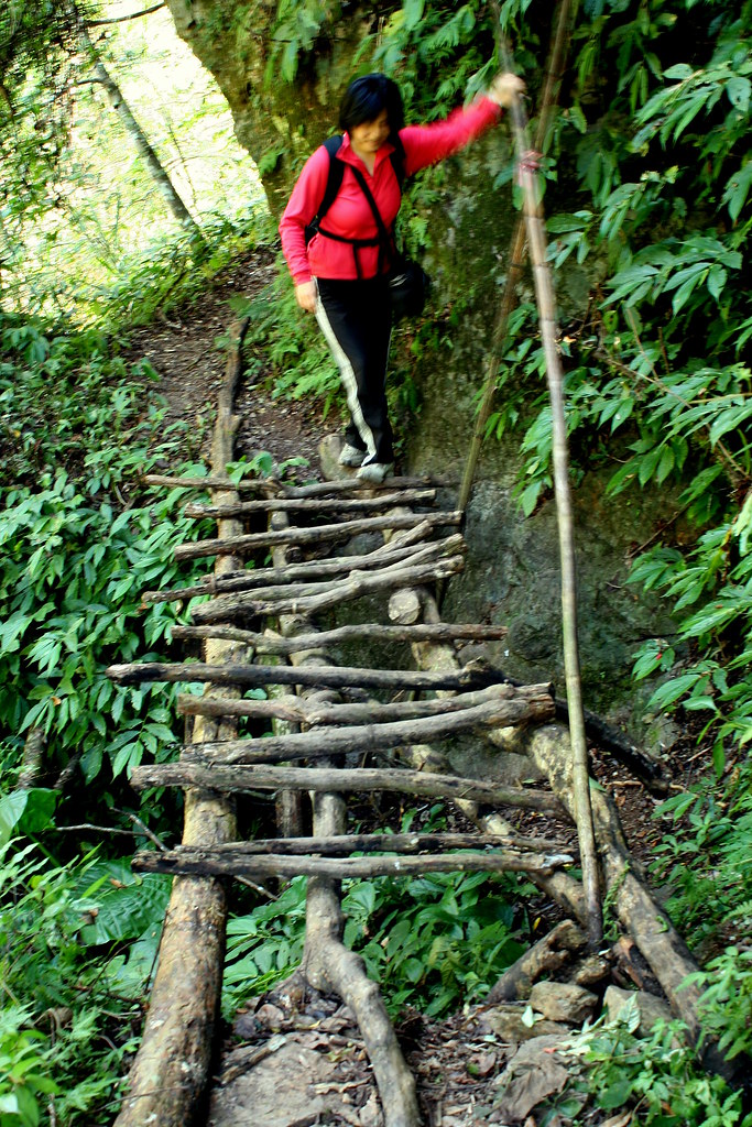
In any case, Kate and I set out on the trail and were delighted to find it wide, smooth, flat and clear. In fact it looked as if someone had been through that day with a machete.
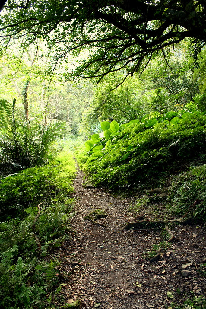
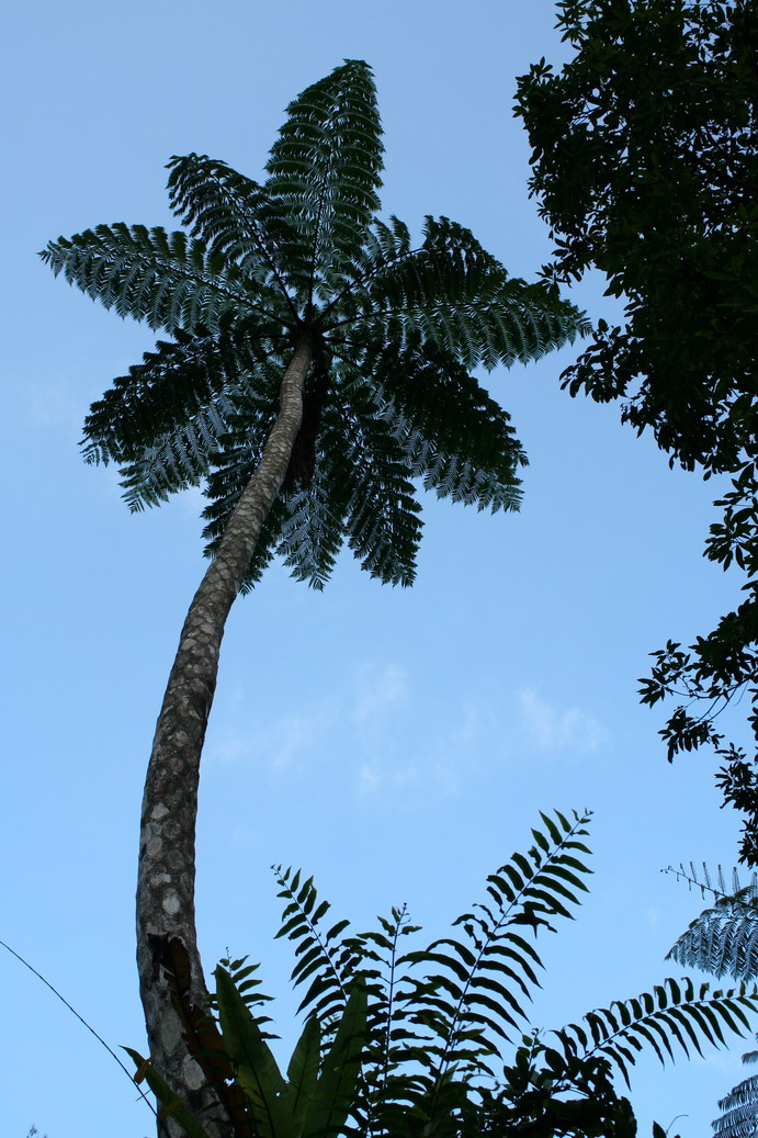
It was a beautiful even trail and its age was apparent in sections that were obviously cut out of the rock face: hunters don't do that, only Japanese or Qing troops. Kate could not help crying Wow, wow, wow, every few seconds. I felt the same way. The views across the valley were superb: the gums were turning red, and the Monkey Slip Trees (Chinese Crape Myrtle) were out in force.
After an hour into the hike we began to hear the sounds of large animals crashing through the underbrush: deer or wild boar likely. We also spotted a gorgeous Muller's Barbet, a partridge, and a small troop of monkeys. And that was an hour in: imagine the wildlife on day two or three.
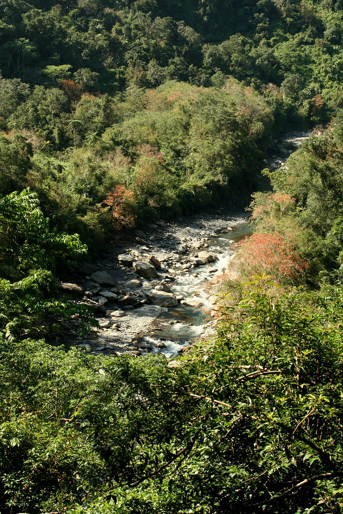
Kate and I hiked in about 2.5 hours and reach side stream that poured into the Nanao South River over a 5 metre high cleft in a stone wall. Below was a beautiful inviting swimming hole that would be worth hiking to on a summer day. We had lunch on the rocks and decided to call it a day.

It was about 4pm when we reached the car. I asked Kate if she minded if we drove to the Zhaoyang Historic Trail that ran along Turtle Hill, a small mound rolling back from the ocean. It's a short trail, 1.9km in all, but the views over the Pacific and down the coast to the famous 1000m Chingshui Cliffs are astonishing. Kate agreed but by the time we arrived at the north trailhead (after an hilarious wrong turn that left us at the end of a no through lane with rice fields dropping on both sides) the weather had suddenly shifted and it was pouring with rain.
I wanted to find the south entry point in any case so we drove out and after a few wrong turns found that trailhead. We were surprised to find it wasn't raining here and so decided to hike up to the top for a look. As it turned out, the best views are closer to the north (harbour) entrance.
We walked the trail through the darkening of night. We passed through a rare intact Gordonia forest, and ended up at a Qing Dynasty lookout that had once held English cannons pointed out to the Pacific. Even in the dark we could tell that the views during daylight would knock your socks off. Anyone heading down the coast to Hualien would do well to make a brief stop in Nanao and climb the Zhaoyang Trail.
So that was my exploration. Now what? Well, after researching and phone calls we have discovered that the Luodong Forestry Department is restoring the trail and it will officially open some time in 2009. Further research has shown that hiking clubs have already begun to explore the area, as the trail, though officially not open is pretty much in walkable shape. One can expect a great 4-5 day trek across the lowland hills of Taiwan through some of the most unspoiled scenery on this island.
Oh and the hot springs.
Thanks to Kate, we found a website of a group that has done the trek; and their videos show a 4 metre hot spring geyser on day two or three. The geyser is called the Mohe Hot Spring Fountain (莫很噴泉) and damn does it look cool. But there is also the Buxiaowan Stream spring (布蕭丸溪). (Scroll down for videos of the springs.)
I really have a hard time sitting still thinking about this trail. I've talked to everyone I know about it, mostly while pacing my floor on the phone.
The Biyahao: an historic hot spring trail. Is there anything more quintessentially Taiwanese? Is there anywhere Pashan would rather be exploring?
I've going to do this some time in the coming months. Without a doubt. Stay tuned. It's going to be a hell of an adventure.
For the full set up pics click here. And here for Kate's blog entry on the hike.
Practicalities:
No prac stuff until I explore the whole trail. For the Dutch, you REALLY have to come and do this with me!
12 comments:
Hi,
I'm teaching English at two elementary schools in Nanao now, and am very excited to read your last post about hiking here! I'm from California, but here for a year as part of the US fulbright program.
This is a beautiful place, and while I've enjoyed going to the beach nearly everyday, I haven't had the chance to go hiking in the mountains yet- will you let me know the next time you go, and are ok with company? If free, I'd really enjoy joining you. My boots have been sitting dejectedly in my closet.
Also, there is a teacher at Nanao Elementary who has done a lot of hiking back up to the old villages and knows these mountains well-- he's recently compiled a report with photos and descriptions of the old budao/villages in the mountains, and old Japanese building sites. If you're interested in speaking to him, let me know and I'll give him your info.
It's great to read your story about our hike in Nan-ao. I am sorry that I haven't finished my stories yet as I am reading more stories about the trail, and I have limited time as my advisor demanded me to work more projects for her. I will try to finish my the hike from my point of view and add extra historical stories about the trail asap(probably around you come back to Taiwan from your Christmas vacation.)
I learned that Wuta trail actually is Buta trail. Wuta is how we pronouse 武塔 in Chinese, and Buta is Atayal.
Oh yes please! Those photo's take my breath away (as would the hike, no doubt, but it would all be worth it, I'm sure). I am definitely coming over, at some point in time, that's a promise set in stone!
Love that new photo at the head of your blog too - amazing!
In the meantime, I will be hiking some 170 km of the South West Coast Path in Cornwall, southwest England this Spring. Not as exotic, I guess, but easily reached and lovely country side. Will email you soon! x
Hi Julia,
I will let you know next time I am in the area for a hike. I'd love to hear about life in such a small coastal town.
As for your friend, yes, I most certainly would like to speak with him and see his reports. I will be leaving on Thursday for Christmas vacation in Canada but he can contact me via email at rscottpk at gmail.com
Kate, keep at it. Your reports were very informative.
Inger, looking forward to your visit like Christmas.
I have been to Taipei too last March and cannot wait to go back again! I look forward to more of your post about Taiwan. HA, thanks for sharing!
"The valley certainly offered every attraction. In places it seemed to close in until both river and climber had the greatest difficulty getting through. As we got lower the water increased in volume and it was only by linking together that we were able to get across. Had there been recent rain it would have been quite unfordable. Our guard had brought with him a dog which seemed to have more lives than the proverbial cat. Again and again he was swept off his feet, and even over waterfalls, but he always turned up in the end, battered but triumphant."
Murray Walton on the Biyahao, 1932
In Walton's account of the trail he mentions three villages Pyahau, Buta, and Sendan. The latter appears to have been located near the current South Nanao River trailhead.
Walton's Pyahau Encounter
"Darkness was falling when we reached Pyahau, but our late arrival in no way detracted from the welcome we got from the police and savages alike. Suitable quarters were placed at our disposal, and a bath was waiting in a room too dark for even savages to enjoy the fun. Later in the evening the chief of the tribe, a old wizened warrior, who must have been responsible for many heads in his day, came to greet us, for we were the first white men who had ever been in those remote parts.
Though the savages of this tribe, the Nanwo, are supposed to be rather backward, yet in one respect they excel: they are ardent devotees of baseball....cladd in the minimum of clothing, going through all the correct postures, shouting the correct cries, and giving promise of that day when their representatives will appear at the Olympic Games."
Murray Walton, 1932
Walton also muses about the lives of the mountain police that escorted him throughout his journey.
"As usual we were handed on from station to station by our police hosts. During the process we got one amusing illustration of the magnificent self-restraint of the Japanese. Our companion over one section during the hottest part of the day was an elderly police inspector of some sixty years. When he reached the divisional point, the policemen who should have been waiting for him was not there. Without a murmur he walked on with us for a further two miles until he met the latecomer, whereupon he handed us over to him without so much as a word of reproof.
Despite the interest of their daily duties, the lives of these mountain police must in some ways be very monotonous, cut off as they are from all but a limited circle, among a people of but little education and none of the wider interests of life. We could not but hope that the day would come when the authorities would equip each post with a radio set, as has been done in England for lighthouse-keepers and other lonely servants of the state."
Murry Walton on the Biyahao, 1932
On Formosan Cooking
"Among our provisions had been included a cock, who was suspended from one of our porters loads, while with a distinct irony the knife which was destined to do the deed hung close by. It did not long survive our arrival, and when later I saw the men dismembering it limb by limb, I could almost smell the odour of chicken stew. But unknown to me they then decided to hash it, bones and all, and when it was dished up for supper my luck was dead out; I could get nothing but bones. Finally I drew the comb and half the beak. The dog had the rest.
Murray Walton on the Biyahao, 1932
Anon, great stuff. I looked into buying some of Walton's books but they are hundreds of US dollars. Where did you get yours?
My copy came from the library at Providence University.
WALTON, REV. W.H. MURRAY Scrambles in Japan and Formosa.
London, Edward Arnold. 1934
Call #:
950
w179
http://nbinet.ncl.edu.tw/search*cht/vBOOK+950+W179/v950+w179+/-3%2C-1%2C0%2CB/frameset&FF=v950+w179+&1%2C1%2C
Fantastic list! Will be checking these out for sure!
Everest Base Camp Trek via Jiri
Post a Comment