Friday, April 25, 2008

The Batongguan Historic Trail


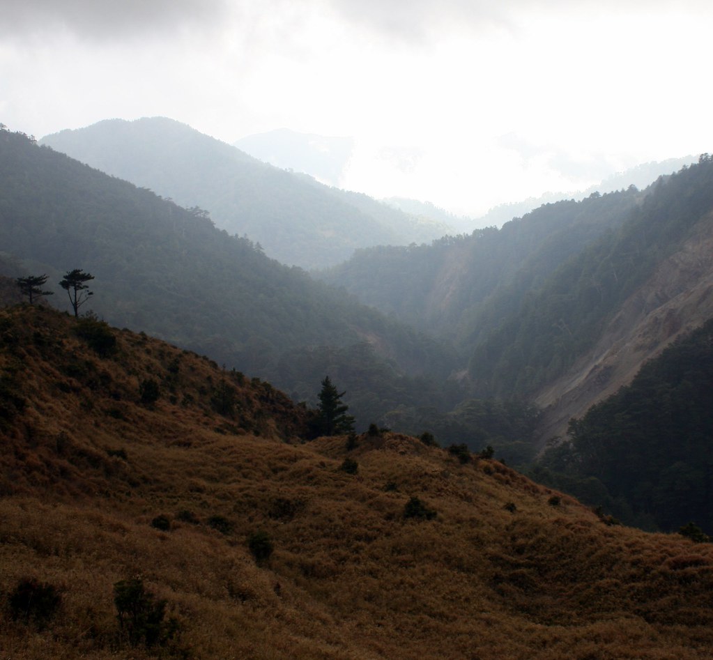
My most recent hike covered the most important of Taiwan’s historic cross-island trails: the week-long Batongguan, which crosses the alpine spine of Yushan National Park.

As this is such a great trail, and one for which there is so little English information, this is going to be a very long blog entry. For ease of navigation, I will divide it into 8 parts, the first of which will center on the history of the trail and overall practicalities:

History of the Batongguan Trail:


My journey into Taiwan’s rugged highlands was made possible by a little know incident way back in the spring of 1874. Paiwan aboriginals had murdered a crew of Japanese sailors and attempts by the Meiji government to force the Qing to punish tribal leaders led to the flimsiest of excuses: we don’t have any control over this part of Taiwan. Sorry.

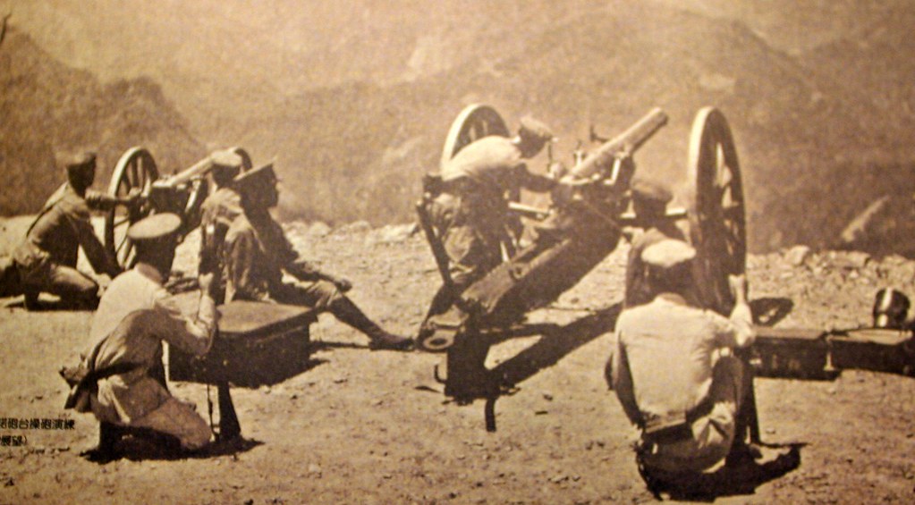
Angered (or looking for a good excuse to scout out the island), the Japanese government sent a punitive expedition of 3,600 soldiers. Under the leadership of one Saigō Tsugumichi (which sounds uncomfortably close to tsutsugamuchi, the disease I was struck with in January) forces invaded southern Taiwan in May 1874. As with a similar assault by US marines in 1867 against aboriginals and pirates in Kenting, the battle was not exactly favorable to the invaders. The Paiwan suffered loses of about 30 men. The Japanese, 543 (12 killed in battle and 531 by disease).

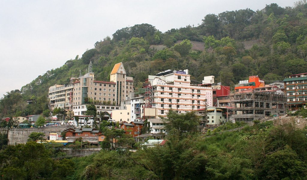
In Taiwan, the expedition is known as the Mudan Incident and there is a monument on one of the battlefields in a large field off Hwy 199 in Pingtung County. It’s not far east of the popular Sichongshi Hot Springs.

The Qing were understandably not happy to be shown to have little control of their territory and so in 1875 sent ambassador Pao-chen Shen to oversee the strengthening of Taiwan's defenses. Shen took charge of developing and charting the mountains, and placating (subjugating) the aboriginal tribes. The project for engineering the Batonguan trail began that same year.

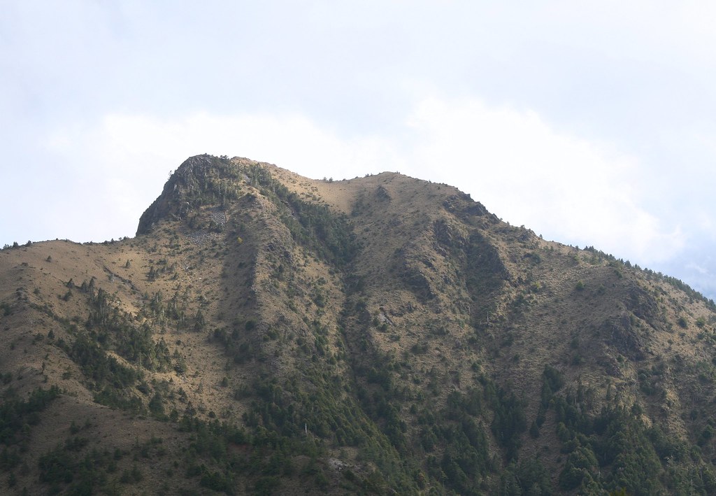
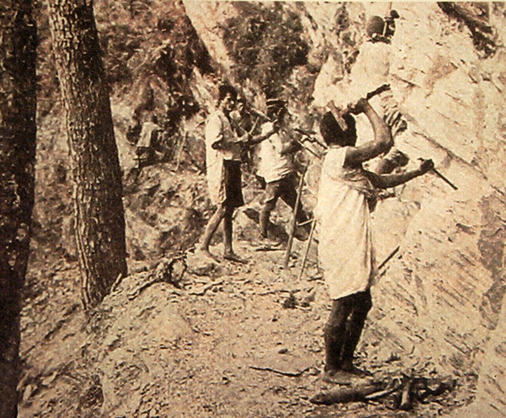
The project was headed by an officer named Wu Guang Liang, who commanded 2000 soldiers from the Flying Tiger Corps. Wu’s route started off at Chushan, Nantou County, passed through Lugu and Hsinyi Villages, climbed over the Batongguan meadows and the Hsiuguluan Mountains, and ended finally in Yuli in Hualian County. In total the route was 152km long.

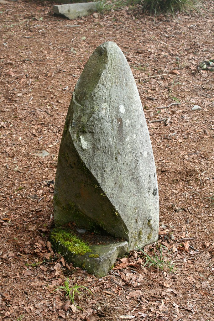
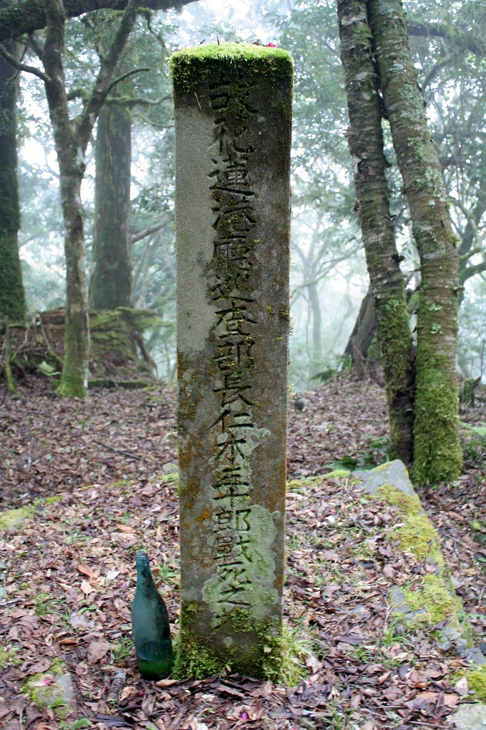
Today, the trail remains intact (but in poor shape) only after Dongpu though in several towns such as Jiji and Lugu there are commemorative stele. This one has an inscription by Wu Guang Liang himself.


The path took a year to complete and was called the Batong Pass Route, though there is no actual mountain pass to cross. Wu decided to use the name Batongguan (which is a transliteration of the Bunun “Pan Toun Kua,” their word for Yushan) as it sounded like the Chinese for “being able to pass unhindered.” Or maybe not. We have read of competing versions of the name.

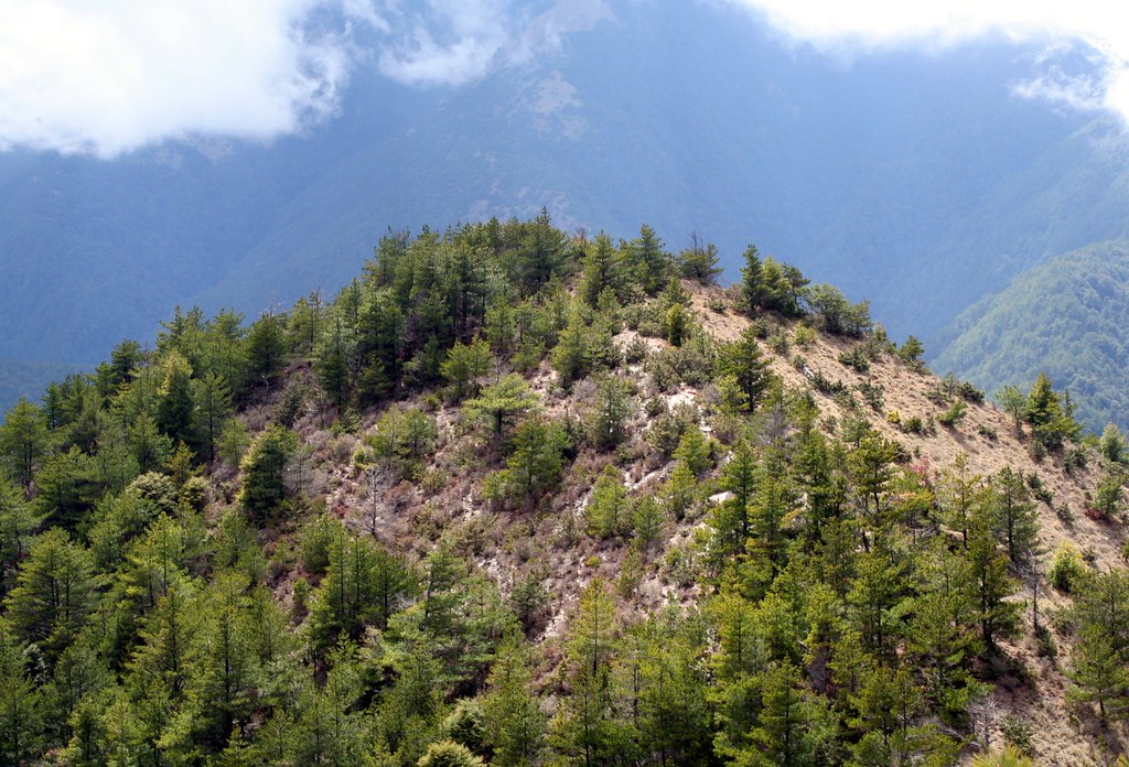
In any case, that is the Qing Dynasty Batongguan Trail. But there is also the Japanese Era Batongguan Traversing Route, which is what we hiked. Both trails both have a common point at Dongpu. They join up again at Batongguan (some reports suggest that the trails are the same from Dongpu to Batongguan) and for the last time at Dashuiku. In general the Qing Dynasty trail follows a harder, higher, more northern route.

The Japanese route was in part designed to facilitate transportation and communication between eastern and western Taiwan. But to a large degree it was built to pacify the aboriginals in the highland areas (using their labor of course).


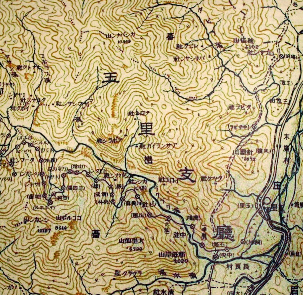
Surveying for the trail began in 1919, with the entire stretch being completed by 1921. However, it does seem that parts were already in place. By 1910, according to reports I have read, there was a trail from Yuli to at least Dafen. Dafen (also Tahun) was a major outpost with a school, martial arts and ceremonial hall, munitions depo, and trading post.


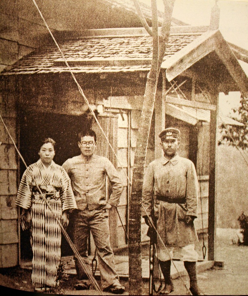
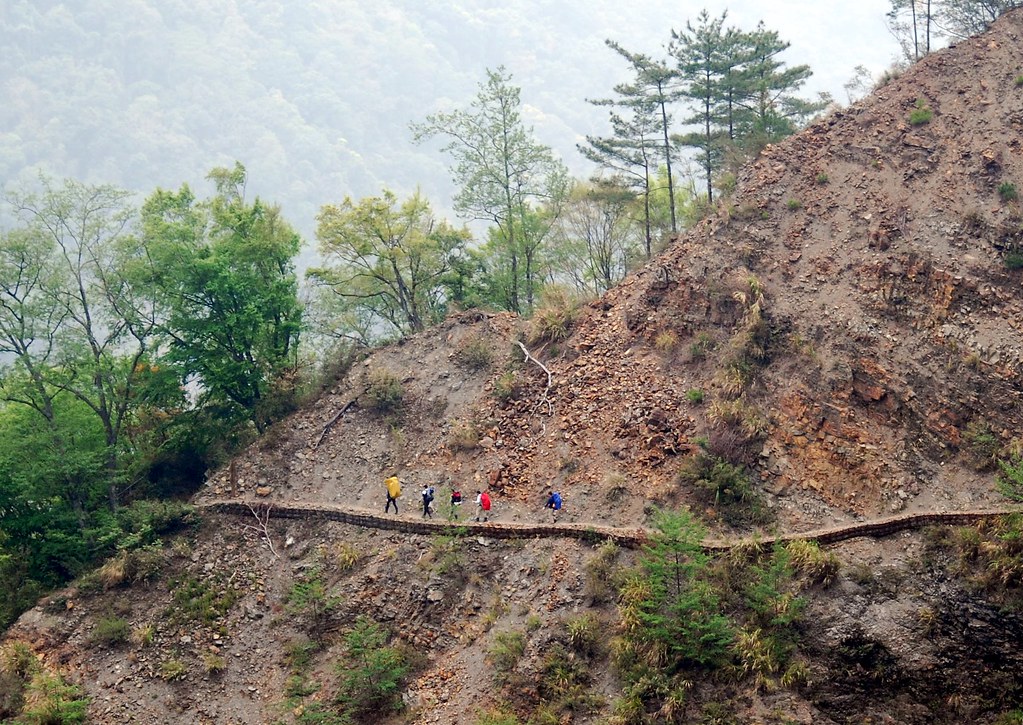
Dafen became the center of the colonial government’s attempts to control the Bunun around the Laku Laku River Valley. An inflexible policy banning all aboriginal firearm possession was met with such resistance (the Bunun revered guns) that police stations had to be set up every 2-4km along this part of the trail. To this day, commemorative steles marking bloody battles can be spotted every few kilometres.


Click here to see Day One.

Practicalities:

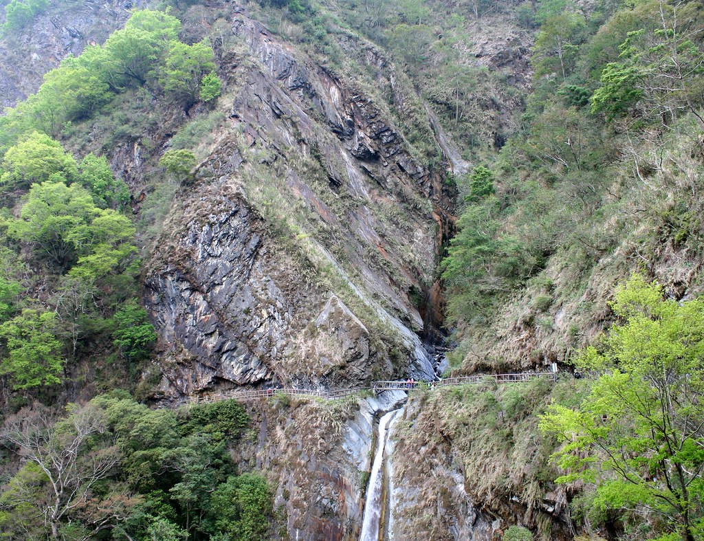
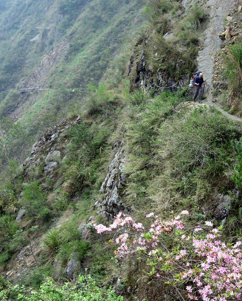
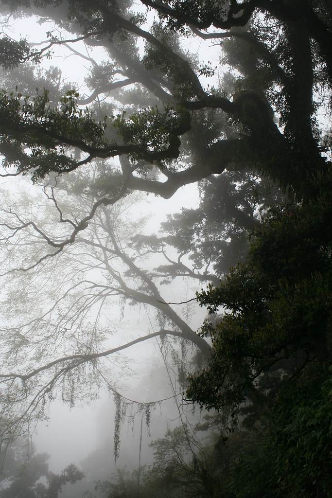
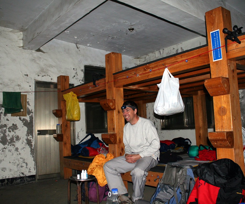
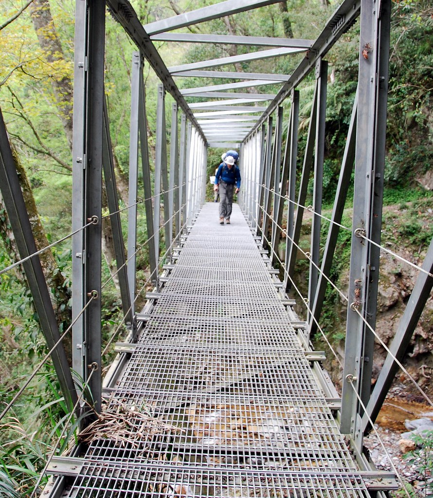
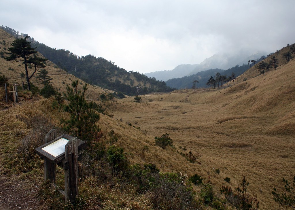
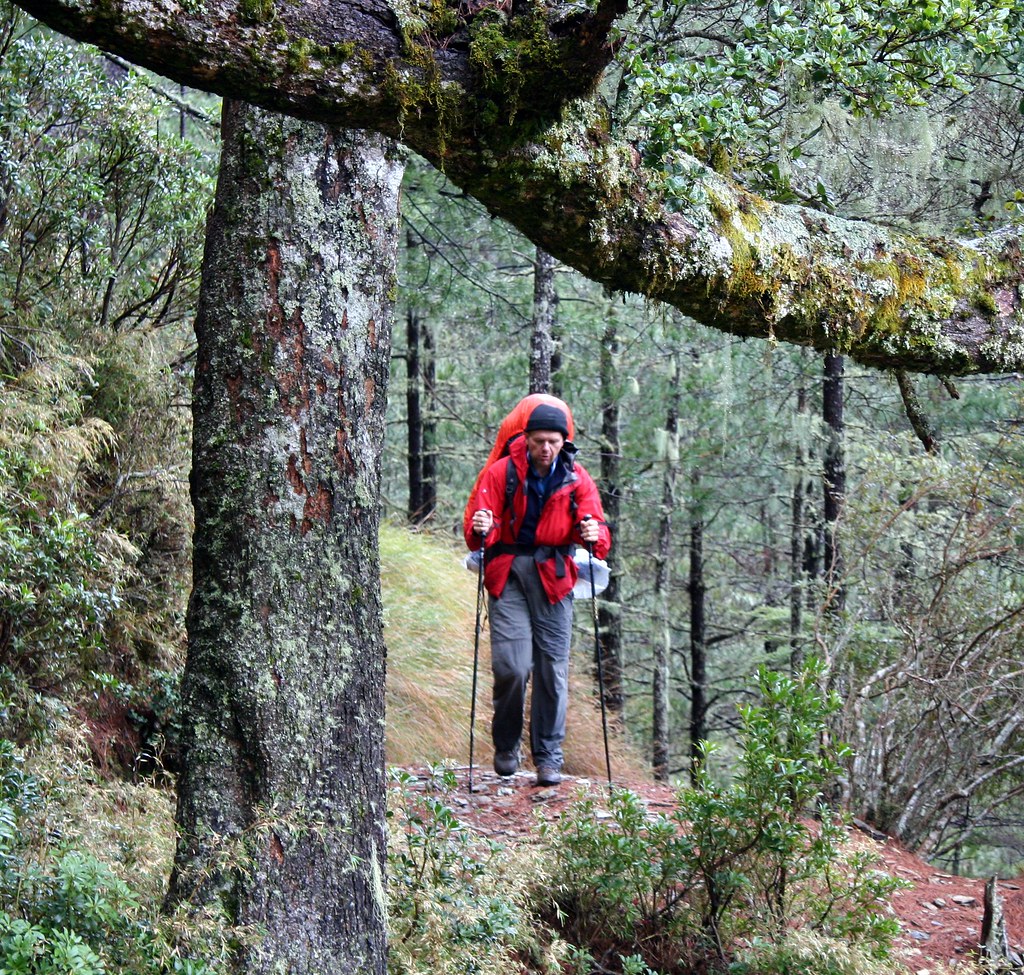
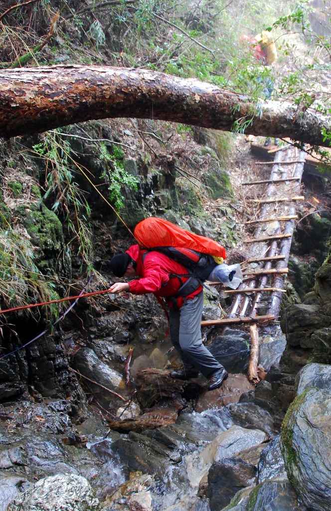
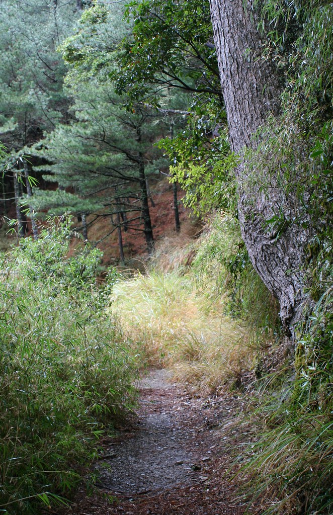
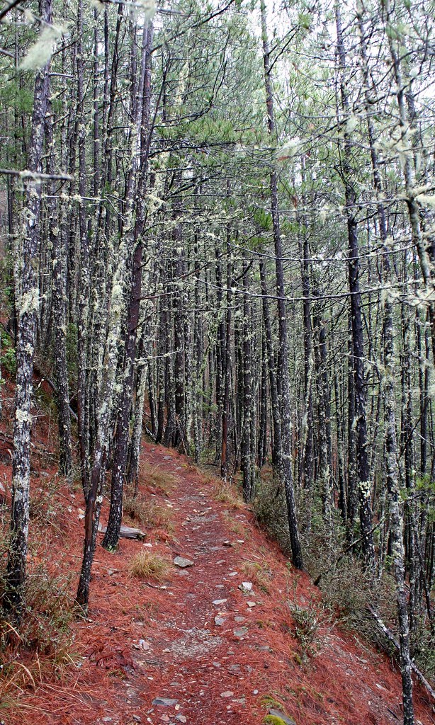
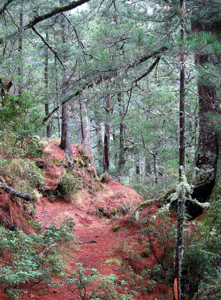
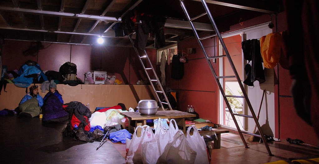
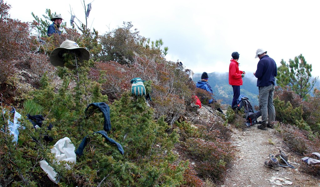
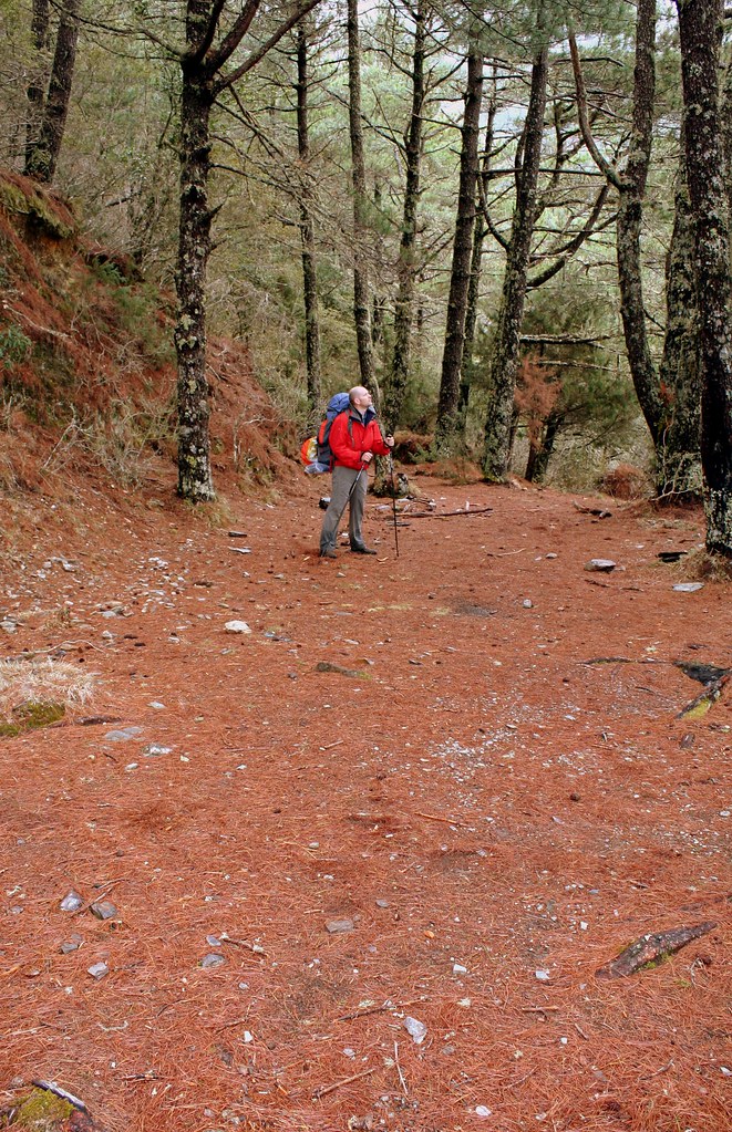
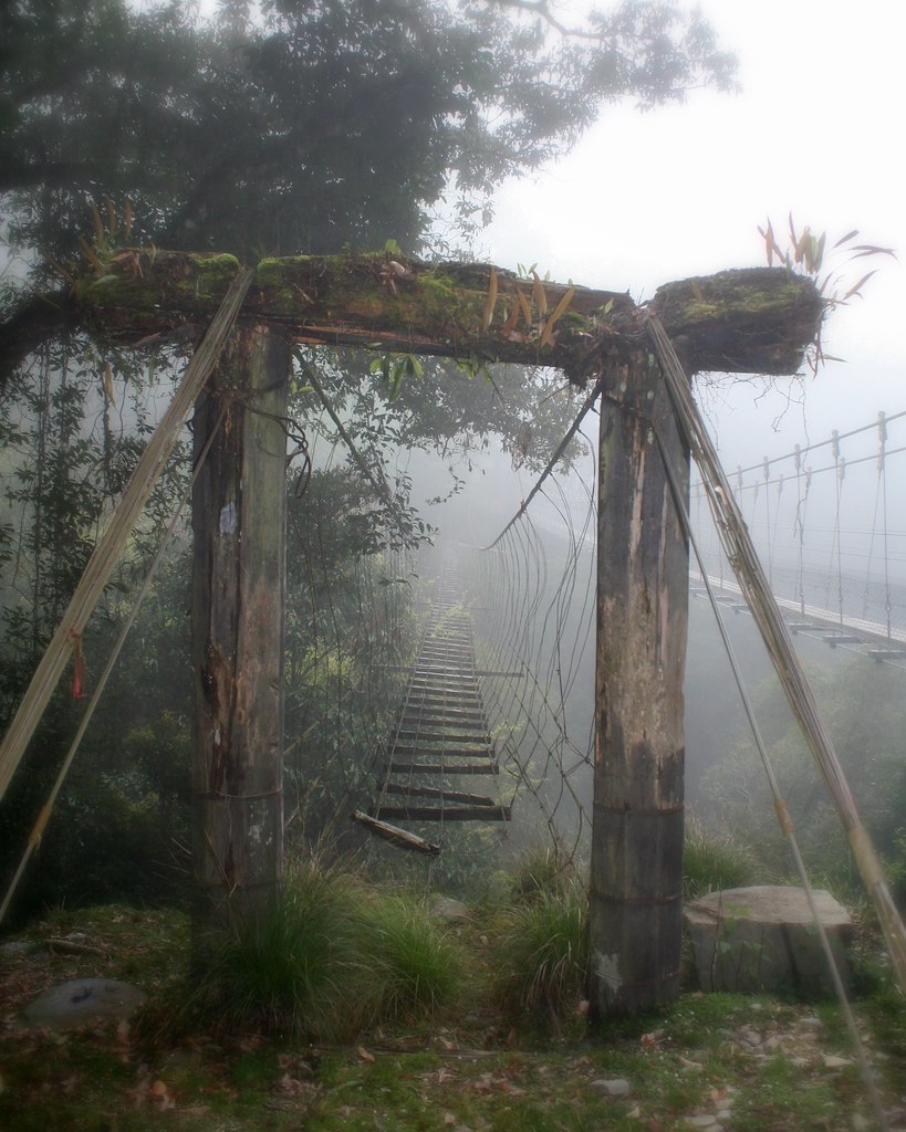
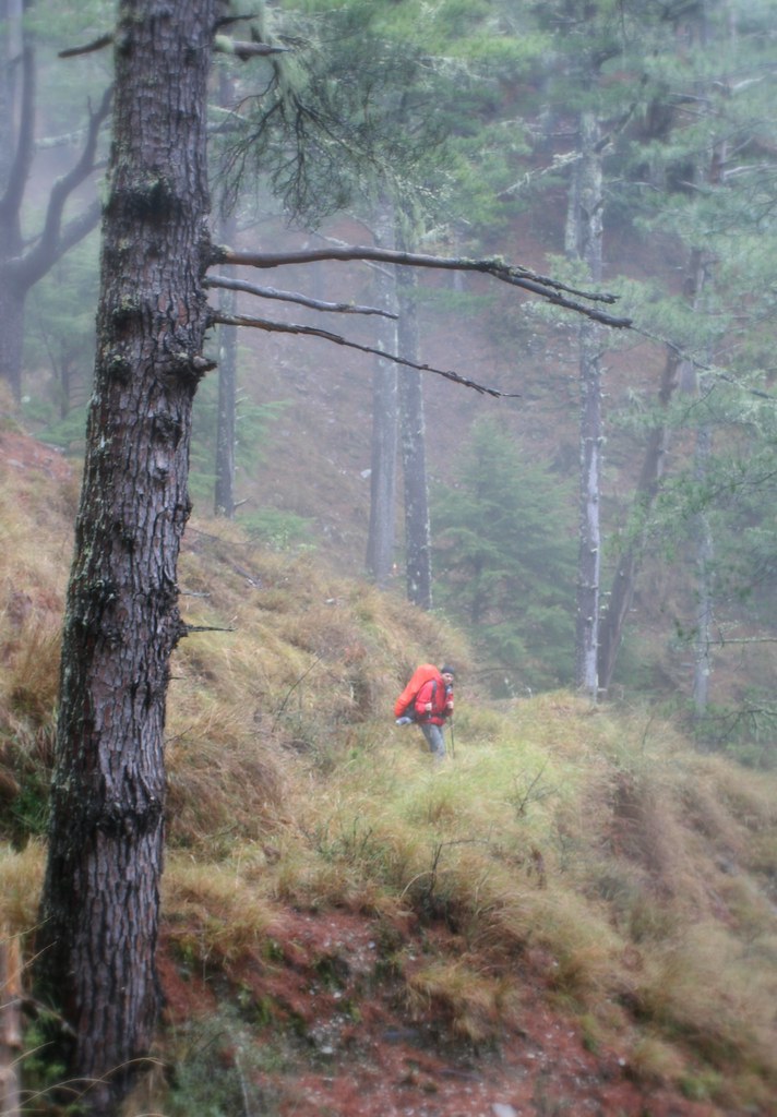
The Japanese Era Batongguan Traversing Route is about 90km long. While it has suffered numerous landslides and washouts over the years, in addition to the unforgiving shifting of tectonic plates, repairs that began in the last 1990s have restored it to a perfectly hike-able condition for most anyone in good shape. There are markings every kilometer or so, and maps and interpretative signs in strategic places. There is also an excellent system of free cabins and campgrounds.

A tent is still recommended however, as there is a 12 hour stretch between the Dashuiku and Dafen cabins, which not everyone may want to do in a day. The weather could also force you into making a shorter day of it. In any case, there are numerous campgrounds along the trail. As these used to be former police stations the ground is flat and sheltered.

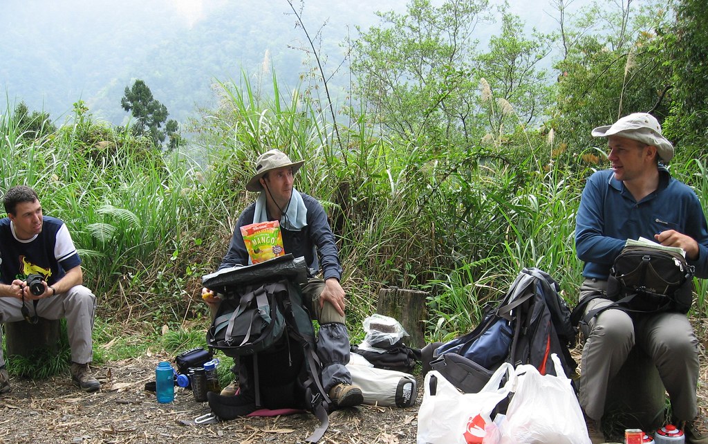
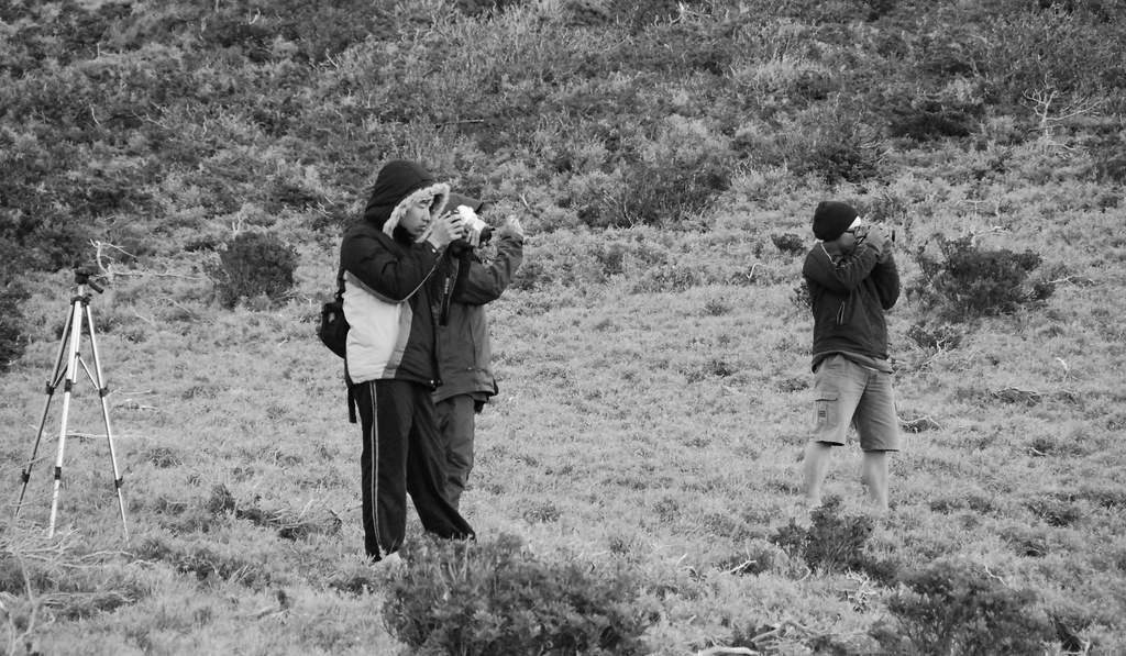
One needs permits from Yushan National Park to hike the trail. These permits usually book you into cabins for the first couple nights. After that, it’s first come first serve, though the trail is hardly busy. We didn’t encounter anyone else on the trails for 3 out of 6 days.

Water sources are plentiful, both at the cabins and from side streams. I mention the availability of water in each day’s entry.

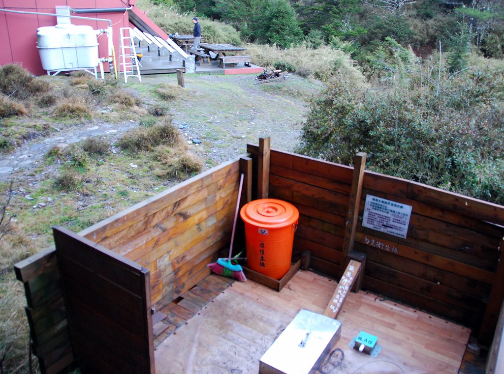
The cabins do not have blankets but they do have thick mattresses, solar powered lighting, and in some cases, toilets. The Dafen cabin has solar heated showers, which are heaven sent after 5 days on the trail.

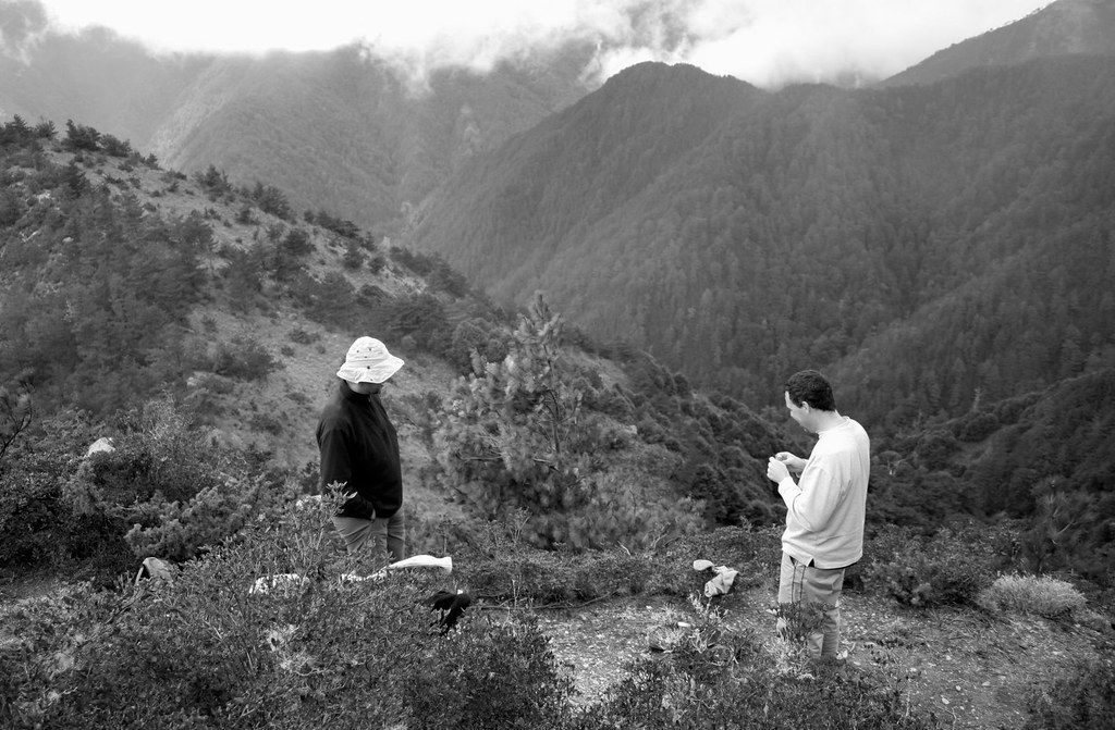
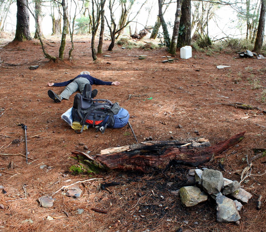
Most people take seven days to complete the trail. We did it in six. Eight would be ideal as it would allow time to climb some of the higher peaks, as well as spend time in the alpine meadows with the sambar deer.

Batongguan: Day One

Sunday March 31


We leave Dongpu (elevation 1100m), a small hot spring village set in glorious mountain scenery, at 9am. It’s not a terribly early start but we'd gone out drinking and eating the night before (carb loading as one member called it) and still needed to sort out our packs in the morning. We grab one last meal at a local breakfast shop and then head out.

My hiking companions are Richard, founder of Barking Deer Adventures, Dave and Mai, two geophysicists from England, now living in Vietnam, and Stephen, who works in the IT industry in Kaohsiung. Everyone is a keen and experienced hiker. Our differing professional and social backgrounds will make for great conversation over the next week.

A cold front was predicted to blow in during the night, but it’s pretty mild outside, if misty. I’m hopeful that with our easterly direction we will avoid the rain predicted for later in the day.

The trail begins just outside the village, and starts to climb steeply almost immediately At first we are on tarmac and then dirt. Despite our heavy packs we still overtake scores of daytrippers heading up to the Yunlong and Yinyu waterfalls.


As Taiwanese tend to be, they are friendly and want us to stop and join them. But we have a long day ahead of us.


In the first hour we passed this little snack shop. It’s the last chance for a can or bottle or aiyu jelly until Yuli.


The trail then cuts right into the side of a ridge with sheer drops to the Chenyoulan River Valley. Metal bridges span streambeds, ravines, and sections where the trail has been washed away. The slopes are so steep here that any washout makes the trail impassible without a bridge across it.


To emphasize just how precarious the ridge is the Chinese have named it the Father and Son Ridge, as in even a father could not help his son here in the event of an accident.


I ask Dave, who is a geophysicist from England, to describe the local geology. He proceeds with an impressively detailed report: The Chenyoulan Valley below is a major fault and the side we are walking on is metamorphosed sediment around 50 million years old. On the other side are un-metamorphosed sediments roughly 10 million years in age. Because we are over a fault, the rock strata is very broken up, which is why the ridge is so steep and prone to landslides.

“You can tell all that just by looking?” I asked.

“No,” he laughs. “I read the sign back there.”

Though cut into the ridge, the trail is for the most part wide and clear, and our view alternates from deciduous forests of camphor, machilus and blue oak, to misty views across the river valley. In fact, all day long we will simply be heading up the valley.


We lunch around noon at a small clearing with a wooden shelter. There was a little mailbox for dropping off reports of bear sightings. What do the bears do when they see us?


Mango Man:


Six hours into the hike there is a noticeable change in the vegetation, from deciduous to coniferous trees. You don’t even need to look up to see this for the trail is now covered in a soft layer of needles whereas earlier it had been a bed of leaves. There is still a picnic grove feel about the area though: soft colors, clear trail, and a warm inviting forest cover.


There are no daytrippers on the trail now, but no serious hikers either. We hear many birds, but don’t see them. It’s been hazy since we left Dongpu and the higher we ascend the foggier it gets. I’m a bit disappointed, as I’m really hoping for some big landscape shots to make carrying my Canon Digital Rebel worthwhile.

But there are some interesting shots of the fog filled forest to capture:


By 5pm I am really feeling the weight of my pack. Guanggaoping (elevation 2580m) is just another km ahead. Then 500m, then 200m, then 200m again, then…we reach the flats and nearly break down to discover that the cabin is actually down a side trail another 600m east. We’ve reached the site of an old police station, an important strategic spot of control along the old trail, but not a place to spend the night.

Fortunately, the path to Guanggao Cabin (elevation 2490m) is downhill and we cover it quickly.

The cabins (there are three structures) are actually the ugliest of all the overnight shelters along the trail and should be replaced with something more modern. The bunk bed frames are good thick cedar, and have nice thick black foam mattresses, but the structures are bare concrete with lots of wall cancer and mold.


It’s a lovely setting though on bit of terraced meadowland overlooking another deep valley (we’re on the opposite side of the ridge now). We’ve arrived in time to watch a sea of clouds roll in.

Click here for Day Two.

Practicalities:

There are small streams for water every hour or two along the trail so there is no need to carry more than 2L at any time. The cabin has running water, toilets, and lighting. We arrived around 6pm, having hiked about 8 hours, not including breaks.

In Dongpu, we stayed at the Youth Activity Centre (4-bed rooms NT1000-1700). Dongpu is a small village, with a cobbled main street lined with shops, restaurants and hot spring hotels of varying quality. It’s the sort of place where across from one of the best hotels in town you can witness a young waitress bashing a fish to death on the side of the road, and then to carrying it into the kitchen for cooking.

During Japanese times, Dongpu was famed as a hot spring spa. Today, the waters still flow and there are about 20 hotels to choose from, some with outstanding mountain views. I don’t have the name of it but there’s a fantastic looking new resort perched over a deep valley half a kilometer before town. Accommodation is in 2 story wood cabins.

Tuesday, April 22, 2008

Batongguan: Day Two

Monday April 1


"I’m not getting up at 2am and hiking for 14 hours. No way."

Richard and the others want to spend the second day climbing Yushan by a back route. Since it will involve about 12-14 hours of hiking we need to start at 3am so we can return before nightfall. But the way I look at it, we have to walk in the dark either way, so why not get a good night’s sleep and start out at dawn? 2am is just a little too shy of my usual bedtime of 1am for me to even consider it.

I lose out on the planning, though Richard grants me a 3am wakeup. I sleep little that night, as the snores of fellow hikers eat away at my brain. When 3am rolls round I’ve slept about an hour and tell Richard he and the others can go on without me. I’ll leave at a reasonable hour and either catch up or hang out in the Batongguan Meadows.

When I wake in the morning I find it is much chillier than the day before. The fog lifts and reveals blue patches here and there but overall it is a damp, windy, somewhat biting morning. I head out on the trail about 6.30am.

As I leave I meet one of the schoolteachers from the second cabin. He is leading a group of high school kids from Taichung on a trek up Batongguan Mountain. He’s concerned that I am heading up to Yushan by myself, especially with the weather so changeable. I assure him I have a map, proper waterproof gear, and lots of food and water. But I do take his warning seriously.

I feel like crap for the first hour or so of uphill walking, until I reach Batongguan Meadows (elevation 2800-2900m). The meadows are a glorious sight: a wide expanse of rolling mustard yellow terrain covered in short Yushan cane. The trail cuts through the lowest part of the meadows, which appears flat but is really terraced and furrowed. Rolling high hills hem in the meadows on the sides, and smaller rounded hillocks lip the edges where the ridge drops off.


I watch the fog roll in and out of the valley for a long time. It moves so fast that visibility goes from 1km to 10m in a minute. It’s especially fascinating to watch the fog break on the hillocks as it rolls in and then reform as it sweeps down and across the low meadows.

I’m amazed at how quickly the trail has gone from feeling like a walk in a warm grove to this rather blunt and forbidding environment. I head up a thin side trail on the slopes above a steep valley. My side of the valley is covered in Yushan cane, and white rhododendrons bloom everywhere. Across the rift is dark pine forest, and layers of rugged mountains can be seen receding in the distance when the fog clears.


On a warm, sunny day it must make you want to sing up here, but today I kept asking myself if it was wise to continue on my own, on a trail I don’t know, in dense fog. When it starts to rain heavily as I proceed up a rough side valley toward a cloud-obscured Yushan, I turn back.

I spend the rest of the morning and afternoon resting at the cabin and chatting with the school kids who are preparing for their GEPT tests (General English Proficiency Test). Around 5pm I go out for a walk to see if I can intercept the others. I spot them just up from Guanggaoping. They are cold, miserably wet, and grumpy. They had made it to the top of Yushan, slogging through snow at the end, but visibility was down to a few metres. They might as well have been in a parking lot.


That night we have to switch cabins and sleep with the school kids in the second cabin (which does not improve the mood of my grumpy companions). The kids should have been out already but had decided to spend another night at Guanggao waiting for the weather to turn better. Such are the vagaries of life on the trail.

The kids are quite well behaved considering, and as some compensation we get to eavesdrop on the teacher’s lecture on the high mountains of Taiwan. In case you didn’t know (and I didn’t) there are five mountain ranges on the island: the Yushan, the Central Mountain, the Syue, the Coastal and the Alishan Ranges.

The Batongguan Meadows are a gap of sorts at the intersection of the Yushan and Central Mountain Ranges.

Click here for Day Three.

Practicalities:

If you do decide to climb Yushan from here, give yourself 12-14 hours. You can leave your pack at the cabin but prepare plenty of food and warm weather gear. Water sources are far between so carry 3-4 litres and top up when you can.

Batongguan: Day Three

Tuesday April 2


The cabin we share with the school kids has no proper door, just a corrugated metal sheet that rolls down over the opening as if we were a shop to be shut up for the night. We opt to leave the entrance open during the night, though I do wonder, as I am lying closest to the front, if I will wake up to some weasel chewing my face.

I don't, but the snores, which this time go on uninterrupted all night long, eat into my brain again.

We wake up around 6am but take our time getting moving. As he had the day before, Stephen starts to snap photos of the morning scene in the cabin until Richard makes a joke that he is in fact taking pictures of high school girls in bed. Steve laughs and put the camera away.

We head out about 8.30am in a light rain and fog. We reach the Batongguan Meadows after a 1.5 hour uphill climb. The meadows are more obscured by fog today than yesterday and there is no chance for taking decent photos. We cross quickly and find that on the other side the trail becomes narrower, slippery and rougher. But it also for the first time is more or less flat.


Around 10.30am we make a short climb down a stream as part of a detour round a landslide. Moving along slippery rocks is always slow going, but especially when you are carrying a large pack.


In general it’s all slow going after the meadows as we push through high Yushan cane that is dripping with dew. It’s stopped raining but the vegetation is doing its best to see that we never dry off. I notice Richard and the others are moving considerably slower than the first day.

The trail alternates between a wide clear path through red pine forest and a tight narrow slice bordered by shoulder high dripping Yushan cane. It’s an easy walk either way, and with the splendid scenery, we don't hurry.


The red pine forests are particularly gorgeous, especially with the contrasting light greens of the underbrush and gauzy curtains of darker lichens hanging from the pine branches. Such lichen is often described as resembling an old man’s beard, which is probably why such forests always feel like they contain some ancient mystery.


We reached Jhongyang Cabin (elevation 2850m) around 2.30pm. It’s a very pleasant looking little A-frame, with solar powered lights, and a loft for extra bed space. The roof slopes over the edge of the outer walls to provide some shade from the rain or sun. There’s a good water supply here: two rain tanks, and a nearby stream.


The outdoor squat toilets provide all the privacy three-foot high walls can give.


Jhongyang is a former gold mining area, and last time Richard was here he was able to do a little panning in the creek with equipment left behind. We don’t find any equipment here this time.

We shared the cabin this night with a group of older Taiwanese hikers who are climbing a few of the 3000+metre mountains in the area. Like many big groups they have hired Bunun porters to carry, and cook, their food. The meals these guides provide are astonishing. After preparing various rice, noodle and soups dishes, I watch as the porter prepares abalone and broccoli. Ahem, my tortellini and canned tuna (spiced up with Tabasco) was quite delicious, thank you very much.

Richard is a chatty fellow and makes it a point to be friendly to the other groups. The rest of us discover this is also a good way to score extra calories (or better food) as he is always invited to join the groups he befriends for dinner.

The Bunun porters mostly come from Hsinyi in Nantou. If you recall, this village was on the original Qing Dynasty Batongguan route. The porters carry huge packs, which have the flimsiest waistbands. Most of the weight is as a result carried on the shoulders, and the neck in the traditional way with a head strap. These are tough fellows, but they are quite friendly and professional. They do a great job of enforcing the carry-out-garbage rules.

The cleanliness of the trail is something worth mentioning. While the cabins always had a little litter about, the trail itself was free of bottles, cans, plastic bags, and even sliver paper. The national park, and the hikers themselves, deserve praise for maintaining this route at the highest levels.

This night, as I lie awake in bed (listening to the snores of my fellow travelers reduce my capacity for logical thought) I wonder what I will do when I return to Taiwan.

Click here for Day Four.

Practicalities:

It’s only 5-6 hours to hike from Guanggao to Jhongyang. There is water every 2 hours or so from streams until you reach the cabin. Some maps show a cabin at Banaiyike, but it is only a rough shelter.

Monday, April 21, 2008

Batongguan: Day Four

Wednesday April 3


We’re up early again, but have an easy day ahead so again we take our time at breakfast.

There is a young couple in their 20s who are also sharing the cabin with us and the older Taiwanese. We discover that they have again abandoned their plans to hike the Mabolashi Trail.

The Mabolashi is another week-long trek that breaks from the Batongguan here at Jhongyang Cabin. It’s a much rougher route and the couple, finding themselves the only one’s on the trail and in the cabins, had gotten a little spooked. They decided to return to Dongpu but on the way back met a team heading up who were also planning to tackle the Mabolashi. Well, why not give it another try, the decided. But after a good night’s sleep they choose once more not to continue.

We head out about 8am. My pack is several kilos lighter now (each day I lose at least 1kg of food) and I truly appreciate the reduced load. I notice patches of blue sky above and a fast moving, high cloud level above, and feel grateful for this also.

The trail today starts out with a steep climb up a narrow cane lined trail to the top of a ridge before dropping back down into the valley. It then climbs up a sloping meadow of blooming rhododendrons and azaleas with clear views west across a deep valley.

There are many landslides in the area, and some tricky sections that need to be crossed with ropes.


Collectively I’d say our spirits are the best they’ve been as the weather is warm and dry, and we have the first blue skies since the trip began. Yushan to the west is still obscured by clouds, but we are in high rugged terrain, blessed with outstanding lookouts. No one has a bad word to say.


We stop at one such lookout for lunch. The trail bends 90 degrees here and on a dry terraced knoll rising back toward a high crumbling cliff face, the immensity of the Yushan Range unfolds before us.


The 3000m+ peaks of Tafenjianshan and Yunfeng (Cloud Peak) are closest to us and most visible across the valley. When the fog shifts we can see Batongguan Shan and the meadows. As at Batongguan, we watch the rolling fog get split by peaks and reform as it sweeps into the valleys.

We take advantage of the warm weather to dry off our clothes.


Just as we set off after lunch we see to the south on the col of the Nan Dashuikushan ridgeline a gaggle of hikers. We won’t be alone tonight at the cabin, we think, though this makes us take note that we have not seen anyone else on the trail all day.

We proceed through more red pine forest, and pass some old police stations at Dijuan and Nan Campground. There’s little left at either but some old stone walls, broken bits of ceramic jars, and numerous beer bottles stuffed into the soft earth.


Richard picks up a bottle and points out that it is in fact from Japanese occupation times. If it was later in the trip I would take it with me.


As we leave the site, Stephen and I chuckle about how historically impoverished we are in Taiwan that shards of pottery and old beer bottles from 80 years ago are an exciting discovery.

Our destination today is the cabin at Dashuiku (elevation 3280m). In the last hour or two the terrain starts to change from thick red pine forest to scrub: short alpine juniper and pines, and scraggy shrubs that catch on your pack. It’s a dry and rugged landscape.


We arrive at Dashuiku Cabin around 4pm. The red cabin lies in a rolling yellow alpine meadow similar to Batongguan, though with a wider sweep. The cabin rests just above the lowest point, where a small pond of still water lies. The air is chilled with a lashing wind but the cabin is well made, with double glazed windows, and is remarkably cozy inside. We have it so much better than the Japanese who used to abandon the area 4 months a year because of the extremes of weather.


At Dashuiku, the Qing and Japanese Era trail converge for the last time. It’s the highest point on the entire Japanese era trail and is actually considered the end of the eastern trail (which begins in Yuli). During the Japanese occupation there were plans to build a road through here, but it was deemed too expensive and difficult to attempt. Later plans by the KMT in the 1970s were also shelved. Now fortunately, this is all national parkland.

There is a lovely, but difficult to photo sea of clouds that evening.


Signs of sambar deer (their scat and prints) all over the meadows and around the pond. When night falls I go outside and wander round. I hear deer grunt and squeal not 100m away but I can’t see anything. There’s no moon tonight and the stars don’t give off enough light to see your hand in front of your face.

I don’t wander too far as the fog rolls in and out without warning and there is only a single red light on the cabin roof to guide you back.

The hikers we had seen on the saddle share the cabin with us that night. They are a student group that had tried to catch the snowfall at Jiaming Lake the week earlier (Richard, Dave and Mai saw it and described it as one of the most beautiful sites they have seen). But they arrived just a little too late and now are stuck carrying and wearing heavy boots and parkas.


Oddly, they also carry a heavy frying pan. That evening, as the rest of us settle into our sleeping bags for a few hours rest, they can be seen crowding round a glowing gas stove preparing pancakes for the morning. I fall asleep to the clink, clink of a spatula hitting the frying surface. It’s a restful sound. At least compared to the snores of the middle aged that make me lose brain cells.

Click here for Day Five.

Practicalities:

There’s water from a stream in the first hour and more maybe 3 hours later. Dashuiku has rainwater tanks but they are often empty. Some people take water from the pond but there is a nice clean stream not 30 minutes back toward Jhongyang. After we arrived and realized there was no water, Stephen and I hiked back (it’s flat) to the stream and collected 8 liters. We were rewarded with the sight of a sambar on a flat across a gully.


Batongguan: Day Five

Thursday April 4


This looks like it’s going to be a long long day. We agree the night before to get up at 4.30am to begin at daybreak. Unless we get stuck and have to camp out along the way, we will hike 21.9km today over a 12 hour period.

There is time in the morning before we leave to take pictures of a beautiful sea of clouds from the edge of the meadows. The slope of Shinkang mountaintop also catches our attention.


And then we head out at 6am sharp. It’s all downhill today, and for the first while we get clear wide vistas of broken ranges and fog filled valleys.


It's interesting to watch the terrain increasingly grow wooded and lush.


Forty minutes after leaving the meadows we are back in pine forest with a needle carpeted trail. There are also abundant blooming rhododendron bushes.

Despite my apprehension about such an early wakeup, I feel great. Strong, alert and inspired. The scenery is certainly helping.


I’ve mentioned before that Dave (and his wife Mai) are geophysicists. It’s great traveling with scientifically minded people. Not only are they wonderfully informative, and can make intuitive assumptions about the trail that I couldn’t possibly (see the last day) but they can, without the slightest bit of self-consciousness, look at a massive fungal growth and say:

“Now that is a brachus fungi to beat all brachus fungi.”

And indeed it was.


The temperature warms up quickly as we descend and soon everyone is changing out of their thermals. We reach the Miyasa police station (now a lovely flat sheltered area for camping) in a few hours. This area is whited-out 6 months of the year, and today was one of those days.


A few hours later we pass the old walls of the Shashalabi Police station, built in 1922 to cover the large gap between Miyasa and Thomas stations. Shortly afterwards we come across one of the most important commemorative steles on the trail: sura asen.


By the time we reach Thomas police station ruins (6 hours later) we are in dense rainforest.


The air is supersaturated with moisture. Whatever clothing had dried off is now soaked through again. There are also leeches everywhere and everyone ends up with at least 2-3 by the end of the day.

The high stone perimeter walls at Thomas (elevation 2600m) are covered in a fetching lichen green. It’s an atmospheric place and makes an ideal spot to stay overnight between Dashuiku and Dafen.


Does anyone know what this is?


But we decide to press on to Dafen, another 6-7 hours away. This will prove the roughest stretch of the trail with dozens of detours around landslides that make the going slow and frustrating.

Where the trail still exists along this section it is a real treat to walk along, as it’s wide (1.2 to 1.8m) and flat, having been literally hacked into the ridge. But as the ridge is composed of soft siltstone shale, which is prone to sliding, probably half the original trail has been wiped-out. It’s really a slog most of the day, up and down around landslides, down rough slices of path, and my ankle is feeling every twist.

About three hours out of Thomas we reach a series of massive slides called the Tuge Fault. There’s no real path, just the footprints across the loose shale that others before you have made. It’s unpleasant to tackle this when we are already exhausted and few words are spoken.


But we do make it across all the slides without mishap and at the old suspension bridge at Yisala there is time for a little levity. Or levitation, perhaps.


There used to be 12 iron cable suspension bridges along the Batongguan. Three were restored in the 80s, and seven more rebuilt between 1998 and 2004. Only the bridge at Yisala, built with hinoki cypress in the 1930s, remains intact, though most people cross the modern bridge erected beside it in 2005.


When Richard first hiked in this area a decade ago, few of the bridges were even in as good shape as the old one here.

Besides old bridges, something to look for in this section of trail are telephone poles. Though none still carry wires, they were once part of the communication system between the various police stations.


And these odd sail shaped spider webs lined the sides of the trail all the way from Miyasa to Yisala.


It’s dark for the last hour of the day’s hike, and we all worry a bit silently about what we may encounter on the trail (landslides more a concern than bears). But at last we find ourselves on a glorious pure stone causeway crossing a low gully. All we needed was a drawbridge on the other side and a triumphal arch.

We’ve reached Dafen (elevation 1320m), the “eastern capital” of the Batonguan trail. In its time it was the largest of the police outposts, and also held a trading post, general store, martial arts and ceremonial halls, a munitions store, and guesthouses. Today the area is famous for being the center of the largest black bear reserve in Taiwan. It is estimated that the population of bears is in the hundreds and quite stable. As long as areas like this remain protected there is no reason the bears should ever go extinct.

The original wood structures at Dafen remained until 1992, when they unfortunately burned to the ground in a fire. Today there is a modern cabin, which nicely has hot showers and a steady supply of water. In addition to being a way station for tired hikers, the cabin functions as a research center and we find it occupied this night by 4 graduate students from Pingdong University.

The student read our faces and quickly make room for us inside. By now we had descended almost 2000m, hiking over 12 hours. I’m sure every is sore, but my right ankle feels like it has been twisted, my knees ache from the strain of going downhill for so many hours, my left lower calf is swollen like a piano leg (my knee brace has, much to my surprise, cut off circulation), and my right hand is pink and stinging from landing palm first into a patch of nettle (called Cat Bite People Plant in Chinese).

I am also feeling mighty annoyed that my voice recorder (which I was using to take notes – you don’t think I could recall all this from memory did you?) had fallen into a bucket of water at Thomas and was not working.

I can’t recall ever being so stiff all over as I climb into my sleeping bag around 9pm. Perhaps this explains why I finally sleep right through the night.

Click here for Day Six.

Practicalities:

There is little water from Dashuiku to Thomas (6 hours). Thomas however has a steady supply. There are some small streams from Thomas to Dafen. Carry around 3 liters and top up when you can.

It’s best to break the trek from Dashuiku to Dafen into two days. After 9-10 hours on the trail, crossing a serious of tricky landslides is not the sort of thing you want to face.