This looks like it’s going to be a long long day. We agree the night before to get up at 4.30am to begin at daybreak. Unless we get stuck and have to camp out along the way, we will hike 21.9km today over a 12 hour period.
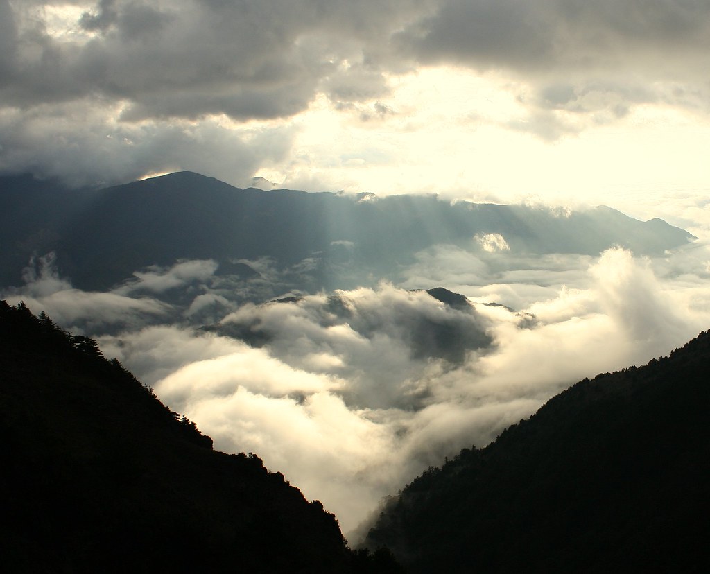
There is time in the morning before we leave to take pictures of a beautiful sea of clouds from the edge of the meadows. The slope of Shinkang mountaintop also catches our attention.

And then we head out at 6am sharp. It’s all downhill today, and for the first while we get clear wide vistas of broken ranges and fog filled valleys.

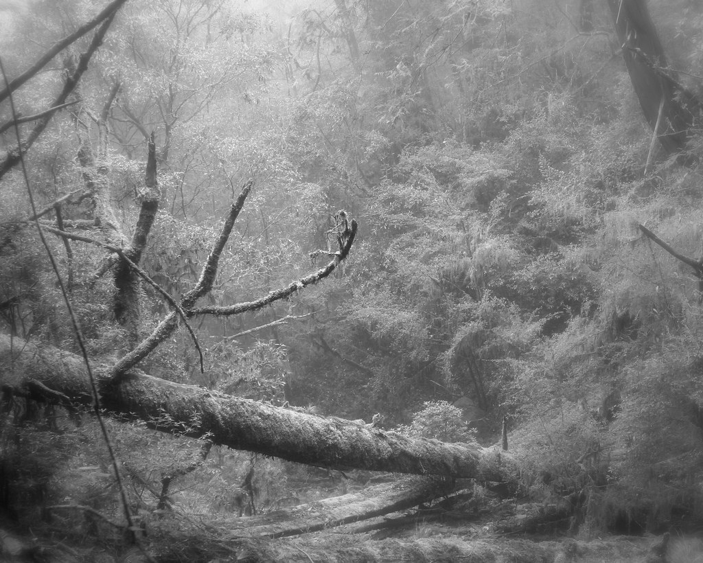
It's interesting to watch the terrain increasingly grow wooded and lush.


Forty minutes after leaving the meadows we are back in pine forest with a needle carpeted trail. There are also abundant blooming rhododendron bushes.
Despite my apprehension about such an early wakeup, I feel great. Strong, alert and inspired. The scenery is certainly helping.
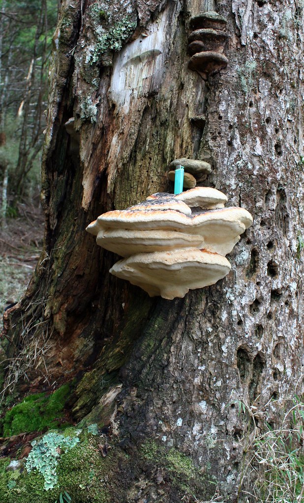
I’ve mentioned before that Dave (and his wife Mai) are geophysicists. It’s great traveling with scientifically minded people. Not only are they wonderfully informative, and can make intuitive assumptions about the trail that I couldn’t possibly (see the last day) but they can, without the slightest bit of self-consciousness, look at a massive fungal growth and say:
“Now that is a brachus fungi to beat all brachus fungi.”
And indeed it was.
The temperature warms up quickly as we descend and soon everyone is changing out of their thermals. We reach the Miyasa police station (now a lovely flat sheltered area for camping) in a few hours. This area is whited-out 6 months of the year, and today was one of those days.
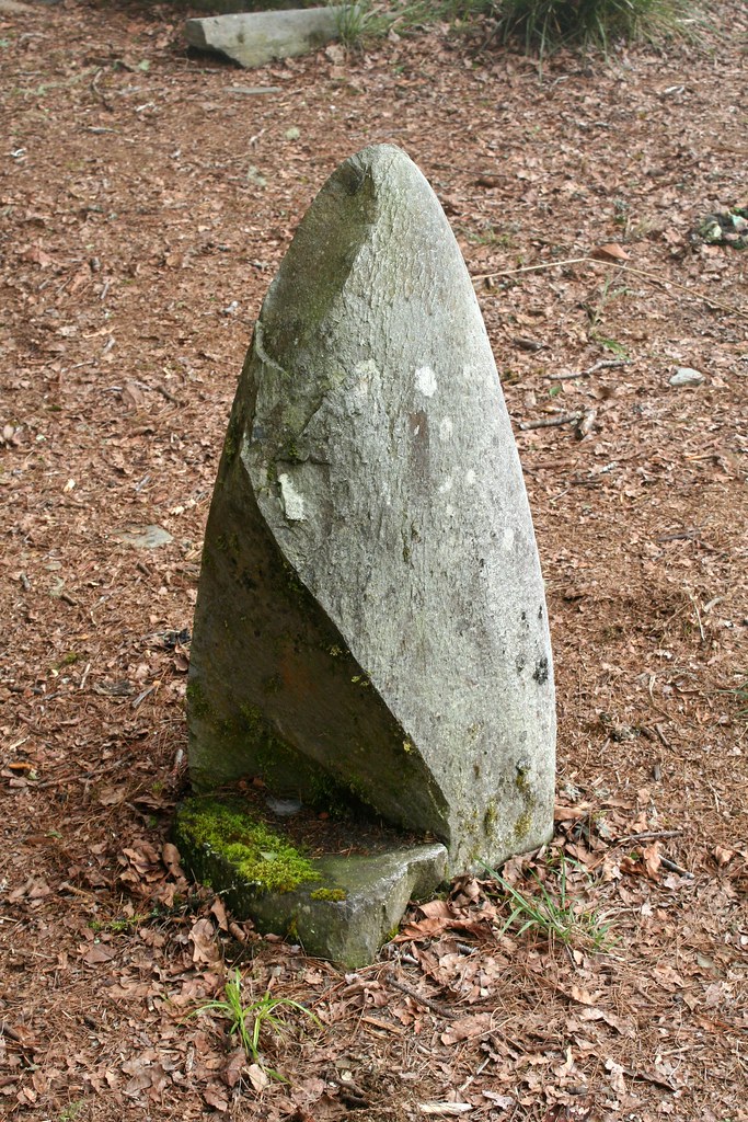
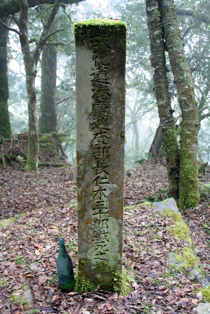
A few hours later we pass the old walls of the Shashalabi Police station, built in 1922 to cover the large gap between Miyasa and Thomas stations. Shortly afterwards we come across one of the most important commemorative steles on the trail: sura asen.

By the time we reach Thomas police station ruins (6 hours later) we are in dense rainforest.
The air is supersaturated with moisture. Whatever clothing had dried off is now soaked through again. There are also leeches everywhere and everyone ends up with at least 2-3 by the end of the day.
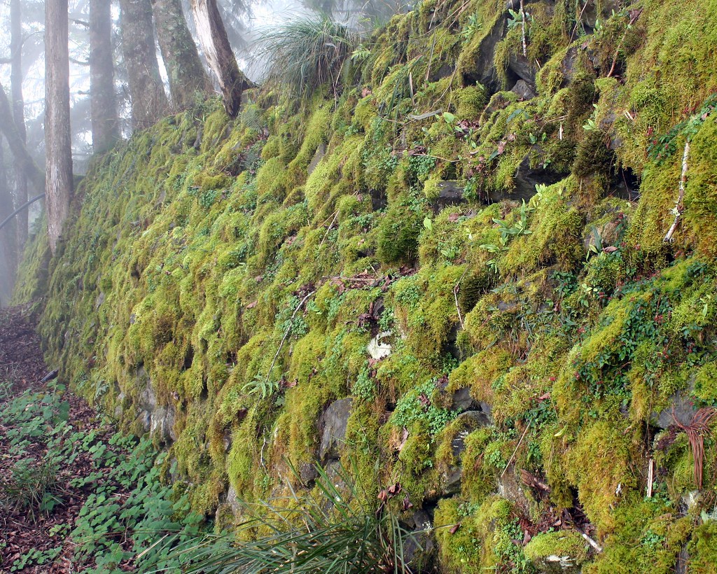
The high stone perimeter walls at Thomas (elevation 2600m) are covered in a fetching lichen green. It’s an atmospheric place and makes an ideal spot to stay overnight between Dashuiku and Dafen.

Does anyone know what this is?
But we decide to press on to Dafen, another 6-7 hours away. This will prove the roughest stretch of the trail with dozens of detours around landslides that make the going slow and frustrating.
Where the trail still exists along this section it is a real treat to walk along, as it’s wide (1.2 to 1.8m) and flat, having been literally hacked into the ridge. But as the ridge is composed of soft siltstone shale, which is prone to sliding, probably half the original trail has been wiped-out. It’s really a slog most of the day, up and down around landslides, down rough slices of path, and my ankle is feeling every twist.
About three hours out of Thomas we reach a series of massive slides called the Tuge Fault. There’s no real path, just the footprints across the loose shale that others before you have made. It’s unpleasant to tackle this when we are already exhausted and few words are spoken.

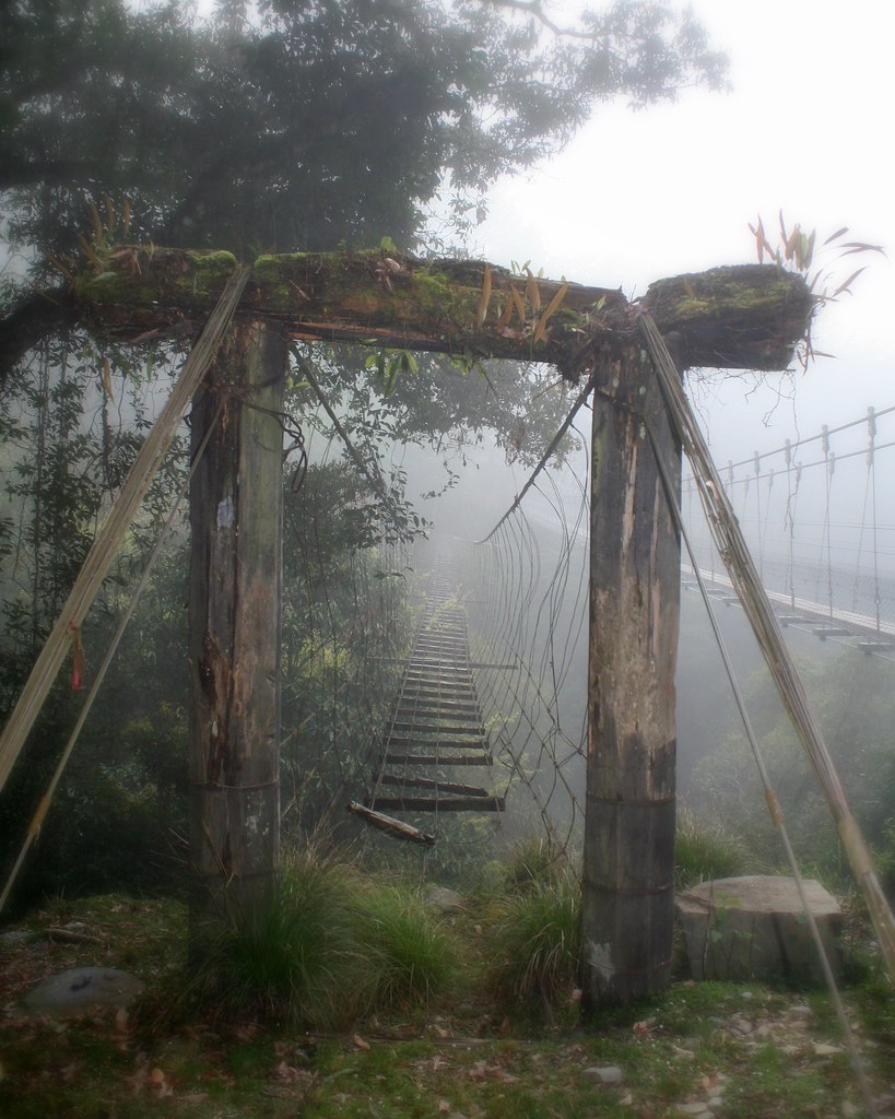
But we do make it across all the slides without mishap and at the old suspension bridge at Yisala there is time for a little levity. Or levitation, perhaps.

There used to be 12 iron cable suspension bridges along the Batongguan. Three were restored in the 80s, and seven more rebuilt between 1998 and 2004. Only the bridge at Yisala, built with hinoki cypress in the 1930s, remains intact, though most people cross the modern bridge erected beside it in 2005.

When Richard first hiked in this area a decade ago, few of the bridges were even in as good shape as the old one here.
Besides old bridges, something to look for in this section of trail are telephone poles. Though none still carry wires, they were once part of the communication system between the various police stations.

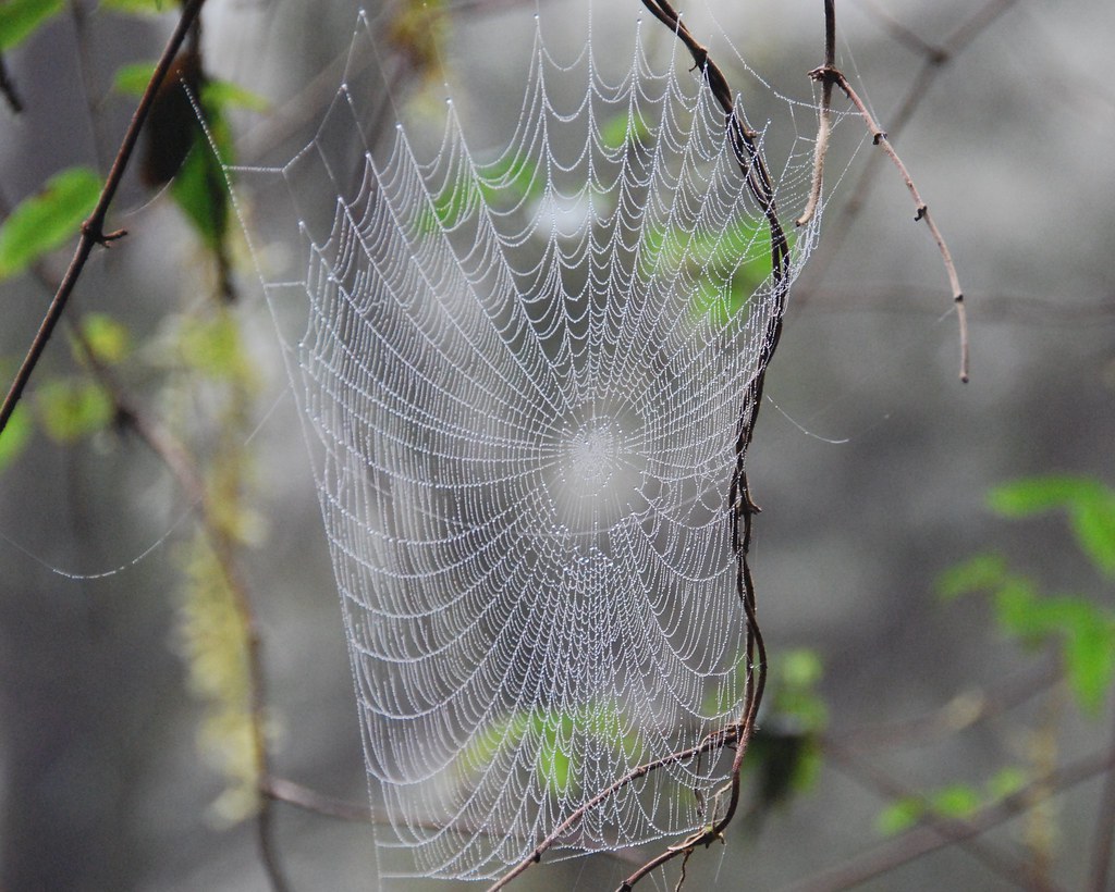
And these odd sail shaped spider webs lined the sides of the trail all the way from Miyasa to Yisala.
It’s dark for the last hour of the day’s hike, and we all worry a bit silently about what we may encounter on the trail (landslides more a concern than bears). But at last we find ourselves on a glorious pure stone causeway crossing a low gully. All we needed was a drawbridge on the other side and a triumphal arch.
We’ve reached Dafen (elevation 1320m), the “eastern capital” of the Batonguan trail. In its time it was the largest of the police outposts, and also held a trading post, general store, martial arts and ceremonial halls, a munitions store, and guesthouses. Today the area is famous for being the center of the largest black bear reserve in Taiwan. It is estimated that the population of bears is in the hundreds and quite stable. As long as areas like this remain protected there is no reason the bears should ever go extinct.
The original wood structures at Dafen remained until 1992, when they unfortunately burned to the ground in a fire. Today there is a modern cabin, which nicely has hot showers and a steady supply of water. In addition to being a way station for tired hikers, the cabin functions as a research center and we find it occupied this night by 4 graduate students from Pingdong University.
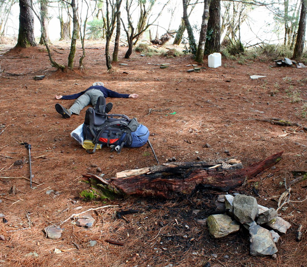
The student read our faces and quickly make room for us inside. By now we had descended almost 2000m, hiking over 12 hours. I’m sure every is sore, but my right ankle feels like it has been twisted, my knees ache from the strain of going downhill for so many hours, my left lower calf is swollen like a piano leg (my knee brace has, much to my surprise, cut off circulation), and my right hand is pink and stinging from landing palm first into a patch of nettle (called Cat Bite People Plant in Chinese).
I am also feeling mighty annoyed that my voice recorder (which I was using to take notes – you don’t think I could recall all this from memory did you?) had fallen into a bucket of water at Thomas and was not working.
I can’t recall ever being so stiff all over as I climb into my sleeping bag around 9pm. Perhaps this explains why I finally sleep right through the night.
Click here for Day Six.
Practicalities:
There is little water from Dashuiku to Thomas (6 hours). Thomas however has a steady supply. There are some small streams from Thomas to Dafen. Carry around 3 liters and top up when you can.
It’s best to break the trek from Dashuiku to Dafen into two days. After 9-10 hours on the trail, crossing a serious of tricky landslides is not the sort of thing you want to face.
1 comment:
Appreciate you bloggging this
Post a Comment