The cabin we share with the school kids has no proper door, just a corrugated metal sheet that rolls down over the opening as if we were a shop to be shut up for the night. We opt to leave the entrance open during the night, though I do wonder, as I am lying closest to the front, if I will wake up to some weasel chewing my face.
I don't, but the snores, which this time go on uninterrupted all night long, eat into my brain again.
We wake up around 6am but take our time getting moving. As he had the day before, Stephen starts to snap photos of the morning scene in the cabin until Richard makes a joke that he is in fact taking pictures of high school girls in bed. Steve laughs and put the camera away.
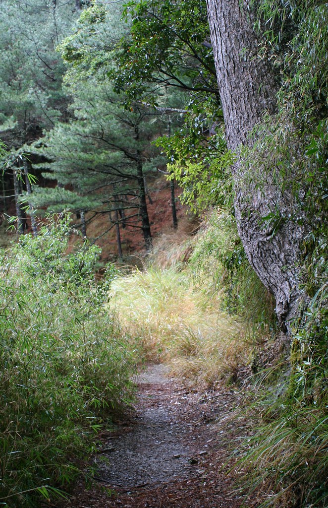
We head out about 8.30am in a light rain and fog. We reach the Batongguan Meadows after a 1.5 hour uphill climb. The meadows are more obscured by fog today than yesterday and there is no chance for taking decent photos. We cross quickly and find that on the other side the trail becomes narrower, slippery and rougher. But it also for the first time is more or less flat.

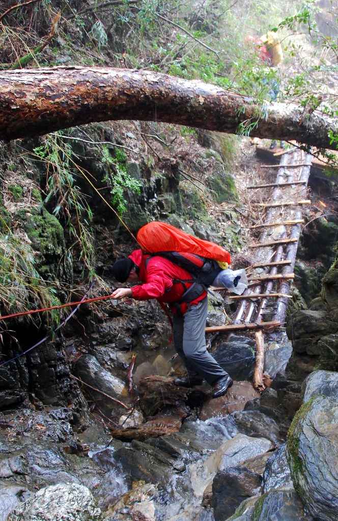
Around 10.30am we make a short climb down a stream as part of a detour round a landslide. Moving along slippery rocks is always slow going, but especially when you are carrying a large pack.
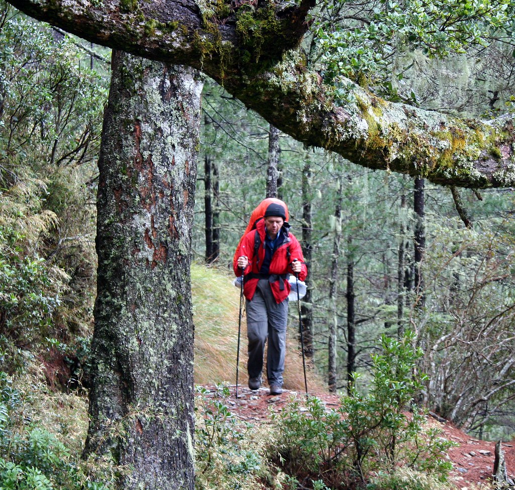
In general it’s all slow going after the meadows as we push through high Yushan cane that is dripping with dew. It’s stopped raining but the vegetation is doing its best to see that we never dry off. I notice Richard and the others are moving considerably slower than the first day.
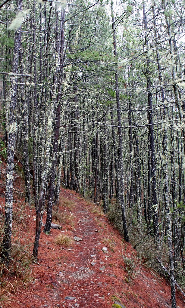
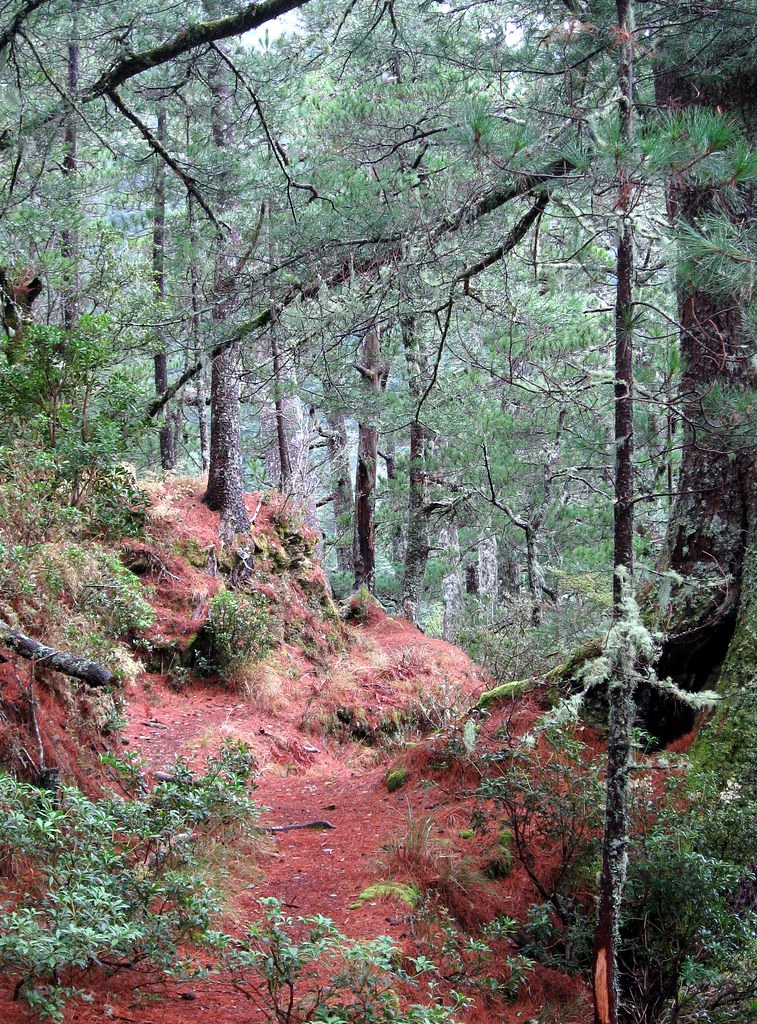
The trail alternates between a wide clear path through red pine forest and a tight narrow slice bordered by shoulder high dripping Yushan cane. It’s an easy walk either way, and with the splendid scenery, we don't hurry.
The red pine forests are particularly gorgeous, especially with the contrasting light greens of the underbrush and gauzy curtains of darker lichens hanging from the pine branches. Such lichen is often described as resembling an old man’s beard, which is probably why such forests always feel like they contain some ancient mystery.
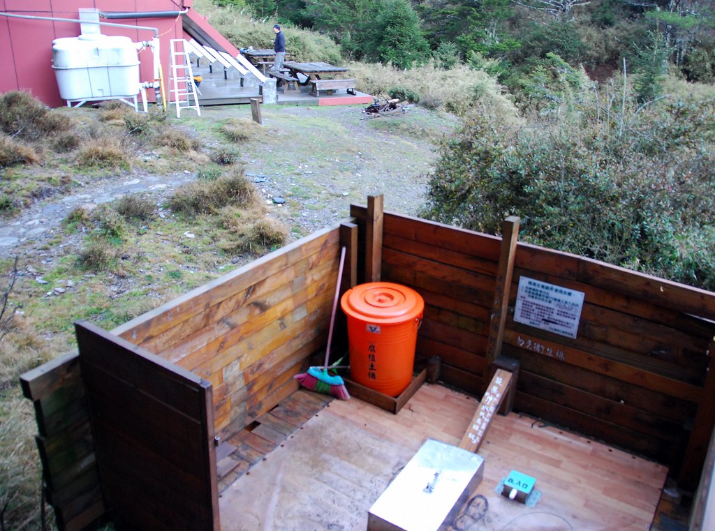
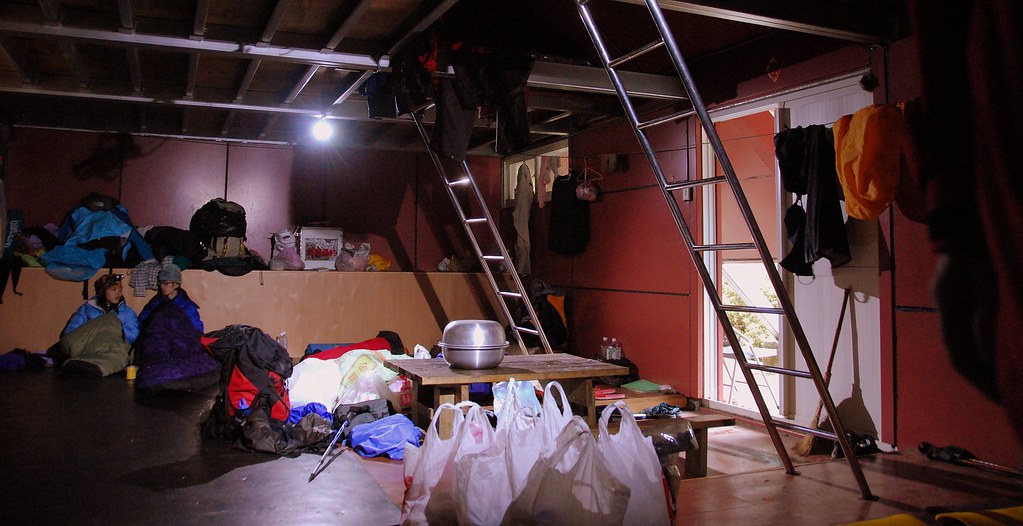
We reached Jhongyang Cabin (elevation 2850m) around 2.30pm. It’s a very pleasant looking little A-frame, with solar powered lights, and a loft for extra bed space. The roof slopes over the edge of the outer walls to provide some shade from the rain or sun. There’s a good water supply here: two rain tanks, and a nearby stream.

The outdoor squat toilets provide all the privacy three-foot high walls can give.
Jhongyang is a former gold mining area, and last time Richard was here he was able to do a little panning in the creek with equipment left behind. We don’t find any equipment here this time.
We shared the cabin this night with a group of older Taiwanese hikers who are climbing a few of the 3000+metre mountains in the area. Like many big groups they have hired Bunun porters to carry, and cook, their food. The meals these guides provide are astonishing. After preparing various rice, noodle and soups dishes, I watch as the porter prepares abalone and broccoli. Ahem, my tortellini and canned tuna (spiced up with Tabasco) was quite delicious, thank you very much.
Richard is a chatty fellow and makes it a point to be friendly to the other groups. The rest of us discover this is also a good way to score extra calories (or better food) as he is always invited to join the groups he befriends for dinner.
The Bunun porters mostly come from Hsinyi in Nantou. If you recall, this village was on the original Qing Dynasty Batongguan route. The porters carry huge packs, which have the flimsiest waistbands. Most of the weight is as a result carried on the shoulders, and the neck in the traditional way with a head strap. These are tough fellows, but they are quite friendly and professional. They do a great job of enforcing the carry-out-garbage rules.
The cleanliness of the trail is something worth mentioning. While the cabins always had a little litter about, the trail itself was free of bottles, cans, plastic bags, and even sliver paper. The national park, and the hikers themselves, deserve praise for maintaining this route at the highest levels.
This night, as I lie awake in bed (listening to the snores of my fellow travelers reduce my capacity for logical thought) I wonder what I will do when I return to Taiwan.
Click here for Day Four.
Practicalities:
It’s only 5-6 hours to hike from Guanggao to Jhongyang. There is water every 2 hours or so from streams until you reach the cabin. Some maps show a cabin at Banaiyike, but it is only a rough shelter.
3 comments:
I am an idiot!
(which is not the answer to the question posed in this post)
I was fiddling with things, remembered I had a Gmail account as well and could log on and such and then managed to delete my comment. And it only asks you if you are sure twice. I guess I was sure.
But, re: your post. That thing is an obelisk. Obviously. Or at least, it was, until someone hacked away at it. It now looks like something that would adorn a gnome's garden (do garden gnomes have gardens too?) than the prehistoric curiosity it once was.
Or it could be just a rock. Says the archaeologist.
PS Any chance of directiond to this trail from Holland?
PS2 I AM actually working. It's just that it's tea break now. And your blog is addicting.
directions. not directiond.
(in which I prove my idiocy)
Post a Comment