
For some time, my weekend hiking partners have been asking me to arrange an overnight hike with them; preferably in the high mountains. I had many options in mind, but when I read a report of my friend Stephen's hike up Beidawushan, I knew I had my destination.
Beidawushan (aka The Ship of the South) is the most southerly of the 3000m+ mountains that run north-south along Taiwan's central spine. It stands apart from mountains to its north giving it excellent prominence and affording stunning views to the east and north. On clear days it is possible to observe both the Pacific Ocean and Taiwan Strait from the summit. Located between the Dawu and Shuanguihu (Ghost Lakes) Nature Reserves, it is an ideal habitat for wildlife and is considered to be the last possible home of the endangered (and probably extinct) clouded-leopard in Taiwan. Other fauna often seen are various kinds of thrushes, gray-throat eagles, crown eagles, phoenix-headed hawks and black kites. Beidawushan is also known for the rare hemlock spruce. It is regarded as a holy mountain, and home to spirits of the Rukai and Paiwan people living in its shadow. Residents of Kaohsiung may sometimes have great views of this mountain, only about 40 kilometer away, after air-clearing typhoons.
The weather reports all showed clear skies and warm days for the entire weekend. In high spirits we met Friday night and drove down to Pingdong, Kate's collection of movie soundtrack CDs adding to the festive mood: Mama Mia!
We stayed the night in a local hotel. Interestingly, the receptionist was the same as two years ago when I had last stayed here, though she didn't seem to recognize me. I suppose lonely Lonely Planet writers have a sharper memory for pretty girls that stray their way than vice versa.
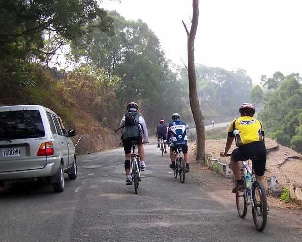
The next day we were on the road by 8am after a hearty breakfast at a local MOS. Though the trailhead was only 30km away as the crow flies it took us 3 hours to drive the backcountry roads and up the final tortuous stretch. At one point we shared the tarmac with hundreds of cyclists engaged in a mountain race. Cycling is getting more and more popular in Taiwan and local communities regularly hold such competitions.
The last 3km of road were terribly broken and potted, and I had to ask my friends to walk to avoid bottoming out on the bumps. We parked about a km from the trailhead (elevation 1520m) and walked the rest of the way up.
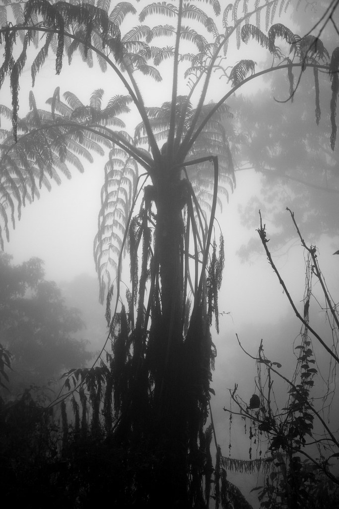
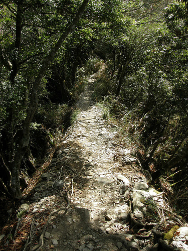
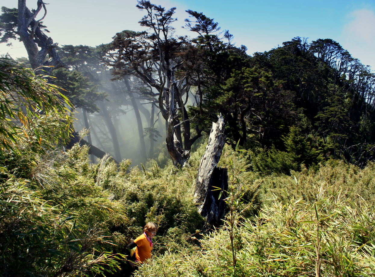
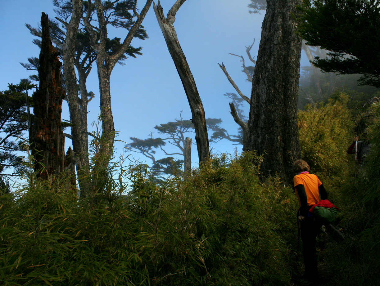
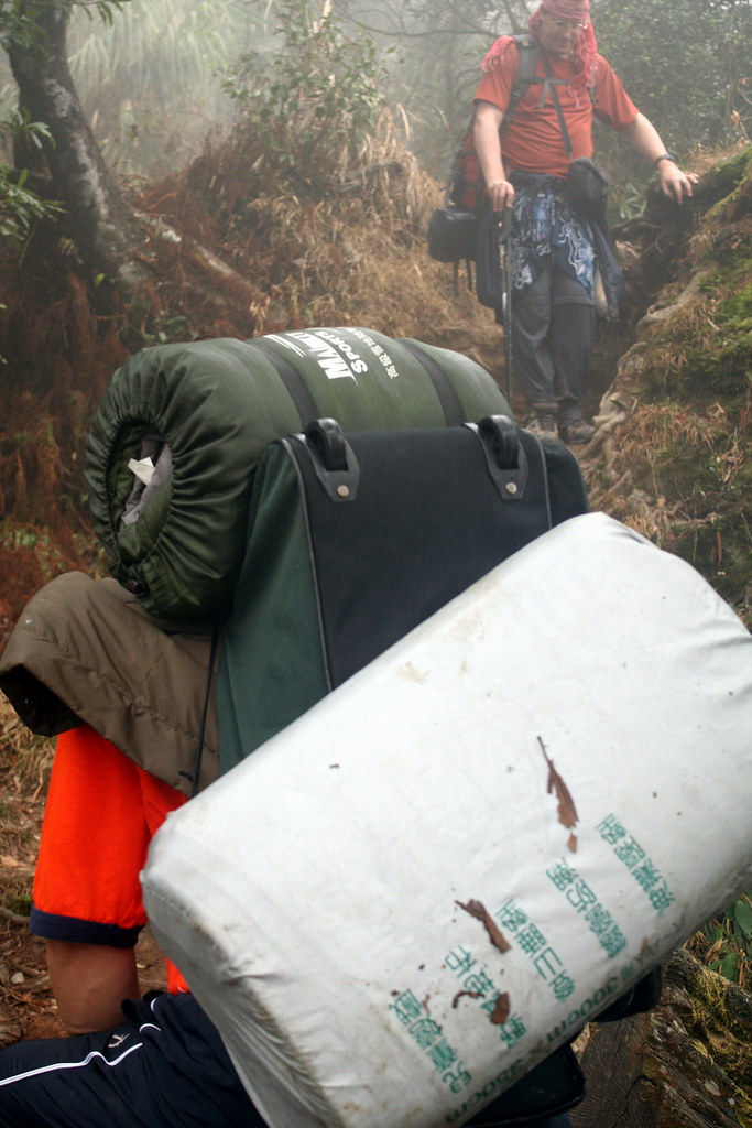
Though we had been promised sunshine, we began in the fog.

Monstrous vegetation hemmed us in.
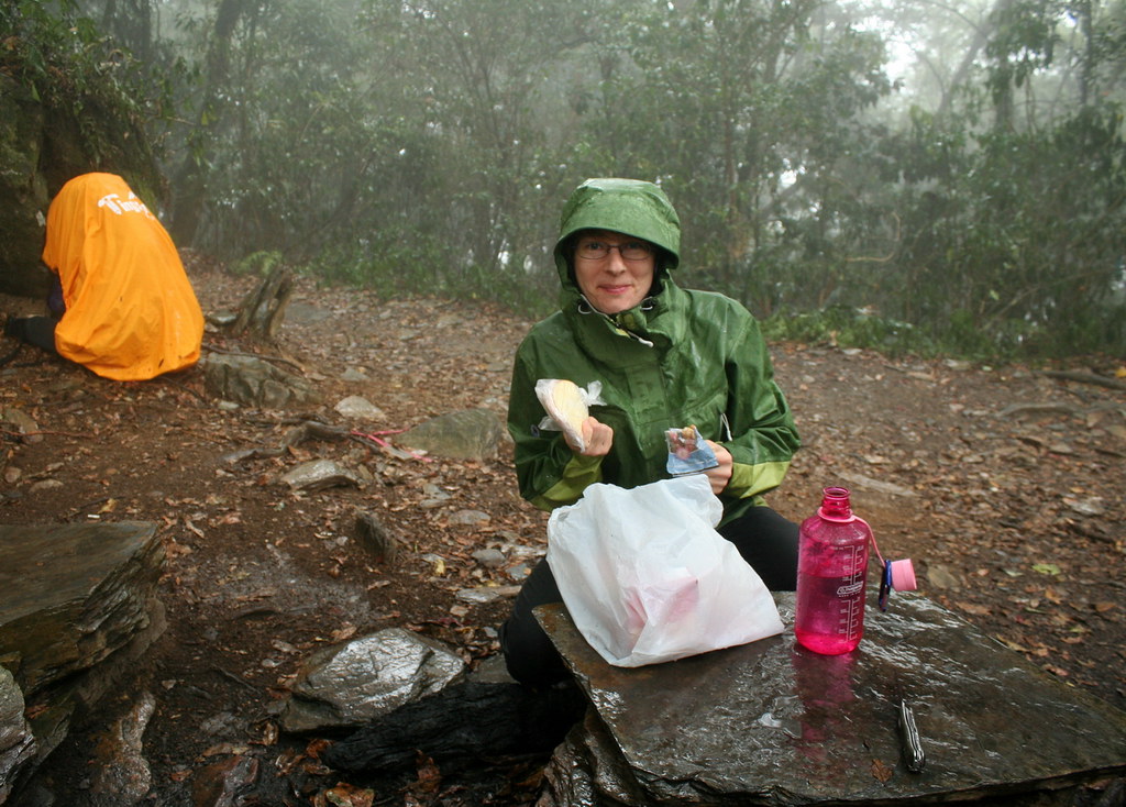
After an hour, a newcomer to our group decided the trail was more than he could handle and turned back. I do thank him though for leaving behind his gouda, salami and crackers. They went down very nicely in the rain.
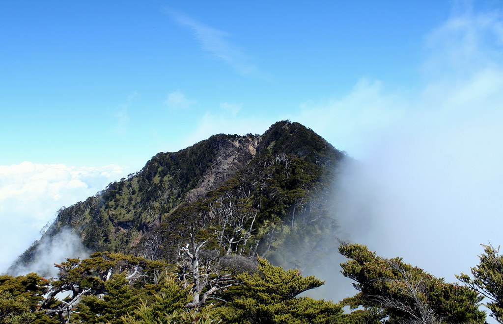
After four hours of hiking we broke through the fog. We were literally above the clouds and sitting on a lumpy rock lookout enjoying one of Beidawushan's premier attractions: the sea of clouds.
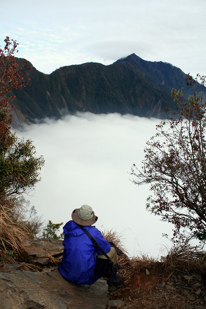
In the photo you can see the peak in the distance and the long arch of the ridgeline we would have to cross the next day to reach it. Before the start of the hike, I knew almost nothing about Beidawishan and had imagined a relatively straightforward climb up a wide trail through a thick forest. But here was something more like a towering Huangdi Dian. It was unexpected, but very welcome.
We continued on and crossed this remarkable stone causeway.
Kate's pic shows pretty clearly that it is more or less a solid natural wall of stone with sheer drops on either side. At some point it must have been wider, and at some further point in time it will surely break during an earthquake or wash out after a typhoon. I suppose the Taiwanese will then simple install ropes to take hikers down to the bottom of the chasm and up on the other side, wherever that may start.
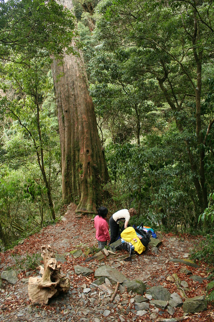
A few minutes past the wall we reached the campground, a place called Juniper Lodge (elevation 2,145 meters). Set amongst centuries old cedars, and featuring rough toilets, sinks, and running water it was another unexpected surprise. That's an understatement. It was fantastic. I could hang out there for days. We found two clear spots and set up our tents. Our neighbor was a junior high school Chinese teacher and a friendly, chatty fellow.
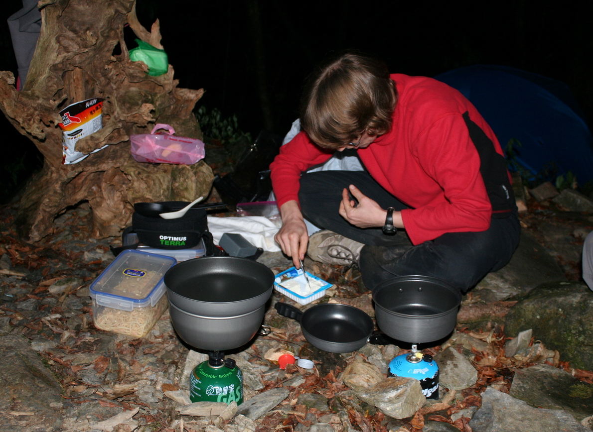
From the trailhead to the campground (which also has a cabin) was a 4-5 hour (4.5km) hike, quite short really and hikers can carry more food and supplies than they might normally consider. We were no different and enjoyed quite the feast for dinner: pasta salad with fresh veggies and feta cheese; more cheese, salami and crackers; Belgian waffles; fresh cut fruit; and a three berry cobbler. Next time a Duvel or Trappist beer or two will surely be included.
Alarms rang at 5am and waffle, oats, and coffee soon followed. We hit the trail an hour later as the darkness lifted. We were alone as almost all the other hikers had left at 2am to reach the summit by dawn. We planned to summit by 10.30am, spend 30 minutes enjoying the view, then return to the campsite by 2.30pm and be at the trailhead before 6pm.
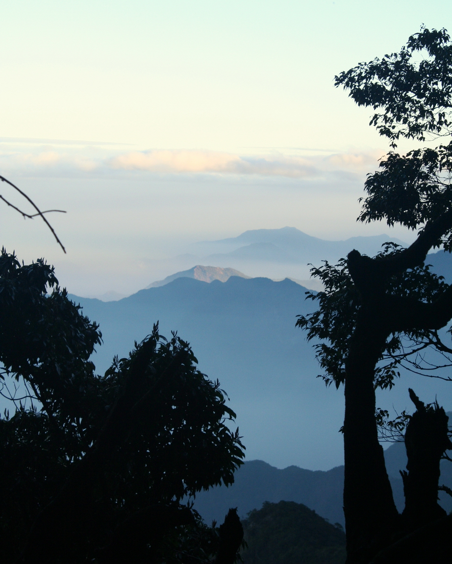
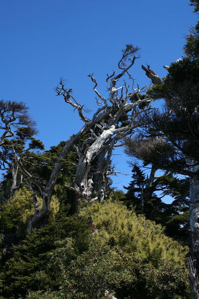
The morning air was warm and clear, though already the lowland plains were beginning to haze over. We peaked out through the trees into some very dreamy distant landscapes.
About an hour into the hike we encountered this 1000 year old red cedar with a 25m circumference. What a beauty, and again, what a surprise.

The trail rose in a series of switchbacks. Some tricky rope climbs and scrambles across rock faces kept us on our toes. The pre-dawn hikers were now on their way back. They cheered us to no end, asked far too many questions, and in general slowed our progress up the rougher sections.
We reached the top of the ridgeline (at about 3000m) in two hours. At this point, we realized our time was getting short, and Chris, not our fastest hiker, decided to drop out and return to the campsite to pack up. Katanya and I continued on as fast as we could.
The trail, now just meters wide - and sometimes narrower - ran atop a wooded ridgeline, and was pure joy to hike. At times we were making haste through thick swatches of dwarf bamboo, shaken dry by the hundreds of hikers before us. Other times we were scrambling down inclines holding on to the roots of old junipers. One side of the ridge lay obscured in fog; the other bathed in sunlight. It was fine, pure, colorful, and enchanting.
About an hour after leaving Chris behind, we reached the remains of a Japanese shrine.
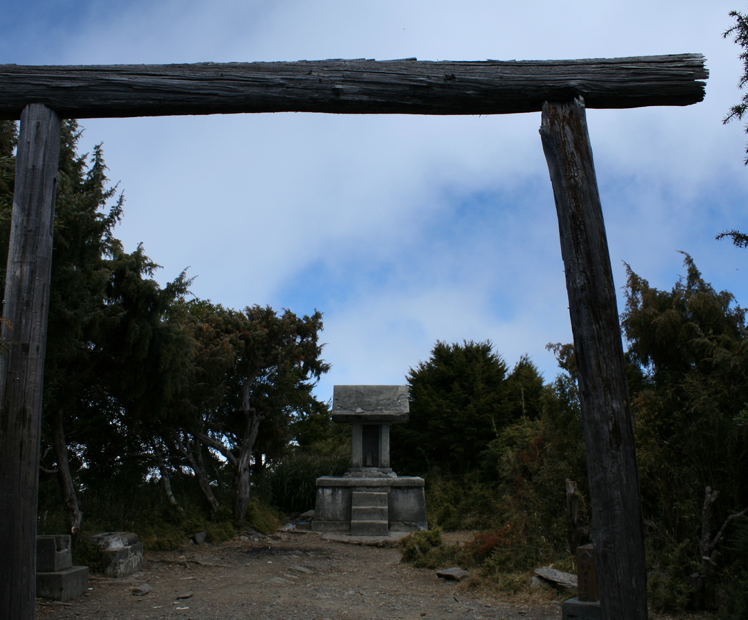
It's a landmark of sorts for hikers indicating that the summit, though only 50m higher, is still an hour away.
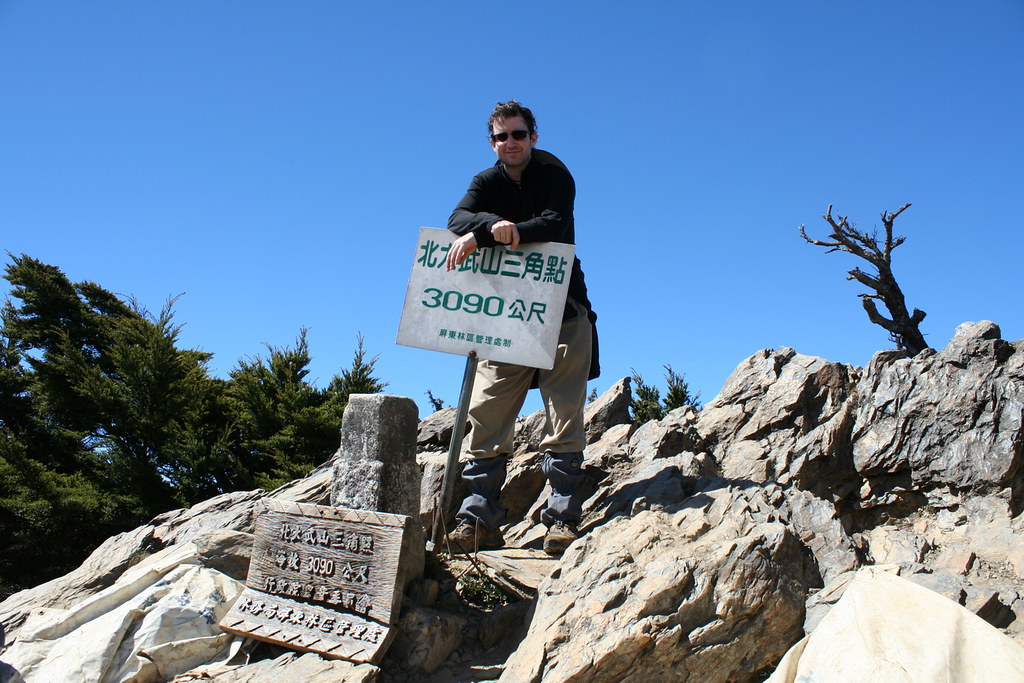
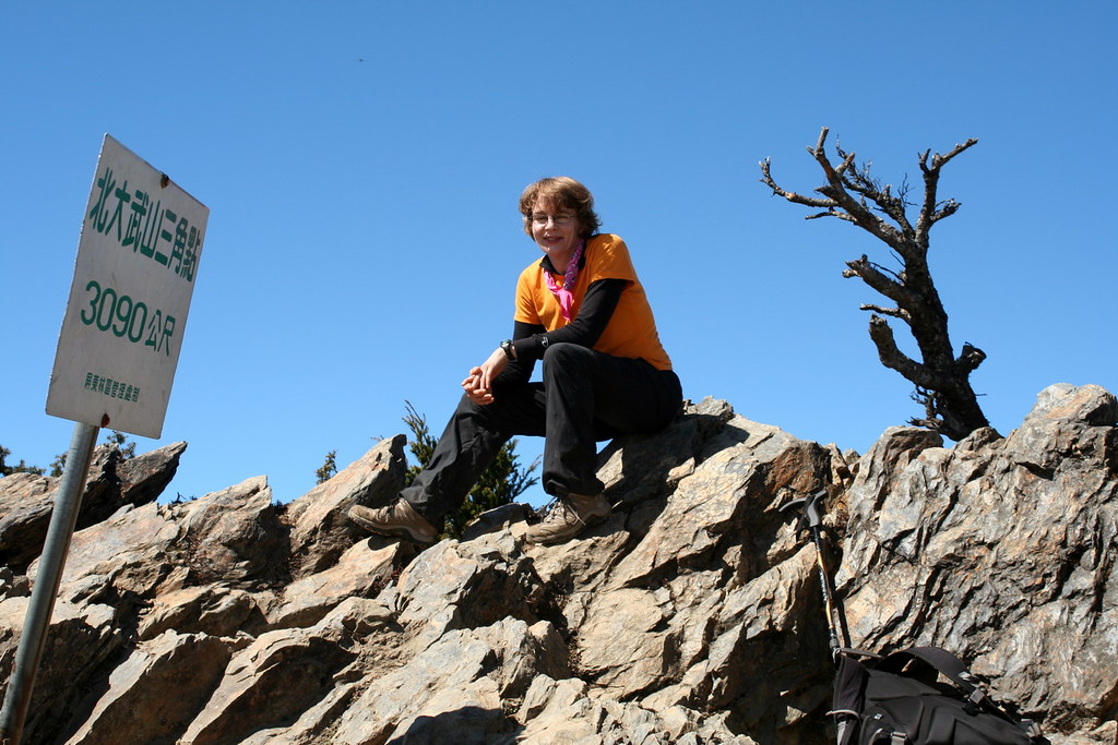
We reached the summit at 11am, just 30 minutes off schedule.
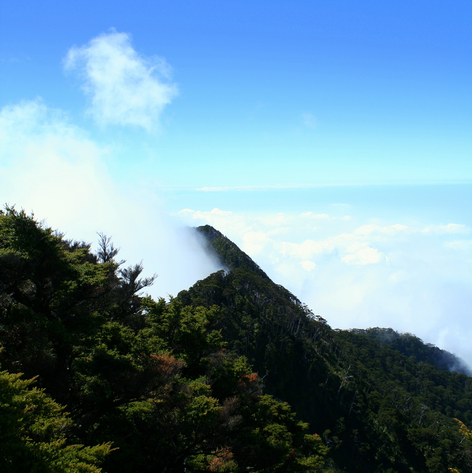
The way the fog piled up on one side made the back peak look like a volcano erupting:
After a quick lunch and some photos, we hustled back to camp. It's worth mentioning a short conversation we had along the way with an older fellow who had hiked the mountain 20 times.
"Did you see a man with a red helmet at the summit?" he asked in quite respectable English.
We had.
"Well, he has climbed Beidawushan 579 times. He comes up here 2 or 3 times a week."
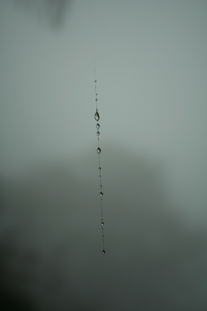
Kat and I arrived at camp around 2.30pm. An hour later we were all packed and heading down the trail. We entered the fog zone and again a light misty rain fell on us sideways.
We met a group of Seventh Day Adventists on their way up. One carried a guitar. That caught Kat's eye. Another carried a suitcase. That caught my eye.
Now going up a damp, slippery trail is one thing; going down is another. We made good time but had to be very cautious on the wet stones and logs and especially on the cliffs when the trail narrowed and dropped off sharply on the left.
Near the end, we ran into our neighbor from the campground. His hand was bleeding from a slip going down a rocky incline. Typically, he would not let us help but waved us on. A little while later he passed us again, encouraging us to speedup our pace as the daylight was fast waning.
As it was, we did walked the last 30 minutes to the car in the dark. Even with our headlights it was difficult to see through the vapours. Driving was even worse, with visibility only 4-5m in the distance, and almost no ground visibility at all. I knew I was on the road only because I could see the vegetation lit up on both sides.
Conditions were pretty awful. Kat got out to help me steer around a switchback and then decided to stay out and run in front, pointing out turns and dangerous potholes and lumps on the road. She was a trooper for doing so after 10 hours of hiking. In the hazy visibility, however, watching her and her orange short dashing ahead of the moving car made us all laugh.
"It's like a horror scene from Christine!" Kate yelled out.

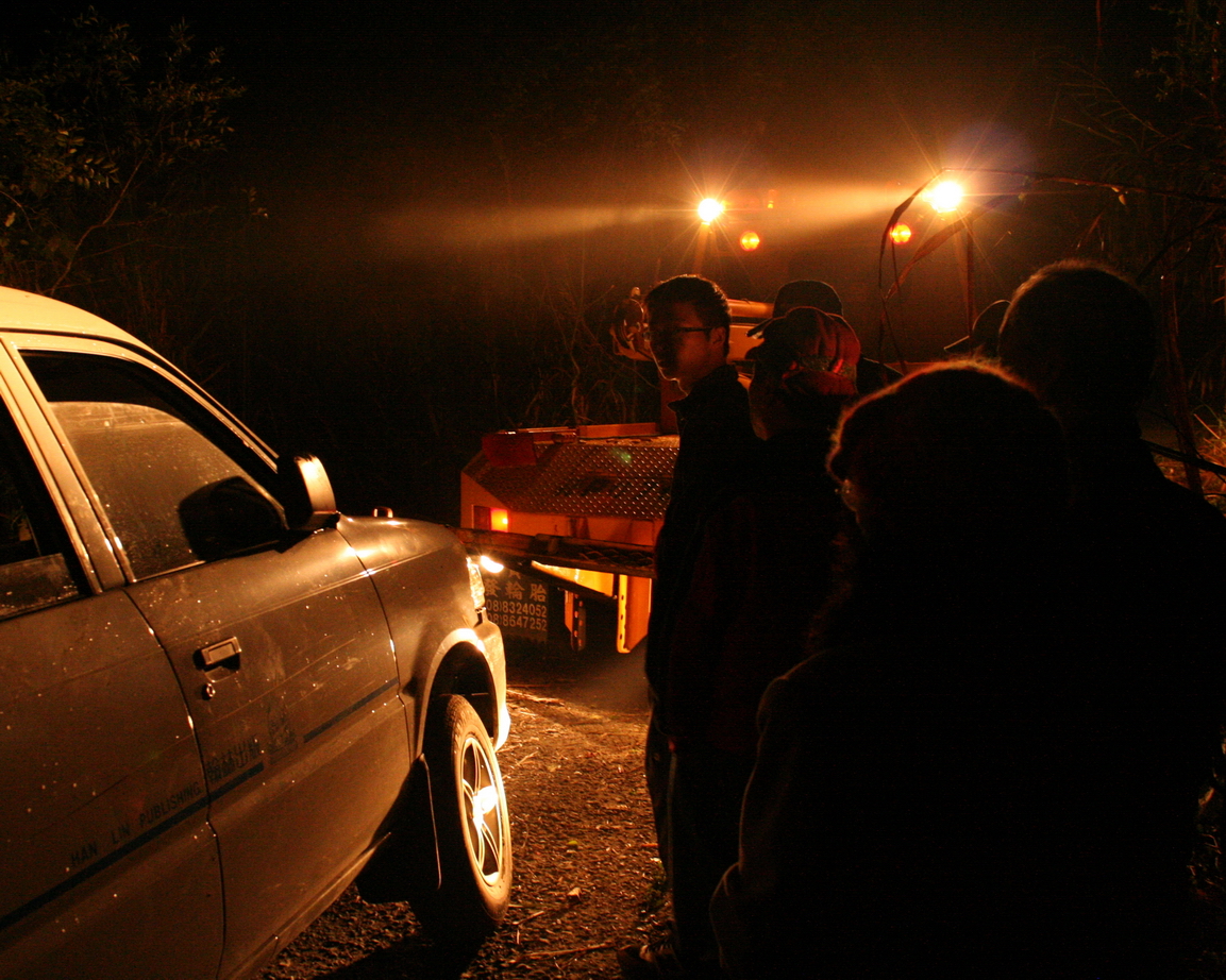
I wish I could say that we quickly hit the main road and rode out of the fog. But we didn't. About 3km down we almost literally ran into our neighbor, stuck in a ditch. We got out and pushed, planned, schemed and sulked, but there was no way to unstuck the vehicle. And no way to get around it.
As luck would have it there was no cell phone reception either. Kate and I decided to walk to the nearest village to get help. Our neighbor was opposed to this for some reason but I had decided already that while he was a nice man, he didn't have much sense dealing with emergencies.
As it turned out, we got reception about 200m down the road.
After this things get a bit confused. Though we called a tow truck it never arrived. Meanwhile, another hiking group pulled up behind my car and became pretty vocal and aggressive expressing their annoyance at not being able to pass.
Three hours from the moment when we had first arrived at the accident, two local police officers, one rather heavy set and the other short and underfed drove up on scooters. What followed next was a classic scene of small town cop fatuousness.
Seeing the front left wheel of the car had no traction, the cops began loading the ditch with stones. It seemed like a good idea and we had even tried it ourselves. The problem was the van had back wheel drive. We watched amused as the cops spent 20 minutes moving stones and chopping down plants, all to create a path under the front wheel that would not revolve an inch when our neighbor revved the engine.
"Oh, its rear wheel drive," the heavy cop muttered.
Around 11pm a tow truck finally arrived. It seems our neighbor, fearing a great fleecing from a local operator, had gone down the road to cancel the one Kate and I had called. The truck that showed up 3 hours later belonged to some nationwide car association that has fixed rates for this kind of thing. Great. At 11.30pm we were finally on our way home. We drove all night, Chris and I taking turns at the wheel when we weren't stealing a few minutes sleep.
I stepped into my apartment at 7.30am. I dropped my muddy pack and muttered that I would empty it tomorrow, and give it a wash too. I stepped into the bathroom, looked at my salty, sweaty face and noted that I would wash it later too. I went to bed and slept till six.
Practicalities:
The hike is almost a perfect weekend getaway if you live in the south. It's a bit more of a slog on the last day if you live in the north as you will have to drive 5-6 hours after 10 hours of hiking (unless you take three days). In any case, don't be fooled by how close the mountain is to Kaohsiung, Tainan and Pingdong. It is still a three hour drive.
The trail is 10km in length and well maintained. There's reliable water at the campground and also one hour up toward the summit. Signposts are in English and Chinese. You can't get lost.
The following (and also the intro at the start of this blog entry) comes from a practical guide to hiking in Taiwan that Richard of Barking Deer is currently working on:
If driving Freeway Number 3, take the exit signposted for Sandimen - Highway 24, and travel 10 kilometers eastwards. Just before entering Sandimen there are signs for Majia (and 7-11), turn right here, turn right again at the 7-11 five hundred meters ahead. Travel 1.5 km along this road (shares the 187/185 name), before turning left, at a big temple on your left, onto Highway 185. The left turn(towards the hills) for Taiwu is 12 kilometers to the south, just after the 40km marker. If coming from from Kaohsiung city by car it may be more convenient to the Number 88 Expressway to the end, and then drive through Neipu.
One kilometer up the hill you come to Jiaping Village 佳平村 (often known as Taiwu Village, there are actually two Taiwu's - this one and the one further up the mountain), stop here at the police station to complete the permit process. The friendly and helpful police on duty (24 hours, but prefer if you come before midnight) have application forms available, may help you fill them in, AND do NOT need everything in triplicate!
With your permit in order, go up the hill through the village, around a small traffic circle, and then at the top of the village veer right past a closed checkpoint and onto Pingdong Road Number 106. Turn left at the T intersection after 8 kilometers. When, after another 4km, you enter the second Taiwu Village 泰武部落 through an ornate gate keep straight ahead, not turning right into the village proper, or left onto farm roads.
*****(see note below) The remaining 6 kilometers of road gets narrower, bendier, and deteriorates badly before coming to the clearly signposted trailhead at 1,520 meters elevation. Use caution if driving a vehicle with a low wheel-base and consider parking lower down, before the trailhead proper. Additionally, at busy times, such as weekends, there may not be much space right at the trailhead to park easily.
*****Note that the last 6km road was heavily damaged in 2009 by Typhoon Morakot and while the trail is again opened, you must begin hiking at least several kilometres from the official trailhead. This will add another hour or more to the hiking times given above.
As always, reserved parking is always at hand for our Dutch visitors.
For the full set of pics see here.
20 comments:
Great entry! Your description of the hike is fantastic!
I want to go back!
Love your blog. Just a bit curious, how do you manage the camera? From some photos it looks like you let it hang from around your neck. How do you address the bouncing off your stomach?
Thanks, guy. As for the camera, I have it in a padded camera bag. The (tight) strap goes under my pack shoulder harness and when I am hiking it is tucked away at my side so it doesn't bounce. When I have to climb a lot of rough sections it actually goes under my jacket, leaving me looking like I'm 8 months pregnant.
I love this blog entry! I want to go back too, but make it a two-night camping trip so there's no need to hurry to the peak and back. More time to stop and smell the flowers.
Great description of our ordeal being stuck on the road!
Reading this entry makes me feel as if we did the hike yesterday.
I've always known that you're a great writer, Robert, but I'm really impressed with how great of a photographer you've become too. It's a great combination of skills to have, and I'm glad that I can get a glimpse at your talents through this blog.
Hopefully I'll be able to join you for a hike sometime in the near future.
Scott M.
I'm glad you all enjoyed the hike. What a fantastic adventure... all the way to the end.
There is still a beckoning Southern First Section some day.
I like this new layout; it's well-organized and very informative. I like those photos you present here, they are splendid. But maybe you can test how long it would take to fully display those photos. I wonder if they display well in some conditions. (It works well when I use T1 line in school, but it's slow when I use ADSL service at home.)
I did one test. After deleted all internet temporary files and cookies which faciliate webpages display for old visitors, I spent 7 minutes getting full entry displayed but with photos display errors. That means new visitors probably can't see whole entry well.
Thanks, Kate. Is anyone else having troubles? I may have to reduce the pic sizes to facilitate quicker loads.
Scott, thanks for the kind words. Hope to see you out on the trails again soon.
Stephen, ditto.
Wow! The website looks much better. Easier to navigate too.
Hi!
Whoa! I really enjoyed reading about all the great hikes you have done in Taiwan. Good stuff!
I just wanted to quickly say ask if you would be interested in a link exchange. My name is Andrew Dunkle and I represent Reach To Teach, a recruiting company here in Taiwan the provides job placement services across Asia.
I enjoyed reading your blog and I think other people who are interested in moving to Taiwan but want to learn more would too. If you are interested, please take a look at our website at www.reachtoteachrecruiting.com.
You can reach me directly at andrew@reachtoteachrecruiting.com
Thanks and happy trails!
Andrew Dunkle
As far as the loading of photos goes: no problems whatsoever on the Dutch side of the world.
As far as the hike entry goes: wow. I miss hiking in foggy conditions, in the early morning, and the reward of a splendid view when you get to the top.
Glad to hear there is parking space reserved! We'll definitely make use of it sometime.
Keep it up, xx
awesome post and pictures mate, great story.
Dennis the Dutch? If so congrats man on the new baby girl. Merijn, I believe is Inger can be trusted. Miss you all, and really hope we can all travel again in the future. Here, there,anywhere. I promise to learn a few more Beatles songs for karaoke.
Excellent post and truly wonderful blog, Robert. Great to see some familiar faces, not to mention the memories these stories bring back.
This last entry sounds a bit like our legendary Fulong hike - times ten!
balazs, what a surprise. Great to hear from you again. Where are you?
Just around the corner - Munich.
Beautiful photos! Thank you for writing this up - I’m about to hike the same trail tomorrow and am really looking forward to it now
Lähetän sen useille kavereille ans lisäksi jakaa herkullisia. Ja tietenkin, kiitos vaivannäöstäsi!
Post a Comment