Day Five:
Just south of the cabin is a narrow col stretching north-south. You can watch the sunset at nigh and the sunrise in the morning. We did both and after the sunrise viewing went back to sleep.
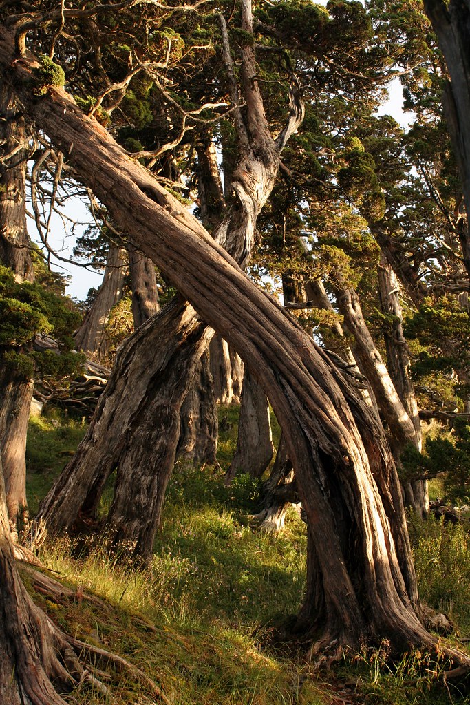
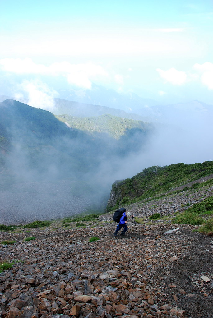
It was 11am before we finally hit the trail again. The terrain was similar to the day before: rough, rocky, challenging and dangerous. We were fogged in most of the time and it rained hard on us several times during the day. There were many pretty sections with old juniper forests, low here, and gnarled and twisted. Pale grey rhododendron bushes sprouted up from any patch of rock or soil they could take root in.

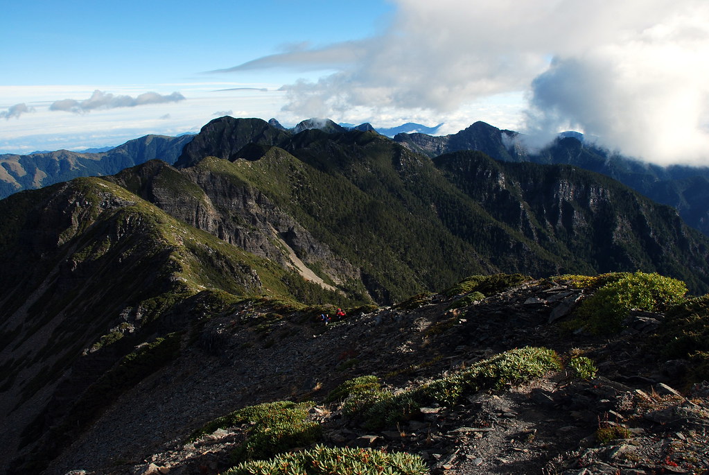
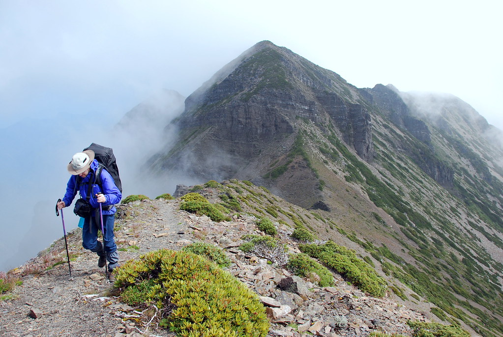
This is what it would look like on a clear day:
Just past Mount Kailantekun (凱蘭特崑山; 3730m) the trail split, with the left trail descending down the slopes to 369 cabin (used by hikers tackling the main route up Snow Mountain). We continued along the ridge until a downpour made us stop and shelter under a plastic tarp I had carried along. We were at 3700m and getting wet and chilled. The rain flowed down the natural fissures and channels in the rocks and soaked our backs. There wasn't much to do but eat and tell bad jokes. Eventually we got bored and decided to push on. There would be a cabin at the end of the day where we could dry out.
It was tricky hiking in the slick whited-out conditions. I remember inching down a long fissure where one giant rock slopes was being thrust over another and then discovering that we had to traverse a ridge wall that seemed to extend into the abyss. Not over or down but straight across the face which offered very few solid foot or handholds. Insane, and after a few attempts we realized that the ropes had been tossed onto the wall by accident. We were supposed to go down into the ravine and with great relief we did.
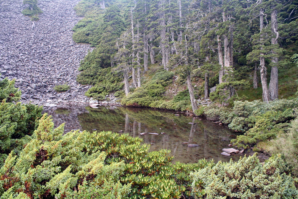
Just below the main peak of Snow Mountain the trail split again. We dropped to the right and followed a long scree slope to a sheltered meadow with another gorgeous juniper forest.

There is a small pond here, Jade Pond (Cui Chi, Ts'ui Pond on the map), which is well regarded in Taiwanese hiking circles. What can I say? Some things have to be seen to be appreciated, and some things are better appreciated simply by being heard about. Jade Pond, revered for being the highest alpine pond in the country, falls into the later category.
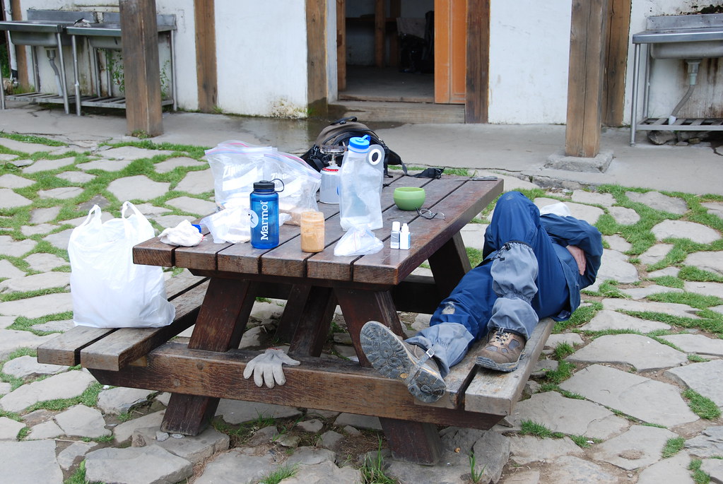
We arrived at the cabin completely soaked. But we were not alone. Three groups of medical students had converged here in preparation for a grand meeting with even more student groups on the summit of Snow Mountain the next morning. It was a tight squeeze but the students were cooperative and very meticulous about leaving the cabin spotlessly clean the next morning.

Day Six:
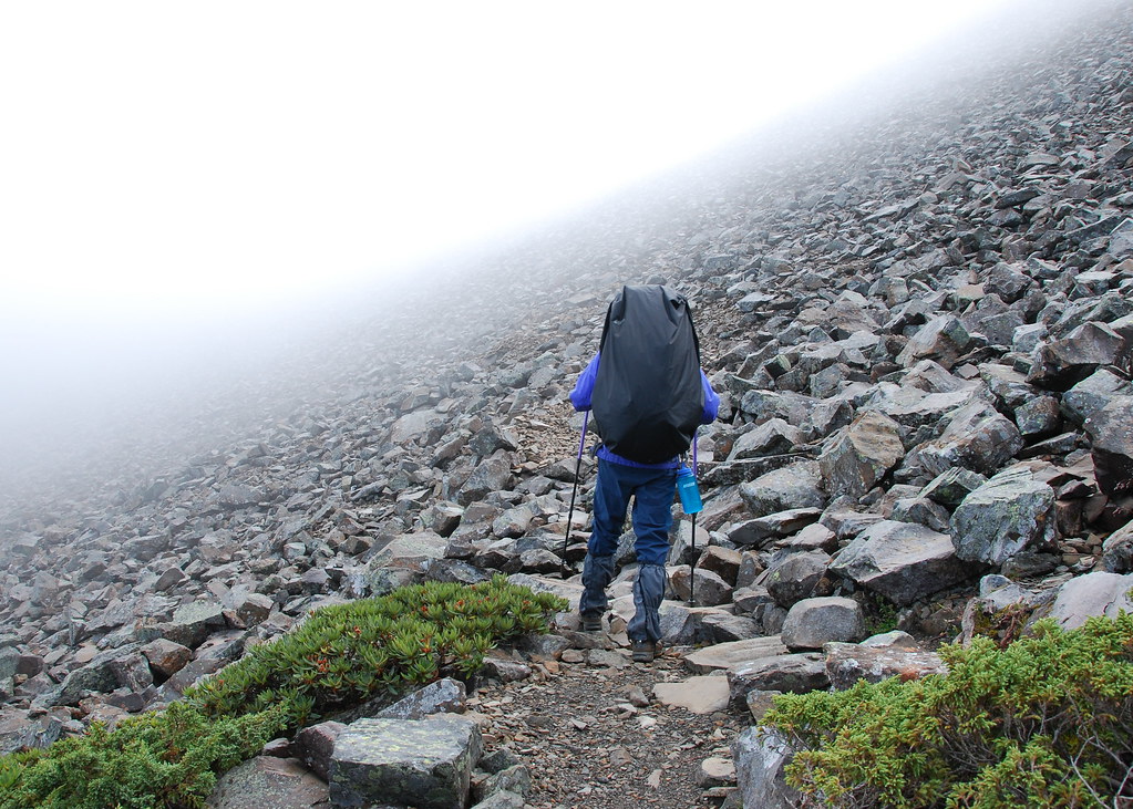
We headed out for the final leg of our hike around 7.30am and for once enjoyed a leisurely flat stretch to the start the day. But then it was back up the very steep and slippery scree slopes to the ridgeline.
From there it was a quick final push to the top of Snow Mountain (3886m).
Look familiar? Yep, Pashan's avatar is of me on this day slogging it up the slopes to Snow. The rugged peak of Beilengjiao (北角峰; 3880m) is in the distance.
Worth noting is that the north slope of Beilengjiao features a textbook perfect glacial cirque and terminal moraine (essentially a big amphitheater-like slope with a mound below formed by the debris left behind by retreating glaciers). We missed it because of the fog but if you do this hike keep an eye out for it.
We hit the summit of Snow at 9.11am.

Shortly the student groups arrived and began to prepare for their group photos. It was a nice exercise in organization. Four teams, all approaching the summit from different directions had arranged to meet that morning for a celebratory photo. The cute young woman in the front even carried a red apple with her for 3 days just so she could pose in that hao ke-ai (how cute) way they do here.

We started down after a break. Up there at the summit the only plants are rhododendron, mosses, and alpine juniper. At the bottom of the massive cirque the Black Forest begins. We were quite surprised to see a troop of rock monkeys at the transition zone.
A few hours later we reached 369 cabin. I felt sore and out of sorts, probably from a lack of water. Jade Lake cabin does not have a water source except for the pond. I hate using pond water and so rationed what I had carried from the North Peak cabin. It was not enough and I went for a few hours at this rather high altitude without much to drink. It was a bad move and I was suffering for it now. (Note that I have since learned the pond is fed by a continuous flow of water and so should be fine for drinking.)
Fortunately, I felt better after downing a litre and eating some food. We left after an hour and made it back to the trailhead without any further troubles.
One thing worth mentioning is the abundance of wildflowers we encountered on the trip. I made a composite of some pics to give readers an idea. This is also late summer by the way, far past the rhodondendron blooming season.

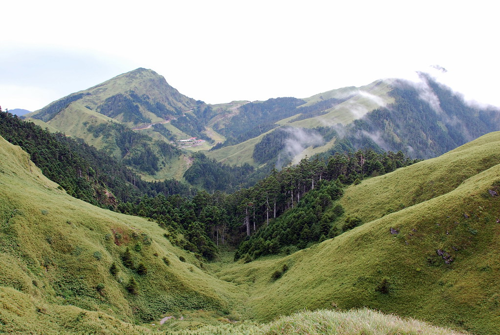
Also worth mentioning, for this hike and pretty much all hikes in the high mountains, is the wonderful variety of bio-geographical zones you encounter in Taiwan. From the alpine conditions at the top of Snow Mountain, we would descend into a pure fir forest, then a more varied forest of oak, ash, hemlock, pine and fir, and finally a mixed wood of red pine, camphor and other laurels. Further down would be sub-tropical forests of camphor, fig and laurel. The zones are usually pretty clearly defined and relate more to altitude than other conditions. It's possible to make a reasonably good guess at your altitude based on the trees around you. I'll write more about this when I blog on the Southern Section Two and Yushan.
When we finally got back to the cabin at Wuling we found that the road back to Taipei was washed out and we would have to make a big detour down to Lishan and then across Highway 14 back to Taichung. It's a scenic route for the most part, especially around Hehuanshan where the highway system in Taiwan reaches its highest point (around 3200m).
Practicalities:
The Holy Ridge lies in the North-East corner of Shei-Pa National Park. Wuling Farm is a small recreation area within the park where you can find lodging and food and the trailhead.
Guoguang Bus Company runs from Yilan city to Wuling Farm. Call the 24-hour tourist hotline to get the latest schedule: 0800 011 765. It's a 6 kilometer walk to the Wuling Villa (really a rough hostel) at the trailhead but you might be able to catch a shuttle bus. Ask at the visitor centre right where the bus drops you off. Note that the trailhead is not the same as the one for Snow Mountain, unless you are going to do the Holy Ridge in the opposite direction I did (which is of course possible). You want the lodging at the beginning of the trail to Taoshan Waterfall.
As always, you need permits to hike the Holy Ridge or any mountain in the park. Barking Deer has now put everything you need online, including free samples of national park and mountain permit applications.
There is a good system of cabins well spaced so you can finish at one each night. Water is available at all the cabins though none in between. We went in August but it was still cool on the ridge, especially in the fog. Waterproof gear is a necessity and some warm clothing no matter what time of year.
I don't recommend people doing this without a guide unless very experienced. The Dutch of course will have me to lead them.

The entire set of pics for this hike, and a few from a later one with clearer weather, can be seen here.
14 comments:
I'm drooling so much I'm afraid my keyboard will short circuit. Great photos.
Fantastic. I am absolutely green with envy. Need to get up and out again. It has been far too long.
I think Barking Deer is planning a Holy Ridge hike this January. Happens to coincide with my birthday so I am going to try my best to make it.
But we all the rest of the club should try for a weekend doing just the Wuling Four.
J, easy on the keyboard. ;)
What a splendid account of an epic jaunt!
You deserve a medal from the Tourism Bureau for so vividly showcasing Taiwan's magnificent hiking attractions. You certainly know how to get a fellow pining for the slopes!
Thanks, Peter. Hope you can join us on another jaunt some time soon.
Great stuff. The road over Hehuan is 3200 meters I think (not 2200).
Feiren, a big D'oh! I'll fix the altitude. What was I thinking?
"The ridge rises abruptly from the col to a series of jagged edges along the summit.The way we took was up a steep shoulder and through an all but impenetrable belt of creeping pine, which with sharp spurs of rock disputed every foot of the way. At last we reached the lower end of the ridge and looked over. There a thousand feet below us in a clear drop was a great torrent of fallen rocks forcing their way with the slow motion of the ages down a narrow gorge into the green of the lower ranges. There is a fierce grandeur in these battlements of the perpetual hills which challenges the imagination. No human architect could have planned such vast designs."
"Farewell. thou unnamed ridge! We thought had conquered thee, as we conquered the pine, but thou didst win in the end. One day we will return."
Murray Walton on the Holy Ridge, 1930
Fantastic post on an incredible route! Enjoying your blog greatly. Keep up the good work.
(GeographicCure, F.com)
Fantastic stuff Robert. Your superb write-up of a great adventure reminds me dearly of the great hiking of Taiwan. Such a long way away now I'm back living in the land-of-flat... Australia.
Please keep hiking and blogging. You have a legion of envious readers worldwide.
Hey, I hadn't even seen this hike story before. Wow. The Dutch will definately need you to lead them, but they would really really like to do this hike. One day, mi amigo, one day, we will be there!
that was truly fascinating
I found the best Tech Support Shoretel
i will share this to my friends.
Tax Prep
can i bookmarked this because i want to share this to my friends
I found the best Mesothelioma Lawyer Galveston TX
Post a Comment